
You also want an ePaper? Increase the reach of your titles
YUMPU automatically turns print PDFs into web optimized ePapers that Google loves.
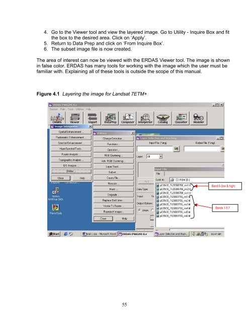
4. Go to the Viewer tool and view the layered image. Go to Utility - Inquire Box and fitthe box to the desired area. Click on ‘Apply’.5. Return to Data Prep and click on ‘From Inquire Box’.6. The subset image file is now created.The area of interest can now be viewed with the ERDAS Viewer tool. The image is shownin false color. ERDAS has many tools for working with the image which the user must befamiliar with. Explaining all of these tools is outside the scope of this manual.Figure 4.1 Layering the image for Landsat 7ETM+Band 6 (low & high)Bands 1-5,755