
You also want an ePaper? Increase the reach of your titles
YUMPU automatically turns print PDFs into web optimized ePapers that Google loves.
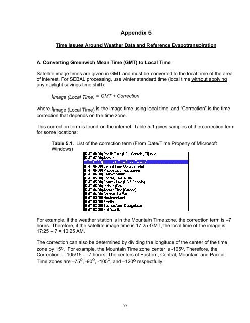
Appendix 5Time Issues Around Weather Data and Reference EvapotranspirationA. Converting Greenwich Mean Time (GMT) to Local TimeSatellite image times are given in GMT and must be converted to the local time of the areaof interest. For <strong>SEBAL</strong> processing, use winter standard time (local time without applyingany daylight savings time shift):t image (Local Time) = GMT + Correctionwhere timage (Local Time) is the image time using local time, and “Correction” is the timecorrection that depends on the time zone.This correction term is found on the internet. Table 5.1 gives samples of the correction termfor some locations:Table 5.1. List of the correction term (From Date/Time Property of MicrosoftWindows)For example, if the weather station is in the Mountain Time zone, the correction term is –7hours. Therefore, if the satellite image time is 17:25 GMT, the local time of the image is17:25 – 7 = 10:25 AM.The correction can also be determined by dividing the longitude of the center of the timezone by 15o. For example, the Mountain Time zone center is -105o. Therefore, theCorrection = -105/15 = -7 hours. The centers of Eastern, Central, Mountain and PacificTime zones are –75 O , -90 O , -105 O , and –120o respectfully.57