

Inventory and Survey Methods for Nonindigenous Plant Species (PDF)
Inventory and Survey Methods for Nonindigenous Plant Species (PDF)
Inventory and Survey Methods for Nonindigenous Plant Species (PDF)
- No tags were found...

Create successful ePaper yourself
Turn your PDF publications into a flip-book with our unique Google optimized e-Paper software.
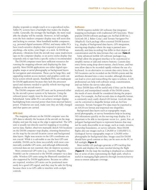
Chapter 4 • Digital Aerial Sketch-Mappingdisplay responds to simple touch or to a specialized stylus.Tablet PC screens have a backlight that makes the displayvisible. Generally, the stronger the backlight, the more readablethe display will be outside. However, in full sunlight,even the best outdoor computer display may still seem dim<strong>and</strong> lacking in contrast. Most h<strong>and</strong>held mobile computers;e.g., personal digital assistants (PDAs), <strong>and</strong> many tablet PCshave touch-sensitive displays that respond to pressure fromanything—the stylus, your finger, or a stick. In DASM applications,vibrations from the aircraft may cause inadvertenttaps on the computer display, so an active-stylus display thatresponds only to taps from a specific stylus is recommended.The DASM computer must have sufficient resources <strong>for</strong>running the mapping software <strong>and</strong> displaying the dataquickly. Most DASM applications use either digital topographicmaps or aerial photography as background layers<strong>for</strong> navigation <strong>and</strong> orientation. These can be large files, <strong>and</strong>upgrading r<strong>and</strong>om access memory <strong>and</strong> graphics cards canboost screen refresh speeds. H<strong>and</strong>held PDAs are inadequate<strong>for</strong> DASM applications because they lack the processorspeed <strong>and</strong> memory needed to quickly refresh moving-mapdisplays as the aircraft moves.The DASM computer <strong>and</strong> GPS unit can be powered eitherby the aircraft’s power system or by batteries. Using theonboard power supply must be discussed with the pilotbe<strong>for</strong>eh<strong>and</strong>. Some tablet PCs can achieve stronger displaybacklighting from external power than from internal batterypower. If batteries are used, make sure they are fully charged<strong>and</strong> that spares are carried.GPS UnitThe mapping software on the DASM computer uses theGPS data to identify the location of the aircraft on the mapdisplay <strong>and</strong> pan the map as the edge is approached. The GPSunit is usually not directly used <strong>for</strong> mapping or recordingsurvey data. Rather, observers manually sketch NIS locationson the DASM computer map display, orienting themselveson the map by the aircraft location cursor <strong>and</strong> backgrounddata layers. Slight inaccuracies in the GPS coordinates arenot crucial. While it is advisable to use the best GPS unitavailable, DASM can be done successfully with most commerciallyavailable GPS units, <strong>and</strong> although differentiallycorrected data are not essential, they do improve accuracy.Most commercial GPS units (e.g., Garmin, Magellan,Trimble) can be connected to the DASM computer via a datacable. Wireless GPS units using the Bluetooth st<strong>and</strong>ard arealso supported by DASM applications. Because no cablesare required, wireless GPS units can be positioned moreeasily <strong>for</strong> a good GPS signal, <strong>and</strong> they may be safer <strong>for</strong> flyingbecause there is no GPS cable to interfere with cockpitcontrols.SoftwareDASM requires mobile GIS software that integratesmapping technologies with traditional GPS functions. Threepopular DASM software packages are ArcPad (ESRI Inc.),GeoLink (M. J. Baker Corp.), <strong>and</strong> Terrain Navigator Pro(MapTech). Each package offers essential DASM features(e.g., display of background data layers, GPS integration,moving-map displays where the map is panned automatically,<strong>and</strong> data recording) but differ in their degree ofcustomization <strong>and</strong> the data <strong>for</strong>mats they can use (Table 2).Some advanced mobile GIS software packages (e.g.,ArcPad) allow the program interface to be customized tosimplify menus or add <strong>and</strong> remove buttons. Custom dataentry <strong>for</strong>ms using drop-down menus, check boxes, <strong>and</strong> buttonsallow data to be recorded rapidly without the use of akeyboard. As an alternative to custom data entry <strong>for</strong>ms, theNIS locations can be recorded on the DASM system <strong>and</strong> theattributes dictated into a voice recorder, although dictationcan lead to error <strong>and</strong> transcribing the tapes is tedious. A GISprofessional can help with software setup, customization,<strong>and</strong> use be<strong>for</strong>e the survey takes place.Since DASM data will be useful only if they can be shared,analyzed, <strong>and</strong> manipulated outside of the DASM system,the needs of users should be considered during the projectsetup. For example, ArcPad records data in shapefile <strong>for</strong>mat,a commonly used, easily shared GIS <strong>for</strong>mat. GeoLink datacan be converted to shapefile <strong>for</strong>mat with an ArcViewextension. Terrain Navigator Pro data must be exported toan ASCII text <strong>for</strong>mat <strong>and</strong> imported into shapefiles.Background data layers such as topographic maps,aerial photography, or survey boundaries help in locatingNIS infestations quickly on the moving-map display. It isimportant to be able to incorporate vector (i.e., point, line, orpolygon) background layers to represent features that maynot be easily discernible in an image, such as roads, streams,ownership boundaries, or survey subunits. Most DASMflights also use images such as 1:24,000 or 1:100,000 U.S.Geological <strong>Survey</strong> topographic maps or 1:24,000 orthophotographs<strong>for</strong> background data. Images used <strong>for</strong> DASMshould have good contrast so they can be seen on the PC infull sunlight (Figure 3).Most mobile GIS packages generate a GPS tracklog thatrecords <strong>and</strong> displays the route traveled during the flight(Figure 4). On the map the tracklog is displayed as a distinctline or series of dots representing the flight path, which isuseful in managing flight patterns through inventory/surveyareas to ensure adequate coverage.37<strong>Inventory</strong> <strong>and</strong> <strong>Survey</strong> <strong>Methods</strong> <strong>for</strong> <strong>Nonindigenous</strong> <strong>Plant</strong> <strong>Species</strong>


