

Inventory and Survey Methods for Nonindigenous Plant Species (PDF)
Inventory and Survey Methods for Nonindigenous Plant Species (PDF)
Inventory and Survey Methods for Nonindigenous Plant Species (PDF)
- No tags were found...

You also want an ePaper? Increase the reach of your titles
YUMPU automatically turns print PDFs into web optimized ePapers that Google loves.
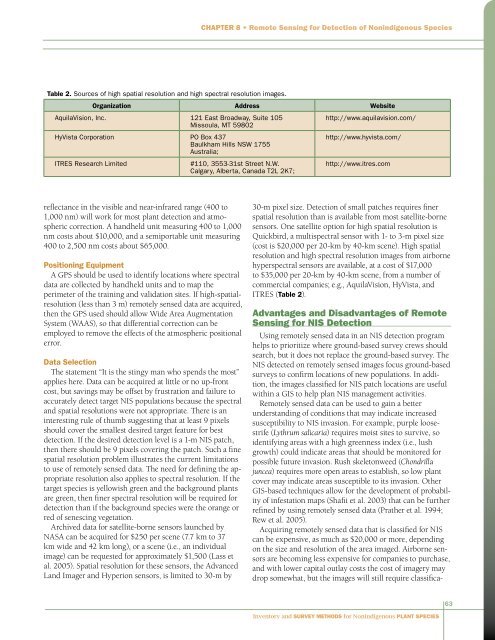
Chapter 8 • Remote Sensing <strong>for</strong> Detection of <strong>Nonindigenous</strong> <strong>Species</strong>Table 2. Sources of high spatial resolution <strong>and</strong> high spectral resolution images.Organization Address WebsiteAquilaVision, Inc. 121 East Broadway, Suite 105Missoula, MT 59802HyVista Corporation PO Box 437Baulkham Hills NSW 1755Australia;ITRES Research Limited#110, 3553-31st Street N.W.Calgary, Alberta, Canada T2L 2K7;http://www.aquilavision.com/http://www.hyvista.com/http://www.itres.comreflectance in the visible <strong>and</strong> near-infrared range (400 to1,000 nm) will work <strong>for</strong> most plant detection <strong>and</strong> atmosphericcorrection. A h<strong>and</strong>held unit measuring 400 to 1,000nm costs about $10,000, <strong>and</strong> a semiportable unit measuring400 to 2,500 nm costs about $65,000.Positioning EquipmentA GPS should be used to identify locations where spectraldata are collected by h<strong>and</strong>held units <strong>and</strong> to map theperimeter of the training <strong>and</strong> validation sites. If high-spatialresolution(less than 3 m) remotely sensed data are acquired,then the GPS used should allow Wide Area AugmentationSystem (WAAS), so that differential correction can beemployed to remove the effects of the atmospheric positionalerror.Data SelectionThe statement “It is the stingy man who spends the most”applies here. Data can be acquired at little or no up-frontcost, but savings may be offset by frustration <strong>and</strong> failure toaccurately detect target NIS populations because the spectral<strong>and</strong> spatial resolutions were not appropriate. There is aninteresting rule of thumb suggesting that at least 9 pixelsshould cover the smallest desired target feature <strong>for</strong> bestdetection. If the desired detection level is a 1-m NIS patch,then there should be 9 pixels covering the patch. Such a finespatial resolution problem illustrates the current limitationsto use of remotely sensed data. The need <strong>for</strong> defining the appropriateresolution also applies to spectral resolution. If thetarget species is yellowish green <strong>and</strong> the background plantsare green, then finer spectral resolution will be required <strong>for</strong>detection than if the background species were the orange orred of senescing vegetation.Archived data <strong>for</strong> satellite-borne sensors launched byNASA can be acquired <strong>for</strong> $250 per scene (7.7 km to 37km wide <strong>and</strong> 42 km long), or a scene (i.e., an individualimage) can be requested <strong>for</strong> approximately $1,500 (Lass etal. 2005). Spatial resolution <strong>for</strong> these sensors, the AdvancedL<strong>and</strong> Imager <strong>and</strong> Hyperion sensors, is limited to 30-m by30‐m pixel size. Detection of small patches requires finerspatial resolution than is available from most satellite-bornesensors. One satellite option <strong>for</strong> high spatial resolution isQuickbird, a multispectral sensor with 1- to 3-m pixel size(cost is $20,000 per 20-km by 40-km scene). High spatialresolution <strong>and</strong> high spectral resolution images from airbornehyperspectral sensors are available, at a cost of $17,000to $35,000 per 20-km by 40-km scene, from a number ofcommercial companies; e.g., AquilaVision, HyVista, <strong>and</strong>ITRES (Table 2).Advantages <strong>and</strong> Disadvantages of RemoteSensing <strong>for</strong> NIS DetectionUsing remotely sensed data in an NIS detection programhelps to prioritize where ground-based survey crews shouldsearch, but it does not replace the ground-based survey. TheNIS detected on remotely sensed images focus ground-basedsurveys to confirm locations of new populations. In addition,the images classified <strong>for</strong> NIS patch locations are usefulwithin a GIS to help plan NIS management activities.Remotely sensed data can be used to gain a betterunderst<strong>and</strong>ing of conditions that may indicate increasedsusceptibility to NIS invasion. For example, purple loosestrife(Lythrum salicaria) requires moist sites to survive, soidentifying areas with a high greenness index (i.e., lushgrowth) could indicate areas that should be monitored <strong>for</strong>possible future invasion. Rush skeletonweed (Chondrillajuncea) requires more open areas to establish, so low plantcover may indicate areas susceptible to its invasion. OtherGIS-based techniques allow <strong>for</strong> the development of probabilityof infestation maps (Shafii et al. 2003) that can be furtherrefined by using remotely sensed data (Prather et al. 1994;Rew et al. 2005).Acquiring remotely sensed data that is classified <strong>for</strong> NIScan be expensive, as much as $20,000 or more, dependingon the size <strong>and</strong> resolution of the area imaged. Airborne sensorsare becoming less expensive <strong>for</strong> companies to purchase,<strong>and</strong> with lower capital outlay costs the cost of imagery maydrop somewhat, but the images will still require classifica-63<strong>Inventory</strong> <strong>and</strong> <strong>Survey</strong> <strong>Methods</strong> <strong>for</strong> <strong>Nonindigenous</strong> <strong>Plant</strong> <strong>Species</strong>


