

Inventory and Survey Methods for Nonindigenous Plant Species (PDF)
Inventory and Survey Methods for Nonindigenous Plant Species (PDF)
Inventory and Survey Methods for Nonindigenous Plant Species (PDF)
- No tags were found...

You also want an ePaper? Increase the reach of your titles
YUMPU automatically turns print PDFs into web optimized ePapers that Google loves.
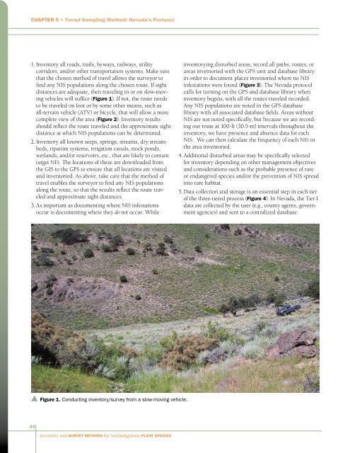
Chapter 5 • Tiered Sampling Method: Nevada’s Protocol1. <strong>Inventory</strong> all roads, trails, byways, railways, utilitycorridors, <strong>and</strong>/or other transportation systems. Make surethat the chosen method of travel allows the surveyor tofind any NIS populations along the chosen route. If sightdistances are adequate, then traveling in or on slow-movingvehicles will suffice (Figure 1). If not, the route needsto be traveled on foot or by some other means, such asall-terrain vehicle (ATV) or bicycle, that will allow a morecomplete view of the area (Figure 2). <strong>Inventory</strong> resultsshould reflect the route traveled <strong>and</strong> the approximate sightdistance at which NIS populations can be determined.2. <strong>Inventory</strong> all known seeps, springs, streams, dry streambeds,riparian systems, irrigation canals, stock ponds,wetl<strong>and</strong>s, <strong>and</strong>/or reservoirs, etc., that are likely to containtarget NIS. The locations of these are downloaded fromthe GIS to the GPS to ensure that all locations are visited<strong>and</strong> inventoried. As above, take care that the method oftravel enables the surveyor to find any NIS populationsalong the route, so that the results reflect the route traveled<strong>and</strong> approximate sight distances.3. As important as documenting where NIS infestationsoccur is documenting where they do not occur. Whileinventorying disturbed areas, record all paths, routes, orareas inventoried with the GPS unit <strong>and</strong> database libraryin order to document places inventoried where no NISinfestations were found (Figure 3). The Nevada protocolcalls <strong>for</strong> turning on the GPS <strong>and</strong> database library wheninventory begins, with all the routes traveled recorded.Any NIS populations are noted in the GPS databaselibrary with all associated database fields. Areas withoutNIS are not noted specifically, but because we are recordingour route at 100-ft (30.5-m) intervals throughout theinventory, we have presence <strong>and</strong> absence data <strong>for</strong> eachNIS. We can then calculate the frequency of each NIS inthe area inventoried.4. Additional disturbed areas may be specifically selected<strong>for</strong> inventory depending on other management objectives<strong>and</strong> considerations such as the probable presence of rareor endangered species <strong>and</strong>/or the prevention of NIS spreadinto rare habitat.5. Data collection <strong>and</strong> storage is an essential step in each tierof the three-tiered process (Figure 4). In Nevada, the Tier Idata are collected by the user (e.g., county agents, governmentagencies) <strong>and</strong> sent to a centralized database.▲ Figure 1. Conducting inventory/survey from a slow-moving vehicle.44<strong>Inventory</strong> <strong>and</strong> <strong>Survey</strong> <strong>Methods</strong> <strong>for</strong> <strong>Nonindigenous</strong> <strong>Plant</strong> <strong>Species</strong>


