The City of Hilliard Sustainability Plan
The City of Hilliard Sustainability Plan
The City of Hilliard Sustainability Plan

Create successful ePaper yourself
Turn your PDF publications into a flip-book with our unique Google optimized e-Paper software.
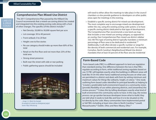
<strong>Hilliard</strong> <strong>Sustainability</strong> <strong>Plan</strong>ECON. EXECUTIVELAND USE DEV.SOCIAL SUMMARY& URBAN EQ.ECOLOGYComprehensive <strong>Plan</strong> Mixed-Use District<strong>The</strong> 2011 Comprehensive <strong>Plan</strong> passed by the <strong>Hilliard</strong> <strong>City</strong>Council recommends that a mixed-use zoning district be createdand integrated into the existing zoning code along with a host<strong>of</strong> other changes. <strong>The</strong> specifics <strong>of</strong> this district include: 14» Net Density: 20,000 to 30,000 square feet per acre» Lot coverage: 30 to 40 percent» Front setback: 0 to 20 feet» Height: one to five stories» No use category should make up more than 60% <strong>of</strong> thetotal» Retail on the first floor and not more than 25% <strong>of</strong> thetotal area» Strong street presence» Built near the street with side or rear parking» Public gathering spaces should be included» Image 3.4. Mixed-Use ExampleAn example <strong>of</strong> a mixed-use development projectSource: http://info.aia.orgwill need to either allow the meetings to take place in the councilchambers or else provide guidance to developers on other publicareas open for meetings in the evening.» Establish a specific zoning district for mixed-use development.<strong>The</strong> most complete way to encourage mixed-use developmentwithin the city, using the existing zoning code system, is to havea specific zoning district dedicated to that type <strong>of</strong> development.<strong>The</strong> Comprehensive <strong>Plan</strong> recommends a new land use mapthat includes a new mixed-use zoning category, as opposed toan overlay (See Comprehensive <strong>Plan</strong> mixed-use district sidebar3.6).106 This type <strong>of</strong> zoning district typically mandates a minimumpercentage <strong>of</strong> floor area to be dedicated to residential. 107Additionally, it will <strong>of</strong>ten dictate a specific number or range forthe density <strong>of</strong> both commercial and residential uses. For example,Cornelius, North Carolina’s Neighborhood Mixed-Use districtmandates that at least 50 percent <strong>of</strong> the floor area be residentialForm-Based CodeForm-based code (FBC) is a different approach to land use regulationthan standard zoning. One difference between the two is that FBCsregulate according to form, while traditional zoning regulates based onuse.15 FBC will legislate exactly what the buildings in different areas willlook like.16 On the other hand, traditional zoning focuses on what usesare permitted in a district and deals with form by setting minimum andmaximum values for things like setbacks, height, et cetera. 17 One studyoutlining form-based codes identified its principal benefits as helping to“[create] a predictable built environment based on a community vision,[provide] flexibility <strong>of</strong> use within planning districts, and [streamline] thereview process.” 18 It does this by telling developers exactly what kind <strong>of</strong>built environment the community wants to have. In this way, the reviewprocess can go quicker because developers know what to build; theyare told what it needs to look like and how it is to be situated on thelot directly by the code. Many communities have implemented partialor full FBCs including at least nine cities in North Carolina; 19 Lowell,Massachusetts; 20 Dublin, Ohio; and New Albany, Ohio. 2168