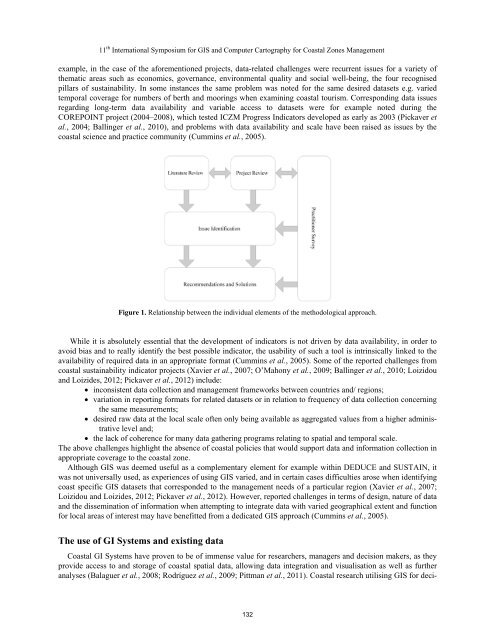
11 th International Symposium for GIS and Computer Cartography for Coastal Zones Managementexample, in the case of the aforementioned projects, data-related challenges were recurrent issues for a variety ofthematic areas such as economics, governance, environmental quality and social well-being, the four recognisedpillars of sustainability. In some instances the same problem was noted for the same desired datasets e.g. variedtemporal coverage for numbers of berth and moorings when examining coastal tourism. Corresponding data issuesregarding long-term data availability and variable access to datasets were for example noted during theCOREPOINT project (2004–2008), which tested ICZM Progress Indicators developed as early as 2003 (Pickaver etal., 2004; Ballinger et al., 2010), and problems with data availability and scale have been raised as issues by thecoastal science and practice community (Cummins et al., 2005).Figure 1. Relationship between the individual elements of the methodological approach.While it is absolutely essential that the development of indicators is not driven by data availability, in order toavoid bias and to really identify the best possible indicator, the usability of such a tool is intrinsically linked to theavailability of required data in an appropriate format (Cummins et al., 2005). Some of the reported challenges fromcoastal sustainability indicator projects (Xavier et al., 2007; O’Mahony et al., 2009; Ballinger et al., 2010; Loizidouand Loizides, 2012; Pickaver et al., 2012) include: inconsistent data collection and management frameworks between countries and/ regions; variation in reporting formats for related datasets or in relation to frequency of data collection concerningthe same measurements; desired raw data at the local scale often only being available as aggregated values from a higher administrativelevel and; the lack of coherence for many data gathering programs relating to spatial and temporal scale.The above challenges highlight the absence of coastal policies that would support data and information collection inappropriate coverage to the coastal zone.Although GIS was deemed useful as a complementary element for example within DEDUCE and SUSTAIN, itwas not universally used, as experiences of using GIS varied, and in certain cases difficulties arose when identifyingcoast specific GIS datasets that corresponded to the management needs of a particular region (Xavier et al., 2007;Loizidou and Loizides, 2012; Pickaver et al., 2012). However, reported challenges in terms of design, nature of dataand the dissemination of information when attempting to integrate data with varied geographical extent and functionfor local areas of interest may have benefitted from a dedicated GIS approach (Cummins et al., 2005).The use of GI Systems and existing dataCoastal GI Systems have proven to be of immense value for researchers, managers and decision makers, as theyprovide access to and storage of coastal spatial data, allowing data integration and visualisation as well as furtheranalyses (Balaguer et al., 2008; Rodríguez et al., 2009; Pittman et al., 2011). Coastal research utilising GIS for deci-132
11 th International Symposium for GIS and Computer Cartography for Coastal Zones Managementsion support often requires integration of data from numerous organisations into a GIS environment (Tolvanen andKalliola, 2008; Meiner, 2010). However, data from external sources has to be evaluated and put into context in orderto generate relevant information. Amalgamation of data sets that are hypothetically deemed useful, will lead to anover-complicated GIS unable to perform as an effective decision support tool (Tolvanen and Kalliola, 2008; Stojanovicet al., 2010). Establishing practical evaluation criteria for the data in order to address spatial and thematicrequirements will enable a GIS to convey meaningful information (Tolvanen and Kalliola, 2008). A specific CoastalIndicator System (COINS) was developed during the BLAST project, where a subset of the DEDUCE developedindicators were integrated within a GI environment in accordance with the INSPIRE Directive. The indicator subsetwas selected with relevance to climate change and harmonised spatial land and sea data were used to populate theindicators (Hansen and Fuglsang, 2012). A GI environment benefited this indicator project, where the technologyovercame specific spatial data constraints which facilitated harmonisation of datasets and the indicators themselvesprovided evaluation criteria to address thematic requirements such as relevance to climate change. Another recentproject identified indicators based on end user needs in reference to the DEDUCE indicators for Brittany. The lessonsof this project emerged from the implementation of number of methods in a Coastal Spatial Infrastructure(CSDI) called GeoBretagne e.g. acquisition, storage and analyses of data in a GI environment and communicatingand sharing that data through an online portal. GeoBretagne used selection criteria such as end user needs and establishedindicator projects (DEDUCE) to incorporate existing data and a combination of technology to overcome dataquality and access issues (Gourmelon et al., 2012).Technical innovation can address some of the limitations such as spatial predictive modelling to fill spatial datagaps (Pittman et al., 2011), while other solutions to communicate meaningful information from existing data sets aresought by arranging the available data in nested hierarchies within a GIS environment to overcome some of theissues relating to scale (Hynes and Farrelly, 2010; Meiner, 2010). However, some ongoing challenges with the useof existing data for any Coastal GIS are still pertinent even if evaluation criteria are well defined, as temporal andspatial scales of data sets are often not compatible and some essential data sets are not universally available at thedifferent scales required in a pan-European context, or not freely accessible due to copyright issues (Meiner, 2010;Stojanovic et al., 2010; Pittman et al., 2011). The INSPIRE Directive, which aims to create a European Union spatialdata infrastructure for sharing of environmental spatial information among public sector organisations and betteraid public access to spatial information across Europe (Longhorn, 2012), is anticipated to address many of the abovementioned challenges (Cummins et al., 2005; Meiner 2010; Gourmelon et al., 2012). However, the roadmap towardsfull implementation, as well as potential future enforcement issues, does not facilitate timely realisation of the Directiveto benefit local and regional coastal managers, who currently and urgently require data and information.Discussion and ConclusionTechnical innovation and a dedicated GIS approach can address some challenges related to the use of existing dataexperienced by sustainable coastal indicator projects in Europe. However, some challenges persist and are notovercome through the use of technical solutions or different GIS approaches. These challenges require tremendousefforts in streamlining metadata for comparison between desired datasets and effective data and information sharingat the European level. This process is supported and has commenced through the INSPIRE Directive. While theDirective addresses a number of the issues outlined above, its implementation may be too slow for coastal practitionersthat require reliable information now in order to support sustainable long-term development in their coastalareas. A number of the above noted challenges hinder analyses of the state of the coast in Europe and reinforce thesectoral perception and evaluation that is traditional. Existing sectoral policies relevant to the coast do not facilitateor incorporate data collection requirements with regards to impacts on the coast. The coast is not covered in thedistinct reporting and data collection units available on a comparable level in Europe. A disconnect between therecognition of indicators to be valuable tools for sustainable coastal development and the common as well as persistentdata issues as experienced by several indicator projects, needs to be addressed as part of an integrated policyapproach in order to make them usable for local and regional coastal managers. Solutions to bridge the disconnectneed to include the use of appropriate technology e.g. building a dedicated GIS that integrates relevant datasets withthe ability to communicate data into meaningful information for a non GIS audience as well as dedicated data collectionguidance appropriate to the coast, the latter being supported through relevant policy. Such data collection133