

Download PDF - COINAtlantic
Download PDF - COINAtlantic
Download PDF - COINAtlantic
- No tags were found...

You also want an ePaper? Increase the reach of your titles
YUMPU automatically turns print PDFs into web optimized ePapers that Google loves.
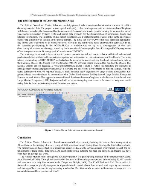
11 th International Symposium for GIS and Computer Cartography for Coastal Zones ManagementThe development of the African Marine AtlasThe African Coastal and Marine Atlas was carefully planned to be a continental-scale online resource of publicdomaingeospatial data. The project was designed to identify, collect and organize data sets into an atlas of biophysicalthemes, including the human and built environment. A second aim was to provide training to increase the use ofGeographic Information Systems (GIS) and spatial data products for the dissemination of appropriate, timely andrelevant information. The inventory of data sets in the atlas is also a useful indicator of gaps, either in the knowledgebase or the availability of the data in the public domain. The initial list of over 200 continental-scale data sets identifiedfor the atlas was based on an extensive survey of coastal and marine data needs undertaken in early 2006 by allthe countries participating in the ODINAFRICA. A website was set up as a clearinghouse of data sets(http://omap.africanmarineatlas.org), hosted by the International Oceanographic Data Exchange (IODE) programmeof the Intergovernmental Oceanographic Commission of UNESCO.The next stage in atlas development was to produce national coastal and marine atlases, additional value-addedproducts and content that could support interrogation and information services at national and local levels. The institutionsparticipating in ODINAFRICA embarked on the exercise to source and add local and national scale data totheir national atlases. The Marine Irish Digital Atlas (MIDA) software engine was used for building the atlases. Thenational atlases can be accessed at www.africanmarineatlas.net (Figure 1) while the metadata are available athttp://geonetwork.iode.org/geonetworkAMA/. Following the successful development of national atlases, regionalteams commenced work on regional atlases, at multi-national scale, organised by Large Marine Ecosystems. Regionalatlases were developed in cooperation with Global Environment Facility-funded Large Marine EcosystemProjects around Africa. This approach also facilitated the dissemination of regional scale datasets from the AfricanLarge Marine Ecosystem (LME) Projects, and will serve as an ongoing data resource for access to long term monitoringdata for these important regions of the coast and ocean.Figure 1. African Marine Atlas site (www.africanmarineatlas.net.)ConclusionThe African Marine Atlas project has demonstrated effective capacity building for marine data management inAfrica through the training of a core group of GIS practitioners and having them develop the final atlas products.The project has also been effective at increasing access to data on the African marine environment through the establishmentof these spatial data portals. An additional positive outcome has been the networks and teams that havebeen built up through this work.The African Marine Atlas, through the IODE programme, is a participating member of the International CoastalAtlas Network (ICAN). Through this association the Atlas will be an important partner in broadening ICAN’s reachand relevance on a truly international scale (Dwyer and Wright, 2008). The ICAN Technical Task Force, which isfocussed on ways to globally-integrate locally-maintained coastal atlases, has assisted with capacity developmentand sharing of best practices in implementing a web atlas. The African Marine Atlas will continue to adopt the recommendationsand best practices of ICAN.173


