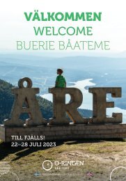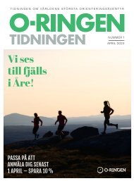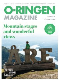
Programme O-Ringen Värmland 2017

Create successful ePaper yourself
Turn your PDF publications into a flip-book with our unique Google optimized e-Paper software.
PROGRAMME O-RINGEN VÄRMLAND <strong>2017</strong><br />
25<br />
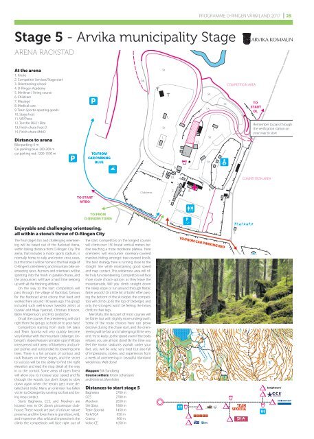
Stage 5 - Arvika municipality Stage<br />
ARENA RACKSTAD<br />
COMPETITION AREA<br />
At the arena<br />
1. Kiosks<br />
2. Competitor Services/Stage start<br />
3. Orienteering school<br />
4. O-<strong>Ringen</strong> Academy<br />
5. Miniknat / String course<br />
6. Childcare<br />
7. Massage<br />
8. Medical care<br />
9. Team Sportia sporting goods<br />
10. Stage host<br />
11. VIP/Press<br />
12. Tent for DH21 Elite<br />
13. Finish chute Foot O<br />
14. Finish chute MtbO<br />
Distance to arena<br />
Bike parking: 0 m<br />
Car parking blue: 200-300 m<br />
car parking red: 1200-1500 m<br />
TO/FROM<br />
CAR PARKING<br />
BLUE<br />
14.<br />
Sit<br />
1.<br />
Sit<br />
1.<br />
9.<br />
11.<br />
12.<br />
1.<br />
Sit<br />
13.<br />
1.<br />
Sit<br />
Sit<br />
Sit<br />
COMPETITION AREA<br />
TO<br />
START<br />
OL<br />
Remember to pass through<br />
the verification station on<br />
your way to start<br />
TO START<br />
MTBO<br />
Club tents<br />
10. 4.<br />
3.<br />
2. 8.<br />
7.<br />
6.<br />
COMPETITION AREA<br />
TO/FROM<br />
O-RINGEN TOWN<br />
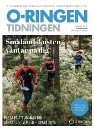
Enjoyable and challenging orienteering,<br />
all within a stone’s throw of O-<strong>Ringen</strong> City<br />
The final stage’s fun and challenging orienteering<br />
will be based out of the Rackstad Arena,<br />
within biking distance from O-<strong>Ringen</strong> City. The<br />
arena, that includes a motor sports stadium, is<br />
normally home to rally and motor cross races,<br />
but this time it will be home to the final stage of<br />
O-<strong>Ringen</strong>’s orienteering and mountain bike orienteering<br />
races. Runners and orienteers will be<br />
sprinting into the finish in parallel chutes, and<br />
the announcers will have a hard time keeping<br />
up with all the finishing athletes.<br />
On the way to the start competitors will<br />
pass through the village of Rackstad, famous<br />
for the Rackstad artist colony that lived and<br />
worked here around 100 years ago. This group<br />
included such well-known Swedish artists at<br />
Gustav and Maja Fjaestad, Christian Eriksson,<br />
Björn Ahlgrensson, and Fritz Lindström.<br />
On all the courses the orienteering will start<br />
right from the get-go, so hold on to your hats!<br />
Competitors starting from starts SIA Glass<br />
and Team Sportia will very quickly become<br />
very familiar with the mountain Oxberget. Oxberget’s<br />
slopes feature runnable open hilltops<br />
interspersed with areas of blueberry and juniper<br />
pushes and surrounded by towering pine<br />
trees. There is a fair amount of contour and<br />
rock features on these slopes, and the secret<br />
to success will be the ability to find the right<br />
elevation and read the map detail all the way<br />
in to the control. Some areas of open forest<br />
will allow you to increase your speed and fly<br />
through the woods, but don’t forget to slow<br />
down again when the terrain gets more detailed<br />
and tricky. Many an orienteer has fallen<br />
victim to Oxberget by running too fast and losing<br />
map contact.<br />
Starts Bagheera, CCS, and Moelven are<br />
located next to OK Jösse’s picturesque clubhouse.<br />
These woods are part of a future nature<br />
preserve, and the forest here is grandiose, wild,<br />
and impressive. Also wild and impressive is the<br />
climb the competitors will face right out of<br />
the start. Competitors on the longest courses<br />
will climb over 150 brutal vertical meters before<br />
reaching a more moderate plateau. Here<br />
orienteers will encounter rosemary-covered<br />
marshes hiding amongst tree-covered knolls.<br />
The best strategy here is running close to the<br />
straight line while maintaining good speed<br />
and map contact. This wilderness area will offer<br />
truly fun orienteering. Competitors will face<br />
more route choice options as they leave the<br />
mountainside. Will you climb straight down<br />
the steep slope or run around through flatter,<br />
faster woods? Or a little bit of both? After passing<br />
the bottom of the ski slopes the competitors<br />
will climb up to the top of Oxberget, and<br />
only the strongest won’t be feeling the heavy<br />
climb in their legs.<br />
Mercifully, the last part of most courses will<br />
be flatter but with slightly more undergrowth.<br />
Some of the route choices here can prove<br />
decisive during the chase start, and the orienteering<br />
will be fast and challenging till the very<br />
end. Try to keep up the speed even if the body<br />
refuses: you are almost done! By the time you<br />
feel the motor stadium’s asphalt under your<br />
feet, you will be very, very tired but also full<br />
of impressions, stories, and experiences from<br />
a week of orienteering in beautiful <strong>Värmland</strong><br />
wilderness. Well done!<br />
Mapper: Erik Sundberg<br />
Course setters: Kristin Johansson<br />
and Kristina Löfvenholm<br />
Distances to start stage 5<br />
Bagheera<br />
CCS<br />
Moelven<br />
SIA Glass<br />
Team Sportia<br />
Tork/SCA<br />
Cramo<br />
Volvo CE<br />
2700 m<br />
2700 m<br />
2650 m<br />
1800 m<br />
1450 m<br />
950 m<br />
900 m<br />
1050 m<br />
TO/FROM CAR PARKING RED<br />
5.