

Crown Land: Indicators and Statistics - Ministry of Forests
Crown Land: Indicators and Statistics - Ministry of Forests
Crown Land: Indicators and Statistics - Ministry of Forests

You also want an ePaper? Increase the reach of your titles
YUMPU automatically turns print PDFs into web optimized ePapers that Google loves.
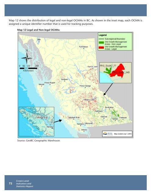
Map 12 shows the distribution <strong>of</strong> legal <strong>and</strong> non-legal OGMAs in BC. As shown in the inset map, each OGMA is<br />
assigned a unique identifier number that is used for tracking purposes.<br />
Map 12 Legal <strong>and</strong> Non-legal OGMAs<br />
Source: GeoBC Geographic Warehouse<br />
<strong>Crown</strong> <strong>L<strong>and</strong></strong>:<br />
<strong>Indicators</strong> <strong>and</strong><br />
72 <strong>Statistics</strong> Report<br />
Map created July 1, 2010


