- Page 3:
T.C.KÜLTÜR VE TURİZM BAKANLIĞIK
- Page 7:
Taner KORKUTTlos 2010 Kazı Etkinli
- Page 10:
açmalar höyüğün tepe düzlüğ
- Page 13 and 14:
uzunlukta ve 5.40 m. genişlikte ol
- Page 15 and 16:
Söz konusu yapı katının altınd
- Page 17:
Birinci yapının güneybatısında
- Page 20 and 21:
Çizim 3: Yenibademli Höyük. F 8
- Page 22 and 23:
Çizim 6: Yenibademli Höyük. F 9-
- Page 24 and 25:
Resim 3: Yenibademli Höyük. G 8 a
- Page 26 and 27:
Resim 7: Yenibademli Höyük. F 9 a
- Page 28 and 29:
2. Güney Nekropolü20Hasan KASAPO
- Page 30 and 31:
M.Ö.6.yy.a tarihlenen büyük boyu
- Page 32 and 33:
ölçülerinde taban blok-tuğlası
- Page 34 and 35:
5. Tiyatro ÇalışmalarıH. Ertuğ
- Page 36 and 37:
parçası, 2 mermer tabak parçası
- Page 38 and 39:
“bronz amphora” üzerinde, Uzma
- Page 40 and 41:
Resim 3: L2 No.lu lâhit ve ölü h
- Page 42 and 43:
Resim 7: Parion Roma Hamamı 2010 y
- Page 44 and 45:
Resim 11: Parion Tiyatrosu Sahne Bi
- Page 46 and 47:
Reim 15: Parion Odeionu 2010 yılı
- Page 48 and 49:
Hadrianoupolis birçok yabancı ara
- Page 50 and 51:
yanında mozaik alanın tesseralar
- Page 52 and 53:
TOPOĞRAFİK HARİTA ÇALIŞMASIHad
- Page 54 and 55:
Resim: 1Resim: 246
- Page 56:
Resim: 5Resim: 648
- Page 59 and 60:
Resim: 1151
- Page 61 and 62:
GirişZEYTİNLİADA 2010 YILI <stro
- Page 63 and 64:
Basamaklı Sunak AlanıKazının ü
- Page 65 and 66:
Süpürgelikleri mermerden sağlam
- Page 67 and 68:
inalarının moloz döküntüsünü
- Page 69 and 70:
yeşil alanla kapatılacaktır. Sey
- Page 71 and 72: Resim 3: Açık hava tapınım alan
- Page 73 and 74: Resim 7: Yer Altı KilisesiResim 8:
- Page 75 and 76: Resim 11: Patrik HamamıResim 12: M
- Page 77 and 78: TEPECİK-ÇİFTLİK KAZI</s
- Page 79 and 80: kaldırılmıştır. Bu bağlamda 1
- Page 81 and 82: görmüş duvar parçaları ve devr
- Page 83 and 84: üç farklı mekânın daha eklenmi
- Page 85 and 86: kalıntıların yer almadığı mer
- Page 87 and 88: ileride malzeme kaynakları-atölye
- Page 89 and 90: 5-9. tabakalar ufak bir derin açma
- Page 91 and 92: Resim 3: 16M açmasında obsidyen i
- Page 93 and 94: Resim 7: 16-17J-K açmalarında 5.
- Page 95 and 96: Resim 11: 16V sondajında açma dib
- Page 97: Resim 15: a, b: 3. tabakada ele ge
- Page 100 and 101: kemik deliciler ile taştan yassı
- Page 102 and 103: arasına, yani M.Ö. 2100 ile M.Ö.
- Page 104 and 105: Resim: 2bResim: 3Resim: 4a96
- Page 106 and 107: Resim: 5 Resim: 6Resim: 798
- Page 108 and 109: Resim: 10Resim: 11100
- Page 110 and 111: Resim: 14102Resim: 15
- Page 112 and 113: It had become obvious that an up-to
- Page 114 and 115: In the southern part of the trench,
- Page 116 and 117: discussed above. A coin (probably 4
- Page 118 and 119: 1327 (8.65%) are diagnostic fragmen
- Page 120 and 121: Table 1: Simplified chronology of c
- Page 124 and 125: was a particular focus on cemeterie
- Page 126 and 127: Another separate zone of the platea
- Page 128 and 129: Geophysical Surveys 2010Armin SCHMI
- Page 130 and 131: Watchtower (P17, F047)This partly e
- Page 132 and 133: iron supply pipe and anomaly [42] i
- Page 134 and 135: New InscriptionsAlexandru AVRAMFour
- Page 136 and 137: 4hederaTranslation:Memnon (raised t
- Page 138 and 139: L. 2: only the top of some letters
- Page 140 and 141: Fig. 1: New site map, Pessinus.132
- Page 142 and 143: Fig. 3: Top plan of Sector R, trial
- Page 144 and 145: Fig. 5: Map of extensive archaeolog
- Page 146 and 147: Fig. 7: Location of surveyed fields
- Page 148 and 149: Fig. 9: Promontory (P13, F132), 0.1
- Page 150 and 151: Fig. 11: Tekören Field C (P16), ma
- Page 152 and 153: Fig. 14: Funerary stele from thesur
- Page 154 and 155: Üniversitesi), Arkeolog Özge Yurt
- Page 156 and 157: 1 No.lu mekânın kuzey sınır duv
- Page 158 and 159: halka kaideli kâseler, çeşitli f
- Page 160 and 161: Apodyteriumun doğu iç cephesinde
- Page 162 and 163: Apodyterium zemin döşemesinin kal
- Page 164 and 165: Nişli yapının en dikkat çeken y
- Page 166 and 167: tesseralarla örülmüş dış bord
- Page 168 and 169: E.SU KANALLARI VE ROMA HAMAMI HİZM
- Page 170 and 171: Plan 1: Smintheion 2010 genel plan1
- Page 172 and 173:
Plan 3: Roma hamamı genel plan164
- Page 174 and 175:
Resim 2: Kalkolitik Gülpınar 2010
- Page 176 and 177:
Resim 6: Roma Evleri. Genel görün
- Page 178 and 179:
Resim 9: Roma hamamı hizmetli kori
- Page 181 and 182:
ILISU BARAJI - SALAT TEPE 2010 YILI
- Page 183 and 184:
taştan üretilmiş bir silindir m
- Page 185 and 186:
irkaç evreli ocak tabanları bulun
- Page 187 and 188:
kullanılan tabanları açılmışt
- Page 189 and 190:
elirlendiğinden, I12/35/M kodu ver
- Page 191 and 192:
Resim 1: K-L 14 Açmaları Orta Tun
- Page 193 and 194:
Resim 5: K 14 Açması Orta Tunç
- Page 195:
Resim 9: I 12 Açması güney basam
- Page 198 and 199:
B 17 açmasının kuzey yarısında
- Page 200 and 201:
oluşan taş kümeleri (C4/002-006/
- Page 202 and 203:
(E4/0006/P/01) ağzı yassı bir ta
- Page 204 and 205:
içimde ele geçirilmiştir. Parça
- Page 206 and 207:
Demir Çağına tarihlenen seramik
- Page 208 and 209:
Resim 2: Ilısu Höyüğü 2010 yı
- Page 210 and 211:
Resim 5: Havuz Mevkii kazı alanın
- Page 212 and 213:
Resim 9: Havuz Mevkii C 4 açması
- Page 214 and 215:
Arbeiten im Zentrum des Gipfelplate
- Page 216 and 217:
Weiter östlich sind Grabungen süd
- Page 218 and 219:
Aus der rezenten Topographie ließ
- Page 220 and 221:
Geländeabsatz getrennt und zu den
- Page 222 and 223:
Abb:3Abb:4214
- Page 224 and 225:
Abb:7Abb:8216
- Page 226 and 227:
Abb:11Abb:12218
- Page 229 and 230:
WORK AT IASOS,THE 2010 CAMPAIGNFede
- Page 231 and 232:
key for understanding (also chronol
- Page 233 and 234:
The study of the water supply syste
- Page 235 and 236:
year), and the group of fourth/thir
- Page 237 and 238:
Fig. 1: Iasos. Plaques from a corse
- Page 239:
Fig. 5: Iasos. The spring-fountain.
- Page 242 and 243:
Müzeler Genel Müdürlüğü’nü
- Page 244 and 245:
u teras-sur duvarı höyüğün etr
- Page 246 and 247:
güney yöndeki 44.21m. uzunluğund
- Page 248 and 249:
içerisinde dört altın küpe, iki
- Page 250 and 251:
Mimarî buluntular arasında mekân
- Page 252 and 253:
ATÖLYE-DEPO MEKÂNI47 No.lu Mekân
- Page 254 and 255:
Mekânın kuzeydoğu köşesinde, 0
- Page 256 and 257:
Resim 1: Seyitömer Höyüğü’n
- Page 258 and 259:
Plan 3: Orta Tunç Çağ IV-C Evres
- Page 260 and 261:
Resim 4: Orta Tunç Çağı metal e
- Page 262 and 263:
Resim 7: Saray kompleksinin depo me
- Page 265 and 266:
KYZIKOS 2010Nurettin KOÇHAN*Korkma
- Page 267 and 268:
gerekir. Ancak Cyriacus’un bu öl
- Page 269 and 270:
devam etti. Geçen yıllarda iki me
- Page 271 and 272:
Çizim: 1Çizim: 2263
- Page 273 and 274:
Resim: 1Resim: 2265
- Page 275 and 276:
Resim: 5Resim: 6267
- Page 277 and 278:
Resim: 9Resim: 10269
- Page 279 and 280:
ANTANDROS 2010 YILI KAZI</s
- Page 281 and 282:
içerisinde 30,60 m. seviyesine kad
- Page 283 and 284:
2009 yılında kripto-portiko içer
- Page 285 and 286:
2009-2010 kış sezonunda yoğun ya
- Page 287 and 288:
11.18 m. seviyesin
- Page 289 and 290:
işlenmiş iki blok taşı 8.97 m.
- Page 291 and 292:
yarısına tarihli boyundan omuza k
- Page 293 and 294:
Güneydoğu II AçmasıNekropolis
- Page 295 and 296:
348 No.lu lâhdin kuzeyinde 353 ve
- Page 297 and 298:
Resim 1 : Yamaç Ev, kuzeydoğu son
- Page 299 and 300:
Resim 5 : Yamaç Ev, güney sondaj
- Page 301 and 302:
Resim 9 : Nekropolis Açması, 336
- Page 303 and 304:
GRE ABDURRAHMAN 2010 YILI K
- Page 305 and 306:
eteklerinde saptanan kerpiç mimar
- Page 307 and 308:
A21’de saptanan duvar ve taban do
- Page 309 and 310:
BuluntularGre Abdurrahman kazılar
- Page 311 and 312:
Üst katmanlarında saptanan ve bir
- Page 313 and 314:
çanak parçası. Katkılar: seyrek
- Page 315 and 316:
ağız parçası; kaba çark üreti
- Page 317 and 318:
Çizim 1: Gre Abdurrahman, topoğra
- Page 319 and 320:
Çizim 5: Gre Abdurrahman, Asurİmp
- Page 321:
Resim 4: Ortaçağ mezar buluntusu,
- Page 324 and 325:
sorumluluğunda yapılan antropoloj
- Page 326 and 327:
kuş tüylerinin sert saplarından
- Page 328 and 329:
The Study of StratigraphyMarion BEN
- Page 330 and 331:
322Discussion: Observations in Tren
- Page 332 and 333:
(% 5) karşılaşılan diş aşınm
- Page 334 and 335:
Zooarkeolojik ÇalışmalarLevent A
- Page 336 and 337:
ilişkilendirmek doğru olacaktır.
- Page 338 and 339:
MOLLESON T. 1994. “The eloquent b
- Page 340 and 341:
Çizim 3: A80 açması doğu profil
- Page 342 and 343:
Resim 3: Taş ve kabuk boncuklar334
- Page 344 and 345:
Resim 7: Dişlerde görülen transv
- Page 346 and 347:
Boyut kategorisi/Taksonomik tanıml
- Page 348 and 349:
altında bu kampanyada da devam edi
- Page 350 and 351:
Kule altı terasındaki mezarlar ap
- Page 352 and 353:
ifade ile kent dışından değil d
- Page 354 and 355:
etmektedir 14 . Buluntular arasınd
- Page 356 and 357:
u bireylerin salgın hastalık sonu
- Page 358 and 359:
350Mozaik taban, binanın orta nefi
- Page 360 and 361:
(kireç taşı) renklerdedir. Yapı
- Page 362 and 363:
Bu mermer ise, delta-13C:-4.88 ve d
- Page 364 and 365:
Bozdağ ocağı mermerinin İ.S. 6.
- Page 366 and 367:
Resim: 1Resim: 2358
- Page 368 and 369:
Resim: 5Resim: 6360
- Page 370 and 371:
Resim: 9Resim: 10362
- Page 373 and 374:
GİRİŞ2010 YILI GÖKÇEADA UĞURL
- Page 375 and 376:
Ayrıca binanın içi mekânlara b
- Page 377 and 378:
üyük çoğunluğunu spatulalar ol
- Page 379 and 380:
ÇİLİNGİROĞLU, Ç., 2009. Centr
- Page 381 and 382:
Fig. 2: Kuzeybatı Açmalarından g
- Page 383 and 384:
KİLİSE TEPE ERKEN TUNÇ ÇAĞI Ç
- Page 385 and 386:
alt safhaya ait olduğu düşünül
- Page 387 and 388:
imâl edilmiştir (G19/45, G20/02).
- Page 389 and 390:
Plan 1: Kilise Tepe’nin açma yer
- Page 391 and 392:
Resim 3: 2010 sezonunda konservasyo
- Page 393 and 394:
Resim 7: Erken Tunç Çağı 2. saf
- Page 395 and 396:
Resim 11: Erken Tunç Çağı açma
- Page 397 and 398:
MAYDOS KİLİSETEPE HÖYÜĞÜ2010
- Page 399 and 400:
ortaya çıkarılan ve buluntu duru
- Page 401 and 402:
sistemi dik konmuş taşlar ile bu
- Page 403 and 404:
ilinen ve üzeri parmak baskılı p
- Page 405 and 406:
Höyük Etrafında Gerçekleştiril
- Page 407 and 408:
Plan 1: Maydos Kilisetepe Höyüğ
- Page 409 and 410:
Plan 3: D4.1 ve D4.3 karelerindeki
- Page 411 and 412:
Resim 1: Maydos Kilisetepe Höyüğ
- Page 413 and 414:
Resim 5: Karesi’ndeki Bizans mima
- Page 415 and 416:
Resim 9: ‘Barbarische Ware’ ya
- Page 417 and 418:
KİNET HÖYÜK (YEŞİL-DÖRTYOL, H
- Page 419 and 420:
III’den ve Orta Tunç I dönemler
- Page 421 and 422:
gönderilmiştir. Buna ek olarak E.
- Page 423 and 424:
TÜPRAŞ Sit Alanı yerinin ortası
- Page 425:
Resim 1: Kinet Höyük 1992-2008 ka
- Page 428 and 429:
OSMANLI DÖNEMİYüzeye oldukça ya
- Page 430 and 431:
sistemde inşa edilmiştir. Dikkati
- Page 432 and 433:
devam etmekte ve D mekânının ara
- Page 434 and 435:
ait ise çok az parça bulunmuştur
- Page 436 and 437:
Şehrin II ve Ib tabakasında 6 , t
- Page 438 and 439:
Özellikle mimarî oluşumlar bağl
- Page 440 and 441:
Plan: 1Resim: 1432
- Page 442 and 443:
Resim: 4Resim: 5434
- Page 444 and 445:
Resim: 8Resim: 9436
- Page 446 and 447:
Resim: 12Resim: 13438
- Page 449 and 450:
LIMYRA 2010Martin SEYER und Mitarbe
- Page 451 and 452:
Der Schwerpunkt der Arbeiten lag in
- Page 453 and 454:
untersucht und bestimmt wurden. Dan
- Page 455 and 456:
Abb. 1: Theaterthermen, schematisch
- Page 457 and 458:
Abb. 5: Theaterthermen, Raum VIIIAb
- Page 459 and 460:
Abb. 9: Christliches Amulett mit gr
- Page 461 and 462:
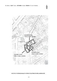
12010 yılı Tlos kazı etkinlikler
- Page 463 and 464:
pencere bulunurken, üçüncü kata
- Page 465 and 466:
loklardan örülerek yapıldığı
- Page 467 and 468:
mezar yuvarlak hatıllı üst silme
- Page 469 and 470:
güneyinde uzunluğu 60 cm., geniş
- Page 471 and 472:
VIII. GİRMELER MAĞARASITaner KORK
- Page 473 and 474:
hakkında veriler sunan su kanallar
- Page 475 and 476:
Resim: 1Resim: 2467
- Page 477 and 478:
Resim: 5Resim: 6469
- Page 479 and 480:
Resim: 9Resim: 10471
- Page 481 and 482:
Resim: 13Resim: 14473
- Page 483 and 484:
PHRYGİA HİERAPOLİS’İ (PAMUKKA
- Page 485 and 486:
üyük monolitik çok renkli breş
- Page 487 and 488:
gerçekleştirildi. Yapının ve ç
- Page 489 and 490:
duvarlarının hidrolik kireçle s
- Page 491 and 492:
kayalığın metamorfik şistten ol
- Page 493 and 494:
Roma Dönemi tabanına kadar kazıl
- Page 495 and 496:
amacıyla yapılan proje 17 , çeli
- Page 497 and 498:
Resim 3: Apollon Kutsal Alanı: Nym
- Page 499 and 500:
Resim 7: Kaynaklar Kutsal Alanıyak
- Page 501 and 502:
Resim 11: 104 No.lu insula, Dor Avl
- Page 503:
Resim 15: Gymnasion, Dorik portikon
- Page 506 and 507:
kuzeybatı yükseltisi üzerinde s
- Page 508 and 509:
J22 ve I22a AÇMALARIJ22 Açması
- Page 510 and 511:
evresinin tümüyle açığa çıka
- Page 512 and 513:
genellikle karına doğru hafif bü
- Page 514 and 515:
L21 AÇMASIİlk kez 2009 yılında
- Page 516 and 517:
Donbaz tarafından serbest bir çev
- Page 518 and 519:
510KAYNAKÇAEINWAG, 2002., “The E
- Page 520 and 521:
Resim 3: OTÇ II fayans kapları (E
- Page 522 and 523:
Resim 7: K21 Açması, OTÇ II, kul
- Page 524 and 525:
Resim 10: K22 Açması, OTÇ II mez
- Page 526 and 527:
Resim 13: L22 Açması, OTÇ II evi
- Page 528 and 529:
kaynaklı olarak kuzey-güney doğr
- Page 530 and 531:
a) Kuzey Yarıdaki ÇalışmalarKuz
- Page 532 and 533:
yerleştirilmiş tuğla malzemenin
- Page 534 and 535:
Tümülüsün ön ve mezar odasın
- Page 536 and 537:
Resim 1: 1 Numaralı DuvarResim 2:
- Page 538 and 539:
Resim 5: PithosResim 6: Koru Tümü
- Page 540 and 541:
Resim 9: Koru Tümülüsü, yanık
- Page 542 and 543:
yayılmış olduğundan hattın ge
- Page 544 and 545:
Kurgan 21: Mezarlığın güneydoğ
- Page 546 and 547:
Son Tunç-Erken Demir Çağ parçal
- Page 548 and 549:
u yeni yerleşim sistemini gösteri
- Page 550 and 551:
Çizim 1: Bozkurt Mezarlığı topo
- Page 552 and 553:
Çizim 3: Kurgan 32.Çizim 4: Kurga
- Page 554 and 555:
Resim 2: Kurgan 26.Resim 3: Kurgan
- Page 556 and 557:
Resim 6: OrtaTunç/Erken Demir Ça
- Page 558 and 559:
Resim 10: Frit ve tunç boncuklar,
- Page 560 and 561:
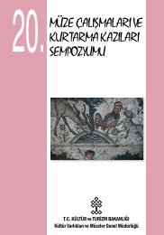
DEĞERLİ BİLİM ADAMIGenel Müdü


![11. Türk Arkeoloji ve Etnografya Dergisi [2011] - kulturvarliklari.gov.tr](https://img.yumpu.com/50970752/1/182x260/11-turk-arkeoloji-ve-etnografya-dergisi-2011-kulturvarliklarigovtr.jpg?quality=85)