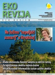
Eko revija broj 15 - Fond za zaštitu okoliša i energetsku učinkovitost
Eko revija broj 15 - Fond za zaštitu okoliša i energetsku učinkovitost
Eko revija broj 15 - Fond za zaštitu okoliša i energetsku učinkovitost

You also want an ePaper? Increase the reach of your titles
YUMPU automatically turns print PDFs into web optimized ePapers that Google loves.
Davor Verković: Lokve - the green frog<br />
awaits help! (page 75)<br />
The little green frog is one of the cutest<br />
creatures we have encountered in Lokve.<br />
A smiling frog will greet you from every<br />
promotional leaflet and even trashcans<br />
are decorated with frogs. That makes<br />
sense if you know that the name of the<br />
village Lokve means “a pond” and ponds<br />
are frogs’ favorite habitat. Although often<br />
humorously called “frog-eaters”, the inhabitants<br />
of the village have turned that<br />
nickname to their advantage. Today, a frog<br />
is their trademark and no one can take it<br />
away from them. They have also founded<br />
a Museum of Frogs and its owner tells us<br />
it is unique in Europe. For <strong>15</strong> kuna, you can<br />
explore more than <strong>15</strong>00 exhibits - live and<br />
stuffed frogs or frog-related souvenirs.<br />
You can also buy The Frog’s Blood - liquor<br />
made of forest fruit (not blood). They<br />
also hold events titled the Frog-catchers’<br />
Week, the Frog-catchers’ Night and the<br />
Little Frog-Catcher’s Night.<br />
Krunoslav Rac: The island of Prvić<br />
(page 76)<br />
Not many people in Croatia would know<br />
the answer to the question of which is the<br />
largest uninhabited Croatian island. How<br />
about the windiest? The answer to both<br />
questions is: Prvić. Prvić is located southeast<br />
of Krk, the largest Croatian island, from<br />
which it is separated by the 800 meters<br />
wide channel Senjska Vrata. The island is<br />
mostly a barren, rocky plateau made additionally<br />
inhospitable by harsh northern<br />
wind bora. While people were living in<br />
a Stražica lighthouse, they kept track of<br />
meteorological conditions on the island.<br />
According to the statistic, bora blows on<br />
Prvić 303 days a year, out of which on 73<br />
days it rises to 11-12 bofors. The wind is<br />
strongest in the Senjska Vrata channel and<br />
can pose a serious threat for sailing boats.<br />
Although the island is uninhabited, there<br />
are many traces of human activities. Inhabitants<br />
of the Sveti Juraj and Baška on Krk<br />
keep their sheep there. They move across<br />
the island acting like wild animals, grazing<br />
dispersed, wherever they find something<br />
to graze upon. Because they do not graze<br />
in herds, every owner marks his sheep<br />
with a different color.<br />
Vanja Vitelj: The island of Rab (page 78)<br />
The island of Rab is a part of the Kvarner<br />
Bay archipelago, in the northern Adriatic.<br />
The island is sheltered from cold, northern<br />
winds by the Kamenjak hill, so the temperatures<br />
almost never drop below the<br />
freezing point. Average summer temperature<br />
is 26 °C and 7°C in the winter. With<br />
an average of 2470 hours of sunshine a<br />
year, Rab is rightfully called “the island of<br />
the sun”. The island’s population is on the<br />
increase, while all other Croatian islands<br />
are experiencing a decrease in the native<br />
population, as many people leave for<br />
mainland, in search of a better life. The<br />
island of Rab has a population of 9000,<br />
but number triples during the summer<br />
months. In the very heart of the town of<br />
Rab, there is one of the most beautiful<br />
parks on the Adriatic - the Komrčar Park.<br />
That green maze covers 12 hectares of<br />
forests and numerous paths connect the<br />
town center with beaches and the surrounding<br />
countryside. The town of Rab has<br />
a long cultural and political history. It is<br />
first mentioned in a Roman document dating<br />
from the 10 BC, by which the Roman<br />
Emperor Octavian Augustus proclaimed<br />
it a municipium and granted it independence.<br />
Before long it was granted another<br />
rare honorary title, that of FELIX (happy);<br />
it bears witness to the fact that Rab was<br />
already a fully developed and highly civilized<br />
town at the time, providing amenities<br />
such as running water, baths, temples, a<br />
theatre, and a network of streets. In the<br />
12th and 13th centuries, the town was<br />
fortified and a part of those medieval fortifications<br />
stand to this day.<br />
Edita Gregurić-Cvenić: Pag - the center<br />
of lace-making in Croatia (page 80)<br />
The island of Pag, elongated, rocky island,<br />
buffeted by cold, northern winds, is one<br />
of the largest and most indented Croatian<br />
islands. Its barren northern aspect has<br />
often been compared to the surface of the<br />
Moon. It is connected to the mainland by<br />
the Pag Bridge. In ancient Greco-Roman<br />
times, the town of Pag was no more than<br />
a hamlet (pagus) and the main settlement<br />
on the island was Caska, on the western<br />
shore of the Pag Bay, founded and fortified<br />
by Illyrian, Croatian and Roman tribes.<br />
Historians suppose that Caska sank beneath<br />
the waves after a disastrous earthquake.<br />
Not even modern-day archeological<br />
research has yet given any definite<br />
answers. After that, the town of Pag gained<br />
supremacy and in 1244, it was given<br />
a royal charter by King Bela IV, granting<br />
the settlement and its inhabitants the<br />
town privileges. The main occupations<br />
were navigation, trade, fishing and - salt<br />
making. Salt was called its “white gold”.<br />
The remains of old town fortifications,<br />
constructed as protection against sea raids,<br />
today attract numerous visitors and<br />
the Pag lace is among the most popular<br />
Croatian souvenirs.<br />
Nikola Bilandžija: Sinjska alka<br />
tournament (page 84)<br />
Sinjska alka, a traditional tournament<br />
taking place in Sinj, has been established<br />
in 17<strong>15</strong> to mark the famous victory of fearless<br />
Sinj citizens over Turkish invaders.<br />
According to the legend, on July 23 17<strong>15</strong>,<br />
over 60 000 Turkish soldiers were sent to<br />
conquer the town of Senj and make it a<br />
part of the Ottoman Empire. The town was<br />
defended by 700 fighters - mostly farmers,<br />
families and friars. This attack was to be<br />
just a “simple exercise” on the Turks’ march<br />
towards the sea. The battle raged for <strong>15</strong><br />
days and in mid-August, on the eve of the<br />
Feast of the Assumption, defenders finally<br />
defeated their foes. The legend says that<br />
Virgin Mary appeared on the town wall,<br />
forcing the enemy to retreat in fright. To<br />
thank her, the citizens of Sinj established a<br />
tournament, which has been taking place<br />
ever since, for almost three hundred years,<br />
on the first weekend in August. Although<br />
for numerous tourists, Sinjska alka is just<br />
an action-packed stage show, for the inhabitants<br />
of Sinj, it is a matter of pride,<br />
honor, prestige and even defiance.<br />
Dora Belamarić: Vrbnik (page 86)<br />
Vrbnik is one of the oldest towns on the<br />
island of Krk, although the exact time of<br />
its foundation cannot be determined, due<br />
to the lack of historical sources. Vrbnik is<br />
first mentioned in a written document in<br />
1100 AD. Vrbnik as we know it today was<br />
erected on a high cliff. That rock still forms<br />
a part of many basement walls in today’s<br />
houses. Interspersed with narrow, winding<br />
lanes and numerous blind alleys, Vrbnik is<br />
a real maze. Vrbnik is also the world center<br />
of the Glagolitic script, because almost<br />
every Glagolitic document is directly or<br />
indirectly connected to Vrbnik. Glagolitic<br />
script has played an important part in the<br />
town’s long history because Glagolitic<br />
monks and scribes for many centuries<br />
governed the town’s public life.<br />
Ružica Cindori: Krk Wine Days (page 87)<br />
For the fourth year, the Wine Days of the<br />
Island of Krk took place in Vrbnik, the center<br />
of the island’s winegrowing and wineselling<br />
industry. Numerous tourists visit<br />
that town throughout the year because<br />
of its historical monuments, unique geographic<br />
position and its wine - the famous<br />
Vrbnička žlahtina, whose exquisite aroma<br />
earned it a worldwide reputation. At the<br />
Wine Days, which took place on August<br />
25- 26, seven Vrbnik wine producers and<br />
their guests from the Koprivničko-križevačka<br />
and Bjelogorsko-bilogorska Counties<br />
presented their wines. Although wines<br />
were the main attraction, present at the<br />
fair were also bee-keepers and fruit-growers<br />
who offered their honey, fruit and<br />
related products in fancy packaging.<br />
Suada Mustajbegović: The Klima<br />
Freunde in Hvar and Split (page 88)<br />
A stone chair positioned this summer on<br />
the Hvar market with a provocative inscription<br />
in German “Klima Freunde”, served<br />
as a signpost pointing toward an interactive,<br />
open-air exhibition. The exhibition<br />
included artwork inspired by nature. The<br />
stonemason Tokić then moved the “friend<br />
of the climate” to Split and set it up in<br />
front of the national theatre, stressing its<br />
environmental message: “The one who is<br />
clean will feel the moral right to sit in this<br />
chair. The one who isn’t will not be admitted<br />
to it”. Tokić is a sculptor who is turning<br />
blocks of stone into beautiful stone ships,<br />
amphorae, fishing nets and other marine<br />
motifs. The sea is the eternal inspiration<br />
and seaside the workshop of this exceptional<br />
artist who has crossed thousands<br />
of miles on his bicycle and finally settled<br />
down and found his piece in the ancient<br />
Dalmatian stone working trade.<br />
Ružica Cindori: Lazer Lumezi’s “little<br />
school” (page 89)<br />
Lazer Rok Lumezi lovingly calls his Open<br />
Atelier “my little school”. Since 1996, he<br />
has been teaching all interested visitors<br />
the art of jewelry making at his studio,<br />
located in the Zagreb Tkalčićeva Street.<br />
His art and artistic beliefs he freely passes<br />
on to his students, showing them how<br />
to “discover what is hidden in shapes”. If<br />
the value of students’ work proves their<br />
master’s worth, than Lumezi has nothing<br />
to be ashamed of. Brooches, bracelets,<br />
earrings and necklaces were made of silver<br />
complemented with semi-precious or<br />
synthetic stones, wood, corals and gold.<br />
Roman Ozimec: The source of Una<br />
explored up to a depth of -205 meters<br />
(page 90)<br />
The River Una, as its name suggests, is<br />
the only karst river in the Dinarides (una<br />
= one). Approximately half of its total<br />
length of 212, 5 km runs through Croatia<br />
(some 120 km), forming the greatest<br />
part of its eastern and southern border<br />
with Bosnia and Herzegovina. Although<br />
the crystal clear depth of the Una’s source<br />
has always attracted explorers, few diving<br />
expeditions were undertaken, never exceeding<br />
the depth of 50 meters. The preliminary<br />
research has revealed that the cave<br />
reaches far deeper. Several cave diving expeditions<br />
followed, each venturing a lit-<br />
tle further than the former one. Finally, on<br />
June 31, 2007, the Italian cave diver Luigi<br />
Casati dived to the dizzying depth of -205<br />
meters thus breaking the world record in<br />
cold water diving. The whole expedition<br />
was carefully documented so we expect<br />
some spectacular footage soon to be<br />
televised. The bottom of the Una source<br />
was not in sight, so the continuation of<br />
the exploration is planned, in spite of the<br />
extreme coldness of the water (9 - 10 °C).<br />
Ana-Marija Kovačević: Kamačnik - a<br />
lovely karst spring (page 92)<br />
The Kamačnik stream is located in the eastern<br />
part of Gorski Kotar, in the vicinity<br />
of the village of Vrbovsko. This protected<br />
landscape has been attracting numerous<br />
visitors for many years. In his book<br />
Croatian mountains, prof. Željko Poljak,<br />
mountaineer and writer, describes the<br />
Kamačnik Canyon as a “gorge filled with<br />
wild romance”. The canyon is 3 kilometers<br />
long from the spring to the estuary. Along<br />
the stream leads a sandy path, either following<br />
the stream or leading across it,<br />
over its wooden bridges. The spring itself<br />
is located at 410 meters above sea level,<br />
in a lovely green meadow. The canyon is<br />
a home to numerous plant species. Near<br />
a hamlet called Japići, several roaring streams<br />
flow into Kamačnik, whose banks are<br />
there overgrown with willows and black<br />
alders. Upon entering this exceptionally<br />
beautiful canyon, you will be mesmerized<br />
by clear water mirroring the sun’s rays,<br />
finding their way through thick canopy<br />
of leaves.<br />
Edita Gregurić Cvenić: Lighthouses on<br />
Croatian postage stamps (page 93)<br />
The Croatian Post issued a new series of<br />
commemorative postage stamps depicting<br />
lighthouses. This is the first time<br />
that those little architectural wonders<br />
are printed on stamps. They make an indivisible<br />
whole with islets and cliffs they<br />
perch on, as an undeniably valuable part<br />
of our cultural, historical and esthetic heritage.<br />
All Croatian lighthouses were built<br />
at the turn of the 19th century, thanks to<br />
the Austro-Hungarian government that<br />
noticed the strategic importance of the<br />
Adriatic Sea and created a network of<br />
safe sea routes that is being used to this<br />
day. Savudrija is the oldest Croatian lighthouse<br />
built in 1818 on the cape Bašanija<br />
near Savudrija. It is 36 meters high. Porer<br />
is 35 m high and was built in 1833. The<br />
lighthouse offers accommodation facilities<br />
that will undoubtedly fascinate every<br />
lover of a Crusoe-like holiday by its crystalclear<br />
sea, unique sunsets and magnificent<br />
views of the open sea. Sveti Ivan na pučini<br />
is located on the southernmost islet of the<br />
Rovinj archipelago, on the top of a bare<br />
rock. It was built in 1853 as an octagonal,<br />
23-m-high tower, with adjoining living<br />
quarters for the lighthouse keeper.<br />
Roman Ozimec: The Spiders of North<br />
America (page 94)<br />
The American Arachnological Society has<br />
recently published the book titled The<br />
Spiders of North America: an identification<br />
manual, edited by D. Ubick, P. Paquin,<br />
P. E. Cushing and V. Roth. This exceptional<br />
manual has a particular value for us in<br />
Croatia because one of its editors, Darell<br />
Ubick (Darko Ljubić), a world renowned<br />
arachnologist who works at the San<br />
Francisco based Californian Academy of<br />
Sciences, is of Croatian origin. This book is<br />
an important contribution to the scientific<br />
study of spiders and we can only hope<br />
that, after his retirement, Darko Ljubić will<br />
return to his homeland and aid the study<br />
of Croatian spider fauna with his knowledge<br />
and experience.