- Page 1: EUROPEAN WAR No. 4. # [Printed and
- Page 4 and 5: From and to whom. The German Ambass
- Page 6 and 7: No. From and to whom. No. 5021 3475
- Page 8 and 9: No. 375 427 1011 1027 1039 1064 LIS
- Page 10 and 11: 8 LIST OF PAPEBS. PART XV—Continu
- Page 12 and 13: 10 LIST OF PAPERS: PART XV—Contin
- Page 14 and 15: 12 LIST OF PAPEBS. PART XV—Contin
- Page 16 and 17: 14 LIST OF PAPEES. PART XVII—Cont
- Page 18 and 19: 16 LIST OF PAPEBS. 4909 3809 4919 4
- Page 20 and 21: 18 LIST OF PAPEBS. No. From and to
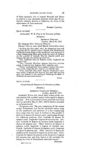
- Page 23 and 24: MARITIME DANGER ZONES AND MINE AREA
- Page 25 and 26: MARITIME DANGER ZONES. 23 trade to
- Page 27 and 28: MABITIME DANGER ZONES. 25 this work
- Page 29 and 30: MABITIMB DANGER ZONES. 27 Article 1
- Page 31 and 32: File No. 763.72/1141. MARITIME DANG
- Page 33 and 34: File No. 763.72/1174. MARITIME DANG
- Page 35 and 36: MARITIME DANGER ZONES. 33 founded i
- Page 37 and 38: MARITIME DANGER ZONES. 35 of German
- Page 39 and 40: MARITIME DANGEB ZONES. 37 E. PARTIC
- Page 41 and 42: File No. 763.72/1549. MABITIME DANG
- Page 43 and 44: MARITIME DANGER ZONES. 41 No. 274 o
- Page 45 and 46: MARITIME DANGER ZONES. 43 "Many app
- Page 47 and 48: Pile No. 841.801/53. MABITIME DANGE
- Page 49: File No. 841.801/80. MARITIME DANGE
- Page 53: PART II. INTERFERENCES BY BELLIGERE
- Page 56 and 57: 54 INTERFERENCES WITH MAILS. 4. The
- Page 58 and 59: 56 INTERFERENCES WITH MAILS. cases
- Page 60 and 61: 58 INTERFERENCES WITH MAILS. 26. Af
- Page 63: PART III. BRITISH ADMIRALTY INSTRUC
- Page 66 and 67: 64 INSTRUCTIONS FOR ARMED MERCHANT
- Page 68 and 69: 66 XEBiKtroiroaB wm AEKDEB MUECHaka
- Page 71 and 72: THE "DECLARATION OF LONDON.' File N
- Page 73 and 74: THE- " DECLARATION 03? LONDON." 71
- Page 75 and 76: THE "DECLARATION OF LONDON." 73 hav
- Page 77 and 78: THE "DECLARATION OF LONDON." 75 war
- Page 79: File No. 763.72112/3089. THE " DECL
- Page 83 and 84: PAPERS RELATING TO PASSAGE OF BRIT
- Page 85: PART VI. BRITISH RESTRAINTS ON COMM
- Page 88 and 89: 86 BEITISH EESTEAINTS ON COMMBBOE.
- Page 90 and 91: 88 BRITISH RESTRAINTS ON COMMERCE.
- Page 92 and 93: 90 BRJMSH BESTBAlifffS ON COMSiEECE
- Page 94 and 95: 92 BRITISH RESTRAINTS ON COMMERCE.
- Page 96 and 97: 94 BRITISH RESTRAINTS ON COMMERCE.
- Page 99 and 100: THE ECONOMIC CONFERENCE OF THE ALLI
- Page 101 and 102:
ECONOMIC CONFERENCE OE THE ALLIES.
- Page 103 and 104:
ECONOMIC CONFERENCE OF THE ALLIES.
- Page 105:
PART VIII. THE SALE OF MUNITIONS OF
- Page 108 and 109:
106 SALE OF MUNITIONS OF WAK TO BEL
- Page 110 and 111:
108 SALE OF MUNITIONS OF WAR TO BEL
- Page 113:
PART IX. STATEMENT BY ITALY REGARDI
- Page 116 and 117:
114 ITALY'S WAR DECLARATIONS. fore
- Page 119:
PART X. DISPLAY BY NAVAL VESSELS OF
- Page 122 and 123:
120 DISPLAY OP DISTINGUISHING MARKS
- Page 124 and 125:
122 DISPLAY OF DISTINGUISHING MASKS
- Page 127 and 128:
STATUS OF BELLIGERENT SUBMARINES IN
- Page 129:
STATUS OF BELLIGERENT SUBMARINES, 1
- Page 133 and 134:
THE TORPEDOING OF THE BRITISH STEAM
- Page 135 and 136:
CASE OF THE PEBSIA. 133 [Inclosuie
- Page 137 and 138:
CASE OF THE PEESIA. 135 [Inclosure.
- Page 139 and 140:
CASE OP THE PEBSIA. 137 hoist a pie
- Page 141 and 142:
CASE OF THE PERSIA. 139 [Inclosure
- Page 143 and 144:
Pile No. 841.857P43/42. CASE OF THE
- Page 145:
CASE OF THE PBBSIA. 143 Everybody b
- Page 149 and 150:
TORPEDOING OF THE ITALIAN STEAM S
- Page 151 and 152:
CASE OF THE ANCOSTA. 149 consulate,
- Page 153 and 154:
CASE OF THE ANCONA. 151 zigzag, in
- Page 155 and 156:
CASE OF THE ANCONA. 153 We being to
- Page 157 and 158:
CASE OF THE ANCONA. 155 The submari
- Page 159 and 160:
CASE OF THE ANCONA. 157 Answer to Q
- Page 161 and 162:
CASE OF THE ANCONA. 159 apology. My
- Page 163 and 164:
CASE OF THE ANCONA. 161 20th Interr
- Page 165 and 166:
CASE OF THE ANCONA. 163 I would hav
- Page 167 and 168:
CASE OF THE ANCONA. 165 He went out
- Page 169 and 170:
CASE OF THE AHCONA. 167 10th. Inter
- Page 171 and 172:
CASE OF THE ANCONA. 169 Sworn and s
- Page 173 and 174:
CASE OF THE ANCONA. 171 Question No
- Page 175 and 176:
CASE OF THE ANCONA. 173 We would ha
- Page 177 and 178:
CASE OF THE ANCONA. 175 "The Govern
- Page 179 and 180:
CASE OF THE ANCONA. 177 "The Govern
- Page 181 and 182:
CASE OF THE ANCONA. 179 of this war
- Page 183 and 184:
CASE OP THE ANCONA. 181 "At the tim
- Page 185:
PART XIV. ATTACK ON THE AMERICAN ST
- Page 188 and 189:
186 CASE OP THE PETKOLITE. by the L
- Page 190 and 191:
188 CASE OF THE PETROLITE. Question
- Page 192 and 193:
190 GASE OF THE PETBOLITE. States o
- Page 194 and 195:
192 CASE OF THE PETBOLITE. vessel,
- Page 196 and 197:
194 CASE OF THE PETROLITE. gram No
- Page 198 and 199:
196 CASE OF THE PETROLITE. tentiary
- Page 200 and 201:
198 CASE Off THE PETBOLITE. the rem
- Page 203:
PART XV. VARIOUS AMERICAN VESSELS O
- Page 206 and 207:
204 SUBMARINE WARFARE. lost. Captai
- Page 208 and 209:
206 SUBMARINE WABFABE. pnclosure 1.
- Page 210 and 211:
208 SUBMARINE WAKFAKE. that I would
- Page 212 and 213:
210 SUBMARINE WARFARE. As -soon as
- Page 214 and 215:
212 SUBMARINE WARFARE. From the tim
- Page 216 and 217:
214 SUBMARINE WARFARE. I do not kno
- Page 218 and 219:
216 SUBMARINE WARFARE. When we clea
- Page 220 and 221:
218 SUBMARINE WARFARE. Redmond, oil
- Page 222 and 223:
220 STJBMAHINE WAEFABE. had heard t
- Page 224 and 225:
222 SUBMARINE WABFARE. File No. 300
- Page 226 and 227:
224 SUBMARINE WARFARE. File No. 300
- Page 228 and 229:
226 SUBMARINE WABEABE. Captain Gunt
- Page 230 and 231:
228 SUBMARINE WARFARE, These affida
- Page 232 and 233:
230 SUBMARINE WARFARE. None of the
- Page 234 and 235:
232 SUBMARINE WARFARE. fly into the
- Page 236 and 237:
234 SUBMARINE WARFARE. In view of t
- Page 238 and 239:
286 SUBMARINE WARFARE. File No. 300
- Page 240 and 241:
238 SUBMARINE "WARFARE. The command
- Page 242 and 243:
240 SUBMARINE WARFARE. cuts and bru
- Page 244 and 245:
242 SUBMARINE WAKFABE. man torpedo,
- Page 246 and 247:
244 SUBMARINE WARFARE. terdam that
- Page 248 and 249:
246 SUBMARINE WARFARE. in the water
- Page 250 and 251:
248 SUBMARINE WARFARE. Mr. Grew is
- Page 252 and 253:
250 SUBMARINE WARFARE. Sworn to thi
- Page 254 and 255:
252 STJBMABINE WABFAJBE. her to kee
- Page 256 and 257:
254 SUBMARINE WARFARE. drenching th
- Page 258 and 259:
256 SUBMABINE WAKFAEE. marine took
- Page 260 and 261:
258 SUBMARINE WARFARE. after it had
- Page 262 and 263:
260 SUBMARINE WARFARE. File No. 841
- Page 264 and 265:
262 SUBMARINE WARFARE. sinking that
- Page 266 and 267:
264 SUBMARINE WARFARE. Parish, Loui
- Page 268 and 269:
266 SUBMARINE WARFABE. reply to the
- Page 270 and 271:
268 SUBMARINE WARFARE. Government o
- Page 272 and 273:
270 SUBMARINE WABFABE. empty wooden
- Page 274 and 275:
272 SUBMARINE "WARFARE. File No. 85
- Page 276 and 277:
274 SUBMARINE WARFARE. File No. 841
- Page 278 and 279:
276 SUBMARINE WARFARE. File No. 300
- Page 280 and 281:
278 SUBMARINE WARFARE. four miles t
- Page 282 and 283:
280 SUBMARINE WARFARE. File No. 300
- Page 284 and 285:
282 SUBMARINE WABFABE. File No. 300
- Page 286 and 287:
284 SUBMARINE WARFARE. 16. Whether
- Page 288 and 289:
286 SUBMARINE WARFARE. [Inclosure 2
- Page 290 and 291:
288 SUBMARINE WARFARE. board side i
- Page 292 and 293:
290 SUBMARINE WARFARE. pnclosure 3.
- Page 294 and 295:
292 SUBMARINE WARFARE. I tie No. 30
- Page 296 and 297:
294 STJBMABINE WAKFABE. tain replie
- Page 298 and 299:
296 SUBMARINE WABFARE. March second
- Page 300 and 301:
298 SUBMARINE WABFARE. File No. 30G
- Page 302 and 303:
300 SUBMARINE WAEFARE. Name of ship
- Page 305:
PART XVI. PEACE OVERTURES OF THE CE
- Page 308 and 309:
306 PEACE OVEBTTJBES OF CENTBAL POW
- Page 310 and 311:
308 PEACE OVEBTTTBES OF CENTRAL POW
- Page 312 and 313:
310 PEACE OVERTURES OP CENTRAL POWE
- Page 314 and 315:
312 PEACE OVERTURES OP CENTRAL POWE
- Page 316 and 317:
314 PEACE OVERTURES OF CENTRAL POWE
- Page 318 and 319:
316 PEACE OVERTURES OP CENTRAL POWE
- Page 321:
PART XVII. SUGGESTIONS CONCERNING T
- Page 324 and 325:
322 PRESIDENT'S SUGGESTIONS TO BELL
- Page 326 and 327:
324 PRESIDENT'S SUGGESTIONS TO BELL
- Page 328 and 329:
326 PRESIDENT'S SUGGESTIONS TO BELL
- Page 330 and 331:
328 PRESIDENT'S SUGGESTIONS TO BELL
- Page 332 and 333:
330 PRESIDENT'S SUGGESTIONS TO BELL
- Page 334 and 335:
332 PRESIDENT'S SUGGESTIONS TO BELL
- Page 336 and 337:
334 PRESIDENT'S SUGGESTIONS TO BELL
- Page 338 and 339:
336 PRESIDENT'S SUGGESTIONS TO BELL
- Page 340 and 341:
338 PRESIDENT'S SUGGESTIONS TO BELL
- Page 342 and 343:
340 PRESIDENT'S SUGGESTIONS TO BELL
- Page 344 and 345:
342 PRESIDENT'S SUGGESTIONS TO BELL
- Page 346 and 347:
344 PRESIDENT'S SUGGESTIONS TO BELL
- Page 348 and 349:
846 PRESIDENT'S SUGGESTIONS TO BELL
- Page 351 and 352:
PROPOSALS OF THE DE FACTO GOVERN
- Page 353 and 354:
MEXICAN PEACE PROPOSALS. 351 "I ava
- Page 355:
MEXICAN PEACE PBOPOBALS. 353 of the
- Page 359 and 360:
DEPORTATION OF CIVILIANS FROM BEL
- Page 361 and 362:
DEPORTATION OF CIVILIANS FROM BELGI
- Page 363 and 364:
DEPORTATION OF CIVILIANS FfiOM BELG
- Page 365 and 366:
DEPORTATION OF CIVILIANS FROM BELGI
- Page 367 and 368:
DEPORTATION OF CIVILIANS EBOM BELGI
- Page 369 and 370:
BEFOBTATION OF CIVILIANS FKOM BELGI
- Page 371 and 372:
DEPORTATION OP CIVILIANS FROM BELGI
- Page 373 and 374:
DEPOBTATION OF CIVILIANS PEOM BELGI
- Page 375:
DEPORTATION OF CIVILIANS FROM BELGI
- Page 379 and 380:
WITHDRAWAL OF THE AMERICAN MINISTER
- Page 381:
PART XXL PRESIDENT WILSON'S ADDRESS
- Page 384 and 385:
382 PRESIDENT'S ADDEESS. and purpos
- Page 386 and 387:
384 PRESIDENT'S ADDRESS. peace will
- Page 388 and 389:
386 PRESIDENT'S ADDBESS. to extend
- Page 391 and 392:
AMERICAN PRISONERS OF WAR TAKEN TO
- Page 393 and 394:
AMERICAN PRISONERS ON THE YARROWDAL
- Page 395 and 396:
AMERICAN PRISONERS ON THE YARROWDAL
- Page 397 and 398:
AMEEICAN PRISONERS ON THE YARROWDAL
- Page 399 and 400:
AMERICAN PRISONERS ON THE YARROWDAL
- Page 401:
AMERICAN PRISONERS ON THE YABBOWDAL
- Page 405 and 406:
SEVERANCE OF DIPLOMATIC RELATIONS B
- Page 407 and 408:
SEVEBANCE OE EELATIONS "WITH GEBMAN
- Page 409 and 410:
SEVERANCE OF RELATIONS WITH GERMANY
- Page 411 and 412:
SEVERANCE OF RELATIONS WITH GERMANY
- Page 413 and 414:
SEVERANCE OF RELATIONS WITH GERMANY
- Page 415 and 416:
SEVERANCE OF RELATIONS WITH GERMANY
- Page 417 and 418:
SEVERANCE OF RELATIONS WITH GERMANY
- Page 419:
SEVERANCE OF RELATIONS WITH GERMANY
- Page 423 and 424:
DECLARATION OF WAR AGAINST THE IM
- Page 425 and 426:
DECLARATION- OF WAR AGAINST GERMANY
- Page 427 and 428:
DECLARATION OP WAS AGAINST GEBMANY.
- Page 429 and 430:
DECLARATION OF WAB AGAINST GEBMANY.
- Page 431 and 432:
DECLARATION OF WAR AGAINST GERMANY.
- Page 433 and 434:
DECLARATION OF WAR AGAINST GERMANY.
- Page 435:
PART XXV. SEVERANCE OF DIPLOMATIC R
- Page 438 and 439:
436 SEVERANCE OF RELATIONS WITH AUS
- Page 440 and 441:
438 SEVERANCE OF RELATIONS WITH AUS
- Page 442 and 443:
440 SEVERANCE OF RELATIONS WITH AUS
- Page 444 and 445:
442 SEVERANCE OF RELATIONS WITH AUS
- Page 446 and 447:
444 SEVERANCE OF RELATIONS WITH ATJ
- Page 449:
PART XXVI. SEVERANCE OF DIPLOMATIC


