treasure valley road dust study: final report - ResearchGate
treasure valley road dust study: final report - ResearchGate
treasure valley road dust study: final report - ResearchGate
Create successful ePaper yourself
Turn your PDF publications into a flip-book with our unique Google optimized e-Paper software.
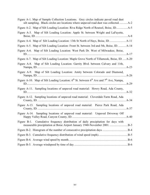
Figure A-1. Map of Sample Collection Locations. Grey circles indicate paved <strong>road</strong> <strong>dust</strong><br />
silt sampling. Black circles are locations where unpaved <strong>road</strong> <strong>dust</strong> was collected. ..........A-2<br />
Figure A-2. Map of Silt Loading Location: Riva Ridge North of Reutzel, Boise, ID...............A-5<br />
Figure A-3. Map of Silt Loading Location: Apple St. between Wright and LaFayette,<br />
Boise, ID.........................................................................................................................A-8<br />
Figure A-4. Map of Silt Loading Location: 13th St North of Hays, Boise, ID......................A-11<br />
Figure A-5. Map of Silt Loading Location: Front St. between 3rd and 5th, Boise, ID...........A-14<br />
Figure A-6. Map of Silt Loading Location: West Park Dr. West of Milwaukee, Boise,<br />
ID..................................................................................................................................A-17<br />
Figure A-7. Map of Silt Loading Location: Maple Grove North of Tillamook, Boise, ID. ....A-20<br />
Figure A-8. Map of Silt Loading Location: Garrity Blvd. between Calvary and 11th,<br />
Nampa, ID.....................................................................................................................A-23<br />
Figure A-9. Map of Silt Loading Location: Amity between Colorado and Diamond,<br />
Nampa, ID.....................................................................................................................A-26<br />
Figure A-10. Map of Silt Loading Location: 6 th St. between 6 th Ave and 7 th Ave, Nampa,<br />
ID..................................................................................................................................A-29<br />
Figure A-11. Sampling locations of unpaved <strong>road</strong> material: Howry Road, Ada County,<br />
ID..................................................................................................................................A-32<br />
Figure A-12. Sampling locations of unpaved <strong>road</strong> material: Cloverdale Farm Road, Ada<br />
County, ID. ...................................................................................................................A-34<br />
Figure A-13. Sampling locations of unpaved <strong>road</strong> material: Pierce Park Road, Ada<br />
County, ID. ...................................................................................................................A-37<br />
Figure A-14. Sampling locations of unpaved <strong>road</strong> material: Unpaved Driveway Off<br />
Happy Valley Road, Canyon County, ID.......................................................................A-40<br />
Figure B-1. Cumulative frequency distribution of daily precipitation for days with<br />
measurable precipitation at Boise Airport January 1940-November 2001. .......................B-3<br />
Figure B-2. Histogram of the number of consecutive precipitation days. ................................B-4<br />
Figure B-3. Cumulative frequency distribution of wind speed (mph)......................................B-5<br />
Figure B-4. Average wind speed by month.............................................................................B-6<br />
Figure B-5. Average windspeed by time of day......................................................................B-6<br />
xv


