Route 132 Corridor Report - Cape Cod Commission
Route 132 Corridor Report - Cape Cod Commission
Route 132 Corridor Report - Cape Cod Commission

Create successful ePaper yourself
Turn your PDF publications into a flip-book with our unique Google optimized e-Paper software.
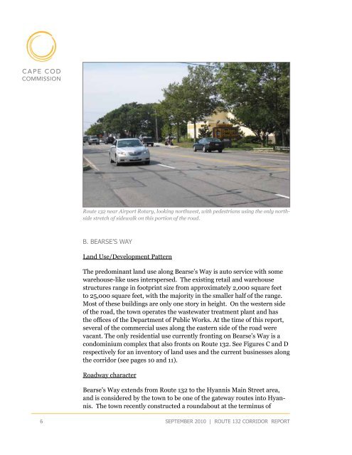
<strong>Route</strong> <strong>132</strong> near Airport Rotary, looking northwest, with pedestrians using the only northside<br />
stretch of sidewalk on this portion of the road.<br />
B. Bearse’s Way<br />
Land Use/Development Pattern<br />
The predominant land use along Bearse’s Way is auto service with some<br />
warehouse-like uses interspersed. The existing retail and warehouse<br />
structures range in footprint size from approximately 2,000 square feet<br />
to 25,000 square feet, with the majority in the smaller half of the range.<br />
Most of these buildings are only one story in height. On the western side<br />
of the road, the town operates the wastewater treatment plant and has<br />
the offices of the Department of Public Works. At the time of this report,<br />
several of the commercial uses along the eastern side of the road were<br />
vacant. The only residential use currently fronting on Bearse’s Way is a<br />
condominium complex that also fronts on <strong>Route</strong> <strong>132</strong>. See Figures C and D<br />
respectively for an inventory of land uses and the current businesses along<br />
the corridor (see pages 10 and 11).<br />
Roadway character<br />
Bearse’s Way extends from <strong>Route</strong> <strong>132</strong> to the Hyannis Main Street area,<br />
and is considered by the town to be one of the gateway routes into Hyannis.<br />
The town recently constructed a roundabout at the terminus of<br />
6<br />
september 2010 | route <strong>132</strong> corridor <strong>Report</strong>