Route 132 Corridor Report - Cape Cod Commission
Route 132 Corridor Report - Cape Cod Commission
Route 132 Corridor Report - Cape Cod Commission

You also want an ePaper? Increase the reach of your titles
YUMPU automatically turns print PDFs into web optimized ePapers that Google loves.
4. Land Use Issues and Opportunities<br />
Issue 1: Gateways<br />
There are several gateways located within the study area. On the western<br />
end of the study area, the intersection of <strong>Route</strong> <strong>132</strong> and Bearse’s Way<br />
serves a dual purpose. This intersection marks the path to the Hyannis<br />
Main Street Waterfront area Growth Incentive Zone (GIZ) and also serves<br />
as a gateway to the regional retail area along <strong>Route</strong> <strong>132</strong>. The intersection<br />
of Bearse’s Way and <strong>Route</strong> 28 also serves as a gateway intersection to<br />
the Hyannis Main Street area. On the eastern end of the study area, the<br />
airport rotary serves as a gateway to several areas: the regional retail area<br />
along <strong>Route</strong> <strong>132</strong>, the Hyannis Main Street area (down Barnstable Road),<br />
and the Barnstable airport. While these areas function as important gateways<br />
to destinations within the town, they have few character-defining<br />
features other than signage to reinforce this purpose.<br />
Opportunity 1A: Reinforce Gateways<br />
Well-defined community gateways are important to people’s<br />
ability to navigate through an area and also provide<br />
sense of transitioning from one distinct area to another.<br />
To reinforce these gateways, the town should aim to<br />
coordinate signage, street improvements and public art to<br />
better define the important gateways within the study area<br />
and to differentiate them from one another. For example,<br />
future plans to make improvements to the Airport Rotary<br />
and to construct a multi-use path along Bearse’s Way<br />
should acknowledge this important role. The town should<br />
implement and build on the “Informational Sign Strategy”<br />
prepared for the town and explore using additional wayfinding<br />
techniques geared to identifying specific areas of<br />
town. For instance, branding the regional retail area in a<br />
way to make it distinct from Main Street Hyannis or the<br />
waterfront area could provide an opportunity for district<br />
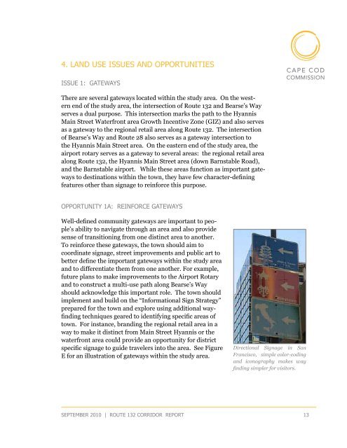
specific signage to guide travelers into the area. See Figure<br />
E for an illustration of gateways within the study area.<br />
Directional Signage in San<br />
Francisco, simple color-coding<br />
and iconography makes way<br />
finding simpler for visitors.<br />
september 2010 | route <strong>132</strong> corridor <strong>Report</strong> 13