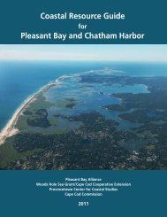
Route 132 Corridor Report - Cape Cod Commission
Route 132 Corridor Report - Cape Cod Commission
Route 132 Corridor Report - Cape Cod Commission

You also want an ePaper? Increase the reach of your titles
YUMPU automatically turns print PDFs into web optimized ePapers that Google loves.
Roadway character<br />
<strong>Route</strong> 28 extends through Barnstable from the Mashpee border to Yarmouth.<br />
The road is a major connection between adjacent towns and is a<br />
state highway. The portion within the study area extends from the intersection<br />
with Bearse’s Way easterly to the airport rotary.<br />
The portion of <strong>Route</strong> 28 in the study area is approximately 0.6 of a mile<br />
in length. The right of way ranges from 60 feet to 70 feet in width and<br />
consists mostly of a single travel lane in each direction, with no median.<br />
There are two signalized intersections along this section of roadway,<br />
one at Bearse’s Way (with additional travel lane in each direction and a<br />
left turn lane) and the other at the south entrance to the <strong>Cape</strong> <strong>Cod</strong> Mall<br />
(where there are two travel lanes in each direction). Small sections of<br />
sidewalk exist on the south side of the street along this portion, but the<br />
majority of the roadway does not have pedestrian paths.<br />
september 2010 | route <strong>132</strong> corridor <strong>Report</strong> 9