Route 132 Corridor Report - Cape Cod Commission
Route 132 Corridor Report - Cape Cod Commission
Route 132 Corridor Report - Cape Cod Commission

You also want an ePaper? Increase the reach of your titles
YUMPU automatically turns print PDFs into web optimized ePapers that Google loves.
pedestrian activity and regional development patterns. To address this<br />
design concern, modifications should be made to the zoning and design<br />
guidelines established for the location of parking and associated landscaping<br />
to insure that parking is not located in front of small to moderate<br />
scale developments along the corridor. Large mall developments may<br />
have parking in front, but only<br />
when screened by landscaping or<br />
frontage buildings. With larger<br />
landscaped buffers, the area would<br />
need clear directional and identifying<br />
signage to ensure that businesses<br />
in the area can be easily<br />
located and identified. See Figure<br />
H for an illustration of parking<br />
areas needing additional screening<br />
within the study area.<br />
Opportunity 7B: Decrease<br />
Parking Footprints with<br />
Public Transit<br />
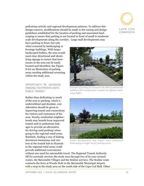
Example of parking lot located to the side of commercial<br />
buildings that incorporates a modest but effective landscape<br />
buffer.<br />
Rather than dedicating so much<br />
of the area to parking, which is<br />
underutilized and desolate, consideration<br />
should be given to<br />
improving transit and connections<br />
for visitors and customers of the<br />
area. Nearby residential neighborhoods<br />
may benefit from improved<br />
transit and/or pedestrian linkages<br />
to provide an alternative<br />
for driving (and parking) when<br />
going to the regional retail areas.<br />
Similarly, finding a way of linking<br />
downtown businesses and visitors<br />
at the transit hub in Hyannis landscaping to buffer larger parking areas.<br />
Larger developments may require more substantial<br />
to the regional retail areas could<br />
provide additional convenience<br />
without any need for automobile travel. The Regional Transit Authority<br />
(RTA) currently services the study area through two of its year-around<br />
routes, the Barnstable Villager and the Sealine services. The Sealine route<br />
connects the ferry at Woods Hole to the Barnstable Municipal Airport,<br />
with a stop in the study area on the south side of the <strong>Cape</strong> <strong>Cod</strong> Mall. Other<br />
september 2010 | route <strong>132</strong> corridor <strong>Report</strong> 25