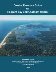
Route 132 Corridor Report - Cape Cod Commission
Route 132 Corridor Report - Cape Cod Commission
Route 132 Corridor Report - Cape Cod Commission

You also want an ePaper? Increase the reach of your titles
YUMPU automatically turns print PDFs into web optimized ePapers that Google loves.
Issue 2: Underutilized green spaces and water bodies<br />
Currently, there is an area of well-established green space that coincides<br />
with the intersection of Independence Drive and <strong>Route</strong> <strong>132</strong> which provides<br />
a brief respite to the commercial development along the corridor.<br />
This more natural character should be continued and widened to reinforce<br />
the transition area between the more heavily developed parts of the<br />
corridor and to introduce the change in uses and forms from Area A to<br />
Area B (see Issue 3 below for a description of these areas). A network of<br />
ponds and waterbodies currently exists in the area but is buried amongst<br />
the commercial development and is poorly maintained and underutilized.<br />
These more natural features, that follow a roughly north/south pattern<br />
cutting through the center of the study area, could be an asset to the area<br />
if appropriately cared for and related to allowed uses. See Figure E for an<br />
illustration of existing/vegetated areas within the study area.<br />
Opportunity 2A: Establish Greenbelt Area and Encourage<br />
Appropriate Uses<br />
Encourage uses that can utilize green space and water bodies as an amenity<br />
and build upon the existing network of greenspace to provide a break<br />
in the development along the corridors. In particular, incentives should<br />
be created to convert outlying parking lots that see little usage into green<br />
space. Additional greenspace adjacent to the intersection of <strong>Route</strong> <strong>132</strong> and<br />
Independence Drive would help to reinforce the natural character of that<br />
transition area between two unique sections of <strong>Route</strong> <strong>132</strong>. In addition,<br />
there are two natural ponds on the south side of the <strong>Cape</strong> <strong>Cod</strong> Mall property<br />
that are currently obscured and overrun with invasive species. These<br />
waterbodies can be better maintained and opened to views and possibly<br />
active use in the future to provide a focal point to this stretch of <strong>Route</strong> 28.<br />
This could be part of a strategy for better using the southern parking area<br />
of the <strong>Cape</strong> <strong>Cod</strong> Mall to attract visitors/customers with a mix of smaller<br />
scale commercial uses centered around newly created green spaces. The<br />
economic development benefits of providing greenways are discussed<br />
further in Section 6 of this report.<br />
Issue 3: Disorganized Character of <strong>Route</strong> <strong>132</strong><br />
The commercial stretch of <strong>Route</strong> <strong>132</strong> is approximately 1.5 miles long and<br />
has few organizing principles, resulting in a lack of any coherent character.<br />
The variety of land uses and development forms makes the corridor<br />
appear disorganized, which makes it difficult for users to negotiate.<br />
14<br />
september 2010 | route <strong>132</strong> corridor <strong>Report</strong>