080121-08MN006-Sabina Hackett River Project Proposal ... - NIRB
080121-08MN006-Sabina Hackett River Project Proposal ... - NIRB
080121-08MN006-Sabina Hackett River Project Proposal ... - NIRB
Create successful ePaper yourself
Turn your PDF publications into a flip-book with our unique Google optimized e-Paper software.
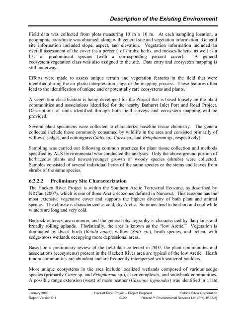
Description of the Existing EnvironmentField data was collected from plots measuring 10 m x 10 m. At each sampling location, ageographic coordinate was obtained, along with general site and vegetation information. Generalsite information included slope, aspect, and elevation. Vegetation information included anoverall assessment of the cover (as a percent) of shrubs, herbs, and mosses/lichens, as well as alist of predominant species (with a corresponding percent cover). A generalecosystem/vegetation class was also assigned to the site. Data entry and ecosystem mapping isstill underway.Efforts were made to assess unique terrain and vegetation features in the field that wereidentified during the air photo interpretation stage of the mapping process. These features oftenlead to the identification of unique and/or potentially rare ecosystems and plants.A vegetation classification is being developed for the <strong>Project</strong> that is based loosely on the plantcommunities and associations identified for the nearby Bathurst Inlet Port and Road <strong>Project</strong>.Descriptions of units identified through both field surveys and ecosystem mapping will beprovided.Several plant specimens were collected to characterize baseline tissue chemistry. The generacollected include those commonly consumed by wildlife in the area and consisted primarily ofwillows, sedges, and cottongrass (Salix sp., Carex sp., and Eriophorum sp., respectively).Sampling was carried out following common practices for plant tissue collection and methodsspecified by ALS Environmental who conducted the analyses. Only the above-ground portion ofherbaceous plants and newest/younger growth of woody species (shrubs) were collected.Samples consisted of several individual herbs of the same species or the stems and leaves fromshrubs of the same species.6.2.2.2 Preliminary Site CharacterizationThe <strong>Hackett</strong> <strong>River</strong> <strong>Project</strong> is within the Southern Arctic Terrestrial Ecozone, as described byNRCan (2007), which is one of three Arctic ecozones defined in Nunavut. This ecozone has themost extensive vegetative cover and supports the highest diversity of both plant and animalspecies. The climate is characterized as cold, dry Arctic. Summers tend to be short and cool whilewinters are long and very cold.Bedrock outcrops are common, and the general physiography is characterized by flat plains andbroadly rolling uplands. Floristically, the area is known as the “low Arctic.” Vegetation isdominated by dwarf birch (Betula nana), willow (Salix sp.), heath species, and lichen, withsedge-moss wetlands occupying more depressional areas.Based on a preliminary review of the field data collected in 2007, the plant communities andassociations (ecosystems) present in the <strong>Hackett</strong> <strong>River</strong> area are typical of the low Arctic. Heathtundra communities are abundant and are frequently interspersed with scattered boulders.More unique ecosystems in the area include localized wetlands composed of various sedgespecies (primarily Carex sp. and Eriophorum sp.), esker complexes, and snowbank communities.A possible range extension (west) of moss heather (Cassiope hypnoides) was identified in a lateJanuary 2008 <strong>Hackett</strong> <strong>River</strong> <strong>Project</strong> – <strong>Project</strong> <strong>Proposal</strong> <strong>Sabina</strong> Silver CorporationReport Version B.1 6–29 Rescan Environmental Services Ltd. (Proj. #833-2)


