concept EIA-rapport - Staatsolie
concept EIA-rapport - Staatsolie
concept EIA-rapport - Staatsolie
You also want an ePaper? Increase the reach of your titles
YUMPU automatically turns print PDFs into web optimized ePapers that Google loves.
SRK Consulting: Project No: 439414 <strong>Staatsolie</strong> Pipeline <strong>EIA</strong> – Draft <strong>EIA</strong> Report Page 24<br />
Although a comprehensive inventory of air quality and emissions in the study area is not<br />
available, pollutants emitted by the existing refinery and the SPCS power plant were estimated<br />
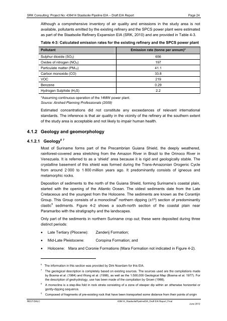
as part of the <strong>Staatsolie</strong> Refinery Expansion <strong>EIA</strong> (SRK, 2010) and are provided in Table 4-3.<br />
Table 4-3: Calculated emission rates for the existing refinery and the SPCS power plant<br />
Pollutant Emission rate (tonne per annum)*<br />
Sulphur dioxide (SO2) 656<br />
Oxides of nitrogen (NOX) 197<br />
Particulate matter (PM10) 41.1<br />
Carbon monoxide (CO) 33.8<br />
VOC 219<br />
Benzene 0.29<br />
Hydrogen Sulphide (H2S) 2.2<br />
*Assuming continuous operation of the 14MW power plant.<br />
Source: Airshed Planning Professionals (2009)<br />
Estimated concentrations did not constitute any exceedances of relevant international<br />
standards. The inference is that air quality in the vicinity of the refinery at the southern extent<br />
of the study area is acceptable and not likely to impair human health.<br />
4.1.2 Geology and geomorphology<br />
6 7<br />
4.1.2.1 Geology<br />
Most of Suriname forms part of the Precambrian Guiana Shield, the deeply weathered,<br />
rainforest-covered area stretching from the Amazon River in Brazil to the Orinoco River in<br />
Venezuela. It is referred to as a ‘shield’ area because it is rigid and geologically stable. The<br />
crystalline basement of this shield was formed during the Trans-Amazonian Orogenic Cycle<br />
from around 2 000 to 1 800 million years ago. It predominantly consists of igneous and<br />
metamorphic rocks.<br />
Deposition of sediments to the north of the Guiana Shield, forming Suriname’s coastal plain,<br />
started with the opening of the Atlantic Ocean. The oldest sediments date from the Late<br />
Cretaceous and the youngest from the Holocene. The sediments are known as the Corantijn<br />
Group. This Group consists of a monoclinal 8 northern dipping (±1⁰) section of predominantly<br />
clastic 9 sediments. Figure 4-2 shows a south-north section of the coastal plain near<br />
Paramaribo with the stratigraphy and the landscapes.<br />
Only part of the sediments in northern Suriname crop out; these were deposited during three<br />
distinct periods:<br />
• Late Tertiary (Pliocene): Zanderij Formation;<br />
• Mid-Late Pleistocene: Coropina Formation; and<br />
• Holocene: Mara and Coronie Formations (Mara Formation not indicated in Figure 4-2).<br />
6 The information in this section was provided by Dirk Noordam for this <strong>EIA</strong>.<br />
7 The geological description is completely based on existing sources. The sources used are the compilations made<br />
by Bosma et al. (1984) and Wong et al. (1998), as well as the 1:500,000 Geological Map (Bosma et al. 1977). For<br />
the description of geohydrology, use has been made of the compilation by Groen (1998).<br />
8 A monocline is a step-like fold in rock strata consisting of a zone of steeper dip within an otherwise horizontal or<br />
gently-dipping sequence.<br />
9 Composed of fragments of pre-existing rock that have been transported some distance from their points of origin<br />
REUT/DALC 439414_<strong>Staatsolie</strong>Pipeline<strong>EIA</strong>_Draft <strong>EIA</strong> Report_Final<br />
June 2012


