- Page 7:
THE J"*
- Page 10 and 11:
LIST OF PLATES WITH INSTRUCTIONS TO
- Page 12 and 13:
IV SOME NOTICE OP THE Soldiers, art
- Page 14 and 15:
\l SOME NOTICE OK TI love of study
- Page 16 and 17:
VI II SOME NOTICE OF THE But Willia
- Page 18 and 19:
X SOME NOTICE OF THE medical intell
- Page 20 and 21:
xii BOME NOTICE OF THE and patches
- Page 22 and 23:
XIV SOME NOTICE OP TUB first sacrif
- Page 24 and 25:
His book collections. TheSecrtt Iwl
- Page 26 and 27:
\\lll SOME NOTICE OF THE handed it
- Page 28 and 29:
\\ SOME NOTICE OF Till-. books, Fra
- Page 30 and 31:
X\ll SOME NOTICE OF THE as early as
- Page 32 and 33:
XXIV SOME NOTICE OP THE that one's
- Page 34 and 35:
XXVI SOME NOTICE OF THE extreme wes
- Page 36 and 37:
XXV 111 SOME NOTICE OF TI1K communi
- Page 38 and 39:
XXX SOME NOTICE OF THE latt-r he ma
- Page 40 and 41:
X.XX11 SOME NOTICE OF THE Pamphlets
- Page 42 and 43:
XXXIV SOME NOTICE OF THE {>. 11, a
- Page 44 and 45:
On the state of the Kingstown poor.
- Page 46 and 47:
LfehtdMi XXXV111 SOME NOTICE OF THE
- Page 48 and 49:
\1 SOME NOTICE OF THE was I. -vied
- Page 50 and 51:
O'Connell's dexterity. HOME NOTICE
- Page 52 and 53:
SOME NOTICE OF THE the quays and pi
- Page 54 and 55:
SOME NOTICE OF THE could investigat
- Page 56 and 57:
xlviii SOME NOTICE OF THE bridge. B
- Page 58 and 59:
The five Slighes. I SOME NOTICE OF
- Page 60 and 61:
Ill SOME NOTICE OF THK is frequentl
- Page 62 and 63:
Hv SOME NOTICE OF Till. for a retre
- Page 64 and 65:
Ivi SOME NOTICE OF THE round it and
- Page 66 and 67:
Iviii SOME NOTICE OF THK with her b
- Page 68 and 69:
Introduction of Iceland." 1 x SOME
- Page 70 and 71:
Ixii SOME NOTICE OF j HI: ecclesias
- Page 72 and 73:
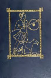
An Irish sheep dog,(A.o 9!K)). port
- Page 74 and 75:
Ixvi SOME NOTICE OF TUB Dublin, fin
- Page 76 and 77:
Ixviii SOME NOTICE OF THE on circui
- Page 78 and 79:
SOME NOTICE OF THE considering the
- Page 80 and 81:
SOME NOTICE OF THK Ostman inhabitan
- Page 82 and 83:
Gilmeholmoc and the Thingmount, A.n
- Page 84 and 85:
SOME NOTICE OF TDK there would be s
- Page 86 and 87:
Ixxviii SOME NOTICE OP THE to John
- Page 88 and 89:
SOME NOTICE OF THE A Habeas Corpus
- Page 90 and 91:
SOME NOTICE OF THE continues Willia
- Page 92 and 93:
SOME NOTICE OF THE curiosity shop i
- Page 94 and 95:
SOME NOTICE OF THE land has been so
- Page 96 and 97:
Ixxxviii SOME NOTICE or THE his doo
- Page 98 and 99:
XC SOME NOTICE OF THE paper, and il
- Page 100 and 101:
XC11 SOME NOTICE OF THE there would
- Page 102 and 103:
XC1V SOME NOTICE OF THE his energet
- Page 104 and 105:
XCV1 SOME NOTICE OF THE accidental
- Page 106 and 107:
XCV111 SOME NOTICE OF THE to in Lon
- Page 108 and 109:
c. Haiiday's C SOME NOTICE OF THE s
- Page 110 and 111:
CU SOME NOTldE OF Till. Her mother
- Page 112 and 113:
CIV SOME NOTICK OF THE diligent tha
- Page 114 and 115:
CV1 SOME NOTICE OF THti which he su
- Page 116 and 117:
CV111 SOME NOTICE OF THE The "Old s
- Page 118 and 119:
CX SOME NOTICE OF Till: the North-s
- Page 120 and 121:
CX11 SOME NOTICE OF T1IE patent, or
- Page 122 and 123:
CX1V SOME NOTICE OF THE they were a
- Page 124 and 125:
CXV1 SOME NOTICE OF THE And the not
- Page 126 and 127:
CXV111 SOME NOTICE OF THE street. I
- Page 128 and 129:
cxx SOME NOTICE OF THE Ballast Boar
- Page 130 and 131:
cxxn ROME NOTICE OF THE 1 i.iving f
- Page 133 and 134:
THE SCANDINAVIANS: AND THE irmitrhw
- Page 135 and 136:
SCANDINAVIAN ANTIQUITIES OF DUBLIN.
- Page 137 and 138:
SCANDINAVIAN ANTIQUITIES OP DUBLIN.
- Page 139 and 140:
SCANDINAVIAN ANTIQUITIES OF DUBLIN.
- Page 141 and 142:
SCANDINAVIAN ANTIQUITIES OF DUBLIN.
- Page 143 and 144:
SCANDINAVIAN ANTIQUITIES OF DUBLIN.
- Page 145 and 146:
SCANDINAVIAN ANTIQUITIES OF DUBLIN.
- Page 147 and 148:
SCANDINAVIAN ANTIQUITIES OF DUBLIN.
- Page 149 and 150:
cain ; ' SCANDINAVIAN ANTIQUITIES O
- Page 151 and 152:
SCANDINAVIAN" ANTIQUITIES OF DUBLIN
- Page 153 and 154:
SCANDINAVIAN ANTIQUITIES OF DUBLIN.
- Page 155 and 156:
SCANDINAVIAN ANTIQUITIES OF DUBLIN.
- Page 157 and 158:
SCANDINAVIAN ANTIQUITIES OF DUBLIN.
- Page 159 and 160:
SCANDINAVIAN ANTIQUITIES OF DUBLIN.
- Page 161 and 162:
SCANDINAVIAN ANTIQUITIES OF DUBLIN.
- Page 163 and 164:
SCANDINAVIAN ANTIQUITIES OF DUBLIN.
- Page 165 and 166:
SCANDINAVIAN ANTIQUITIES OF DUBLIN.
- Page 167 and 168:
SCANDINAVIAN ANTIQUITIES OF DUBLIN.
- Page 169 and 170:
SCANDINAVIAN ANTIQUITIES OP DUBLIN.
- Page 171 and 172:
SCANDINAVIAN ANTIQUITIES OF DUBLIN.
- Page 173 and 174:
SCANDINAVIAN ANTIQUITIES OP DUBLIN.
- Page 175 and 176:
SCANDINAVIAN ANTIQUITIES OF DUBLIN.
- Page 177 and 178:
SCANDINAVIAN ANTIQUITIES OF DUBLIN.
- Page 179 and 180:
SCANDINAVIAN ANTIQUITIES OF DUBLIN.
- Page 181 and 182:
SCANDINAVIAN ANTIQUITIES OF DUBLIN.
- Page 183 and 184:
SCANDINAVIAN ANTIQUITIES OP DUBLIN.
- Page 185 and 186:
SCANDINAVIAN ANTIQUITIES OF DUBLIN.
- Page 187 and 188:
SCANDINAVIAN ANTIQUITIES OP DUBLIN.
- Page 189 and 190:
SCANDINAVIAN ANTIQUITIES OF DUBLIN.
- Page 191 and 192:
SCANDINAVIAN ANTIQUITIES OF DUBLIN.
- Page 193 and 194:
SCANDINAVIAN ANTIQUITIES OF DUBLIN.
- Page 195 and 196:
SCANDINAVIAN ANTIQUITIES OF DUBLIN.
- Page 197 and 198:
SCANDINAVIAN ANTIQUITIES OF DUBLIN.
- Page 199 and 200:
SCANDINAVIAN ANTIQUITIES OF DUBLIN.
- Page 201 and 202:
SCANDINAVIAN ANTIQUITIES OF DUBLIN'
- Page 203 and 204:
M'AXDINAVIAN ANTIQUITIES OF DUBLIN.
- Page 205 and 206:
SCANDINAVIAN ANTIQUITIES OF DUBLIN.
- Page 207 and 208:
SCANDINAVIAN ANTIQUITIES OF DUBLIN.
- Page 209 and 210:
SCANDINAVIAN ANTIQUITIES OF DUBLIN.
- Page 211 and 212:
SCANDINAVIAN ANTIQUITIES OF DUBLIN.
- Page 213 and 214:
SCANDINAVIAN ANTIQUITIES OF DUNLIN
- Page 215 and 216:
SCANDINAVIAN ANTIQUITIES OF DUBLIN.
- Page 217 and 218:
SCANDINAVIAN ANTIQUITIES OF DUBLIN.
- Page 219 and 220:
971, l SCANDINAVIAN ANTIQUITIES OF
- Page 221 and 222:
SCANDINAVIAN ANTIQUITIES OF DUBLIN.
- Page 223 and 224:
SCANDINAVIAN ANTIQUITIES OF DUBLIN.
- Page 225 and 226:
SCANDINAVIAN ANTIQUITIES OF DUDLIX.
- Page 227 and 228:
SCANDINAVIAN ANTIQUITIES OF DUBLIN.
- Page 229 and 230:
SCANDINAVIAN ANTIQUITIES OF DUBLIN.
- Page 231 and 232:
SCANDINAVIAN ANTIQUITIES OF DUBLIN.
- Page 233 and 234:
SCANDINAVIAN ANTIQUITIES OF DUBLIN.
- Page 235 and 236:
SCANDINAVIAN ANTIQUITIES OF DUBLIN.
- Page 237 and 238:
SCANDINAVIAN ANTIQUITIES OF DUBLIN.
- Page 239 and 240:
SCANDINAVIAN ANTIQUITIES OF DUBLIN'
- Page 241 and 242:
SCANDINAVIAN ANTIQUITIES OF DUBLIN.
- Page 243 and 244:
SCANDINAVIAN ANTIQUITIES OF DUBLIN.
- Page 245 and 246:
SCANDINAVIAN ANTIQUITIES OF DUBLIN.
- Page 247 and 248:
SCANDINAVIAN ANTIQUITIES OP DUBLIN.
- Page 249 and 250:
SCANDINAVIAN ANTIQUITIES OF DUBLIN.
- Page 251 and 252:
SCANDINAVIAN ANTIQUITIES OF DUBLIN.
- Page 253 and 254:
of others," 1 SCANDINAVIAN ANTIQUIT
- Page 255 and 256:
SCANDINAVIAN ANTIQUITIES OF DUBLIN.
- Page 257 and 258:
SCANDINAVIAN ANTIQUITIES OF DUBLIN.
- Page 259 and 260:
SCANDINAVIAN ANTIQUITIES OF DUBLIN.
- Page 261 and 262:
SCANDINAVIAN ANTIQUITIES OP DUBLIN.
- Page 263 and 264:
SCANDINAVIAN ANTIQUITIES OF DUBLIN"
- Page 265 and 266:
SCANDINAVIAN ANTIQUITIES OF DUBLIN.
- Page 267 and 268:
SCANDINAVIAN ANTIQUITIES OF DUBLIN.
- Page 269 and 270:
SCANDINAVIAN ANTIQUITIES OF DUBLIN.
- Page 271 and 272:
SCANDINAVIAN ANTIQUITIES OF DUBLIN.
- Page 273 and 274:
SCANDINAVIAN ANTIQUITIES OF DUBLIN.
- Page 275 and 276:
SCANDINAVIAN ANTIQUITIES OF DUBLIN.
- Page 277 and 278:
SCANDINAVIAN ANTIQUITIES OF DUBLIN.
- Page 279 and 280:
' SCANDINAVIAN ANTIQUITIES OF DUBLI
- Page 281 and 282:
SCANDINAVIAN* ANTIQUITIES OF DUBLIN
- Page 283 and 284:
SCANDINAVIAN ANTIQUITIES OF DUBLIN.
- Page 285 and 286:
SCANDINAVIAN ANTIQUITIES OF DUBLIN.
- Page 287 and 288:
SCANDINAVIAN ANTIQUITIES OF DUBLIN.
- Page 289 and 290:
SCANDINAVIAN ANTIQUITIES OF DUBLIN.
- Page 291 and 292:
SCANDINAVIAN ANTIQUITIES OF DUBLIN.
- Page 293 and 294:
SCANDINAVIAN ANTIQUITIES OF DUBLIN.
- Page 295 and 296:
SCANDINAVIAN ANTIQUITIES OF DUBLIN.
- Page 297 and 298:
SCANDINAVIAN ANTIQUITIES OF DUBLIN.
- Page 299 and 300:
SCANDINAVIAN ANTIQUITIES OF DUBLIN.
- Page 301 and 302:
SCANDINAVIAN ANTIQUITIES OF DUBLIN.
- Page 303 and 304:
SCANDINAVIAN ANTIQUITIES OF DUBLIN.
- Page 305 and 306:
SCANDINAVIAN ANTIQUITIES OP DUBLIN.
- Page 307 and 308:
SCANDINAVIAN ANTIQUITIES OT DUBLIN.
- Page 309 and 310:
SCANDINAVIAN ANTIQUITIES OF DUBLIN.
- Page 311 and 312:
SCANDINAVIAN ANTIQUITIES OF DUBLIN.
- Page 313 and 314:
SCANDINAVIAN ANTIQUITIES OF DUBLIN.
- Page 315 and 316:
SCANDINAVIAN ANTIQUITIES OP DUBLIN.
- Page 317 and 318:
SCANDINAVIAN ANTIQUITIES OP DUBLIN.
- Page 319 and 320:
SCANDINAVIAN ANTIQUITIES OF DUBLIN.
- Page 321 and 322:
SCANDINAVIAN ANTIQUITIES OF DUBLIN.
- Page 323 and 324:
SCANDINAVIAN ANTIQUITIES OP DUBLIN.
- Page 325 and 326:
SCANDINAVIAN ANTIQUITIES OP DUBLIN.
- Page 327 and 328:
SCANDINAVIAN ANTIQUITIES OF DUBLIN.
- Page 329 and 330: Butt, 1 SCANDINAVIAN ANTIQUITIES OF
- Page 331: SCANDINAVIAN ANTIQUITIES OP DUBLIN.
- Page 334 and 335: 202 THE SCANDINAVIANS, AND APPENDIX
- Page 336 and 337: 204 THE SCANDINAVIANS, AND APPENDIX
- Page 338 and 339: Mistakes of Stanihurst. 206 THE SCA
- Page 340 and 341: 208 THE SCANDINAVIANS, AND jg built
- Page 342 and 343: 210 THE SCANDINAVIANS, AND with the
- Page 344 and 345: 212 THE SCANDINAVIANS, AND APPENDIX
- Page 346 and 347: APPENDIX. 214 THE SCANDINAVIANS, AN
- Page 348 and 349: 216 THE SCANDINAVIANS, AND APPENDIX
- Page 350 and 351: 218 THE SCANDINAVIANS, AND another
- Page 352 and 353: 220 THE SCANDINAVIANS, they were ov
- Page 354 and 355: APPENDIX. stoin batter. 222 THE SCA
- Page 356 and 357: 224 THE SCANDINAVIANS, AND APPENDIX
- Page 358 and 359: APPKNUIX. From the Cual iTo-^ii^ th
- Page 360 and 361: APPENDIX. 228 THE SCANDINAVIANS, AN
- Page 362 and 363: APPENDIX. Citadel to protect the mo
- Page 364 and 365: 232 THE SCANDINAVIANS, AND APPENDIX
- Page 366 and 367: 234 THE SCANDINAVIANS, AND APPENDIX
- Page 368 and 369: 236 THE SCANDINAVIANS, AND APPENDIX
- Page 370 and 371: 238 THE SCANDINAVIANS, AND no f. Ba
- Page 372 and 373: 1240 THE SCANDINAVIANS, AND j n the
- Page 374 and 375: APPENDIX Plan for a Harbour at Hiii
- Page 376 and 377: 244 THE SCANDINAVIANS, AND ArPEMHX.
- Page 378 and 379: 246 THE SCANDINAVIANS, AND APPENDIX
- Page 382 and 383: 250 THE SCANDINAVIANS, AND APPENDIX
- Page 385 and 386: [ 253 ] TABLE OF CHAPTERS, BOOK I.
- Page 387 and 388: TABLE OF CHAPTERS. 255 BOOK II. OF
- Page 389 and 390: TABLE OF CHAPTERS. 257 thia worship
- Page 391 and 392: Aberfayle (Perthshire), 175, n. Abr
- Page 393 and 394: Athelstan con. rule of the Anglo-Sa
- Page 395 and 396: Bar con. J. Burgh, Engineer and Sur
- Page 397 and 398: Burke, Edmund, his father's house o
- Page 399 and 400: Cillnjosamhog, battle of, 59. Cille
- Page 401 and 402: Custom House, the present, building
- Page 403 and 404: Dubgoill or Danes con. England, ib.
- Page 405 and 406: Duvelina, 23. Dyfflin, Ixv., 23. Dy
- Page 407 and 408: Fliotshild, 101. Floating Light at
- Page 409 and 410: Godred or Godfrey, K. of the Ostmen
- Page 411 and 412: Haliday con. his visit to the Bod-
- Page 413 and 414: Hore, Ralph, 218, n. Horham, Ricard
- Page 415 and 416: Ketel Hcngs, 101,n. 8 Ketell (or Os
- Page 417 and 418: Lindiseyri (Leinster), 29, n. Lindi
- Page 419 and 420: Map, Captain John Perry's rare map,
- Page 421 and 422: O'Brien, Murchard, 93. Murtogh, s.
- Page 423 and 424: 3 Pigeon, John, cxvi, 231, n. Pilin
- Page 425 and 426: Rogerson, Sir John, lease to (1713)
- Page 427 and 428: Sitric con. of Leinster, 49), wins
- Page 429 and 430: Taaffe, Wmiam, 146. Talbot, Lord, x
- Page 431 and 432:
Uladh-ster (Ulster), 134, 135. Ulf,
- Page 437:
H&SS B 226 PLEASE DO NOT REMOVE CAR


![Open [36.0 MB]](https://img.yumpu.com/21032245/381/500x640/open-360-mb.jpg)


![Open [15.7 MB]](https://img.yumpu.com/21046865/1/163x260/open-157-mb.jpg?quality=85)
![Open [26.4 MB]](https://img.yumpu.com/20992400/1/172x260/open-264-mb.jpg?quality=85)
![Open [22.4 MB]](https://img.yumpu.com/20976225/1/163x260/open-224-mb.jpg?quality=85)
![Open [11.3 MB]](https://img.yumpu.com/20944540/1/178x260/open-113-mb.jpg?quality=85)
![Open [20.7 MB]](https://img.yumpu.com/20930720/1/159x260/open-207-mb.jpg?quality=85)
![Open [38.2 MB]](https://img.yumpu.com/20930686/1/169x260/open-382-mb.jpg?quality=85)
![Open [3.9 MB]](https://img.yumpu.com/20901316/1/164x260/open-39-mb.jpg?quality=85)
![Open [20.9 MB]](https://img.yumpu.com/20889975/1/163x260/open-209-mb.jpg?quality=85)
![Open [3.3 MB]](https://img.yumpu.com/20886892/1/189x260/open-33-mb.jpg?quality=85)
![Open [38.8 MB] - Finnegans Wake Extensible Elucidation Treasury](https://img.yumpu.com/20884175/1/144x260/open-388-mb-finnegans-wake-extensible-elucidation-treasury.jpg?quality=85)