

stonehenge - English Heritage
stonehenge - English Heritage
stonehenge - English Heritage

Create successful ePaper yourself
Turn your PDF publications into a flip-book with our unique Google optimized e-Paper software.
135-150 section 4.qxd 6/21/05 4:29 PM Page 131<br />
various times, the Anglo-Saxon landscape, and in some<br />
cases finding the missing slices of time.<br />
The Stonehenge Environs Project used two different<br />
collecting grids, the most appropriate for further work being<br />
the extensive surface survey strategy (Richards 1990, 11-12).<br />
Consideration must also be given to the post-survey<br />
treatment of the material as thinking and practice in this<br />
area has naturally developed since the late 1980s. Simplistic<br />
post-survey treatment will only add further dots to the map<br />
and confirm things that are already known from the very<br />
substantial sample. Further work is needed to establish a<br />
new set of approaches to bring existing data sets into line<br />
with what is now possible.<br />
This objective is a long-term one that can be built up<br />
cumulatively. The key contributors will be curatorial<br />
archaeologists. Within the development control process any<br />
land within the Stonehenge Landscape that is identified for<br />
field evaluation should be fieldwalked to the Stonehenge<br />
Environs Project specification. In some cases it may be<br />
reasonable to ask for fields to be ploughed as a one-off for<br />
this purpose, albeit out of step within prevailing rotational<br />
arable cycles. Within managed land-use change schemes (for<br />
example the extensification of pasture land and the<br />
balancing of pasture and arable proposed in the Stonehenge<br />
Management Plan (<strong>English</strong> <strong>Heritage</strong> 2000, 4.4) fieldwalking<br />
could be introduced as a land-use transition activity,<br />
especially where cultivated ground is likely to be converted<br />
to long-term pasture. The costs of the work could be covered<br />
by organizations and individuals making applications for<br />
land-use change where such work falls under Town and<br />
Country Planning Regulations. In other cases alternative<br />
funding will need to be found; for example as part of the<br />
landscape topic reports produced for land covered by the<br />
Countryside Stewardship Scheme (Carey et al. 2000, 15–17).<br />
Objective 14: Compiling a geophysical map of<br />
the Stonehenge area<br />
The landscape around Stonehenge is highly susceptible to<br />
geophysical survey, especially magnetometry, and has<br />
consistently yielded good-quality results. Large areas have<br />
been covered, but mainly as closely targeted blocks relating<br />
to particular monuments or specific management-related or<br />
development proposals. This objective suggests a more<br />
carpet-based approach, taking in large tracts of the available<br />
landscape around Stonehenge that have hitherto not been<br />
surveyed and joining these together and with existing survey<br />
units. A number of issues could be addressed with extensive<br />
geophysical surveys to hand, and it would usefully<br />
complement the replotting of aerial photography. Other<br />
objectives also call for geophysical surveys of one sort or<br />
another and these could be rolled together.<br />
This medium-term objective could be achieved by a<br />
consortium of universities, geophysical survey groups, and<br />
the <strong>English</strong> <strong>Heritage</strong> geophysical survey group at relatively<br />
modest cost. The data could be amalgamated on the <strong>English</strong><br />
<strong>Heritage</strong> GIS as well as made available to other related<br />
projects. This process could be helped by the inclusion of<br />
geophysical surveys in the specification for all field<br />
evaluations undertaken within the Stonehenge Landscape.<br />
Objective 15: Filling data gaps<br />
Information about the archaeology of some parts of the<br />
Stonehenge Landscape is absent or meagre. With notable<br />
exceptions, much effort has been directed at the<br />
monuments, with the consequence that the spaces<br />
between are less well documented (Illustration 96).<br />
Sampling the apparent gaps through geophysical survey,<br />
auger transects, and perhaps test-pitting would allow clear<br />
insights as to the responsiveness or otherwise of these<br />
areas to particular techniques (e.g. aerial photography,<br />
fieldwalking etc.). In this sense the objective is about<br />
validating the voids, although to do so will mean applying<br />
the same approaches to areas with known archaeology in<br />
order to develop valid comparisons. Additionally, there is a<br />
need to test assumptions inherent to current<br />
understandings of the archaeological data based on smallscale<br />
work and low-level sampling.<br />
Attention may also be given to the hidden landscapes in<br />
the river valleys and beneath colluvium. Any geological<br />
sections relating to the late Pleistocene and Holocene in<br />
particular should be checked for buried land surfaces, and<br />
drift deposits in particular should be sampled for artefacts<br />
and environmental data. Such data would usefully contribute<br />
to the identified research themes relating to the Palaeolithic<br />
and Mesolithic periods in Britain (Gamble 1999, 4–5).<br />
This objective can be fulfilled incrementally by using<br />
opportunities presented by development control works<br />
(especially field evaluation programmes) and routine<br />
management operations (e.g. fence replacement etc.). The<br />
work would be funded by those requiring the operations to<br />
be carried out.<br />
Objective 16: Validating and dating features<br />
revealed by aerial photography<br />
The extensive indications of archaeological remains<br />
throughout the Stonehenge Landscape as a result of<br />
detailed studies of aerial photographs provide an<br />
extremely detailed picture (Illustration 97). Cropmarks and<br />
other features visible on the photographs do not always<br />
correspond to archaeological features, however, and these<br />
need to be verified wherever and whenever possible.<br />
Likewise, many of the features plotted are undated. While<br />
some may be attributed to broad cultural-historical phases<br />
on the basis of plan, morphology, or spatial association,<br />
there are dangers inherent to the perpetuation of<br />
traditionally (and mainly untested) assumptions. Where<br />
possible, features recorded through aerial photography<br />
need to be evaluated and independently dated.<br />
This medium- to long-term objective can be fulfilled<br />
incrementally through the close involvement of curatorial<br />
archaeologists by using opportunities presented by<br />
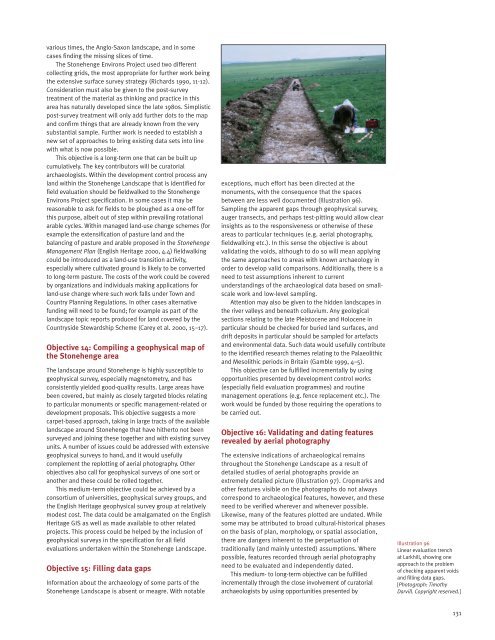
Illustration 96<br />
Linear evaluation trench<br />
at Larkhill, showing one<br />
approach to the problem<br />
of checking apparent voids<br />
and filling data gaps.<br />
[Photograph: Timothy<br />
Darvill. Copyright reserved.]<br />
131


