

stonehenge - English Heritage
stonehenge - English Heritage
stonehenge - English Heritage

Create successful ePaper yourself
Turn your PDF publications into a flip-book with our unique Google optimized e-Paper software.
047-120 section 2.qxd 6/21/05 4:19 PM Page 77<br />
It is important to note that in all these areas there are<br />
hints of settlement sites provided by antiquarian finds and<br />
early rescue excavations but it is really only since the mid<br />
1980s that firm indications of the nature of these sites have<br />
really come to light as a result of evaluation and recording<br />
work at development sites. In all cases it seems that the<br />
areas available for investigation were peripheral to the main<br />
occupation zones; there is thus considerable potential at all<br />
these sites for further exploration and research. It is also<br />
worth noting that northwards, within the SPTA, what appear<br />
to be rather different kinds of settlement involving compact<br />
villages, linear villages, and extensive evidence of cultivation<br />
have been revealed by detailed ground survey and the study<br />
of aerial photographs (McOmish et al. 2002, 88–106).<br />
Whether similar arrangements were also present on the<br />
downlands Stonehenge Landscape east and west of the villabased<br />
settlements along the Avon Valley remains to be seen.<br />
Romano-British pottery and coins have been recovered<br />
at a number of barrow and other prehistoric sites within the<br />
Stonehenge Landscape (see for example Cunnington 1929;<br />
Newall 1931, 432; Ashbee 1980; Hunter-Mann 1999). Even<br />
though the finds are unstratified, the evidence supports<br />
fairly extensive Romano-British occupation/activity within<br />
the Stonehenge Landscape. Stonehenge itself was clearly<br />
visited during the Roman period as a fairly substantial<br />
collection of finds suggests: 20 coins ranging in date from<br />
AD 41–50 through to AD 330–395; pottery (1857 sherds<br />
found in twentieth-century excavations); and personal<br />
ornaments, brooches, pins, toilet equipment, and possibly<br />
some graffiti (Cleal et al. 1995, 431–5 and 491). Whether<br />
these visits were made out of curiosity or because of some<br />
residual significance attaching to the site is not known.<br />
Ritual and ceremonial activity of Roman date seems to be<br />
poorly represented in the Stonehenge Landscape, although<br />
perhaps it is just difficult to see. No conventional temples or<br />
major shrines have yet been found, which is rather odd<br />
given the prehistoric significance of the area. At<br />
Woodhenge, however, the Cunningtons’ excavations of<br />
1926–8 revealed the remains of infant burials in the upper<br />
ditch fills associated with Romano-British pottery and there<br />
is a possibility that the infant buried in the centrally placed<br />
grave at the site is also of this date (Cunnington 1929, 60).<br />
In addition to the burials noted in association with<br />
settlement sites, Roman graves have also been recorded at<br />
four other sites, including a cemetery at Boscombe Down,<br />
Idmiston, excavated in 1995 but not yet published; an<br />
inhumation at Ratfyn (Grinsell 1957, 29); and a cremation<br />
southeast of Milston Farmhouse, Figheldean.<br />
Some of the fieldsystems in the Stonehenge Landscape<br />
undoubtedly originated in the early first millennium AD<br />
while many earlier ones continued in use or were reused.<br />
The Fargo Road settlement noted above is located on the<br />
periphery of a major fieldsystem and lynchets were<br />
recognized in the excavation areas (Wainwright 1971).<br />
A detailed landscape characterization focusing on the<br />
morphology of linear features and field patterns could<br />
perhaps further elucidate the connections between<br />
settlements and associated agricultural features.<br />
The only substantial Roman road identified within the<br />
Stonehenge Landscape is the Old Sarum to Mildenhall road<br />
which is likely to be a Romanized trackway. The trackway<br />
passes just east of Amesbury running in a northnortheasterly<br />
direction, through Boscombe Down Camp and<br />
Bulford Camp, although its precise route on the ground has<br />
never been checked (Margary 1973, 99–100). Other<br />
routeways include the Harrow Way (Ordnance Survey Map<br />
of Roman Britain) and the Old Sarum to Mendip Hills road<br />
which passes just south of the Stonehenge Landscape<br />
(Margary 1973, 101–3).<br />
Overall, the density of known Romano-British sites, their<br />
fairly regular spacing, and the range of available stray finds<br />
and snippets from antiquarian reports suggest that much if<br />
not all the Stonehenge Landscape was significantly more<br />
intensively used in the early first millennium AD than many<br />
recent commentaries would suggest, and with abundant<br />
scope for further research.<br />
SAXON AND EARLY MEDIEVAL<br />
(AD 450–1100)<br />
Archaeological evidence relating to the period from about AD<br />
450 through to the Norman Conquest and even a little<br />
beyond is widely regarded as being notoriously difficult to<br />
find, and hazardous to interpret. This problem is exacerbated<br />
by the general desire to integrate purely archaeological<br />
evidence with tradition, myth, and written historical sources.<br />
There is a general perception that within the Stonehenge<br />
Landscape there is very little evidence relating to the later<br />
first millennium AD; this is not, however, entirely so. For<br />
while there is certainly rather less than for some phases of<br />
prehistory, there are clear indications that the six centuries<br />
following AD 450 are strongly represented and provide much<br />
potential for research (and see Cunnington 1933a; Bonney<br />
1973; Cunliffe 1973f; Hinton 1977; and Eagles 1994 and 2001<br />
for regional background studies). Map M shows the<br />
distribution of recorded Saxon and early medieval sites and<br />
finds within the Stonehenge Landscape.<br />
Eagles (2001) has argued that Germanic migrations into<br />
Wiltshire took place within the framework of the former<br />
Romano-British civitates, with the Avon Valley seeing an<br />
Anglo-Saxon presence relatively early, accompanied by the<br />
development of new cultural identities and social order<br />
among local communities. The River Avon itself was<br />
undoubtedly a significant route into Wessex from the south<br />
coast, and recent finds around Breamore south of Salisbury<br />
have led to suggestions that the river below Charford was<br />
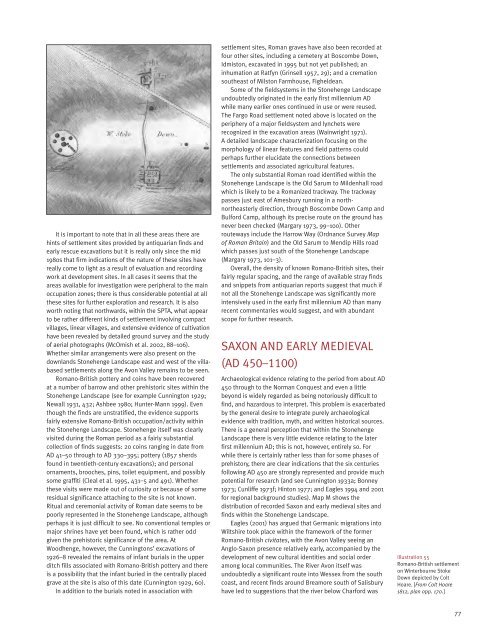
Illustration 55<br />
Romano-British settlement<br />
on Winterbourne Stoke<br />
Down depicted by Colt<br />
Hoare. [From Colt Hoare<br />
1812, plan opp. 170.]<br />
77


