

stonehenge - English Heritage
stonehenge - English Heritage
stonehenge - English Heritage

Create successful ePaper yourself
Turn your PDF publications into a flip-book with our unique Google optimized e-Paper software.
015-046 section 1.qxd 6/21/05 4:14 PM Page 6<br />
physical access to relevant research materials provided that<br />
this does not compromise the ability of other researchers to<br />
pursue their inquiries. Attention is given to the historical<br />
development of approaches to the recovery and processing of<br />
data and to the understanding and interpretation of<br />
Stonehenge and its associated structures in later sections.<br />
Chronologically, the Stonehenge World <strong>Heritage</strong> Site is best<br />
known for its archaeological remains dating to the Neolithic<br />
and Bronze Age, the ‘Age of Stonehenge’, for it is these that<br />
form the basis of the designation. The environs of Stonehenge<br />
have, however, been exploited more or less continuously since<br />
the end of the last glaciation of Britain and both the<br />
emergence of the spectacular monuments and the subsequent<br />
use of the area after their abandonment are very much part of<br />
the overall history of the landscape. In more recent times the<br />
area has been especially significant in terms of its military<br />
history. Thus, although greatest emphasis will be placed on<br />
the periods best represented by the currently known<br />
archaeology, attention will be given to all periods from the late<br />
Pleistocene through to the late twentieth century AD (cf.<br />
<strong>English</strong> <strong>Heritage</strong> 2000, 4.7.5; AAHRG 2001).<br />
Geographically and temporally, the boundary of the World<br />
<strong>Heritage</strong> Site, which covers about 2000ha, is an artefact of<br />
modern mapping, contemporary landscape features, and the<br />
differential survival of archaeological monuments in<br />
surrounding areas. As such it is an arbitrary slice of earlier<br />
patterns, however they may have been defined. Equally, it is<br />
accepted that the world that was known to those who lived<br />
in, worked, and used the landscape around Stonehenge was<br />
a continuous space that extended out in all directions to<br />
limits that today we can only surmise and which were never<br />
constant. While Stonehenge itself now provides the focus for<br />
a great deal of attention, it is fairly certain that for much of its<br />
existence Stonehenge as we know it today was not the<br />
centrepiece of the world in which it stood.<br />
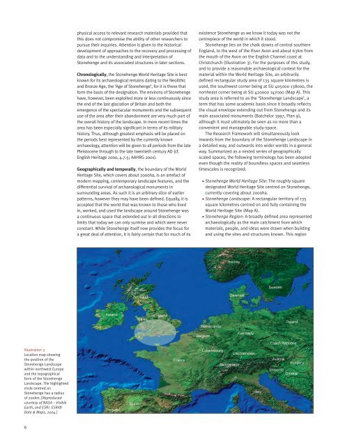
Stonehenge lies on the chalk downs of central southern<br />
England, to the west of the River Avon and about 63km from<br />
the mouth of the Avon on the <strong>English</strong> Channel coast at<br />
Christchurch (Illustration 3). For the purposes of this study,<br />
and to provide a reasonable archaeological context for the<br />
material within the World <strong>Heritage</strong> Site, an arbitrarily<br />
defined rectangular study area of 135 square kilometres is<br />
used, the southwest corner being at SU 405000 138000, the<br />
northeast corner being at SU 420000 147000 (Map A). This<br />
study area is referred to as the ‘Stonehenge Landscape’, a<br />
term that has some academic basis since it broadly reflects<br />
the visual envelope extending out from Stonehenge and its<br />
main associated monuments (Batchelor 1997, Plan 9),<br />
although it must ultimately be seen as no more than a<br />
convenient and manageable study-space.<br />
The Research Framework will simultaneously look<br />
inwards from the boundary of the Stonehenge Landscape in<br />
a detailed way, and outwards into wider worlds in a general<br />
way. Summarized as a nested series of geographically<br />
scaled spaces, the following terminology has been adopted<br />
even though the reality of boundless spaces and seamless<br />
timescales is recognized:<br />
• Stonehenge World <strong>Heritage</strong> Site: The roughly square<br />
designated World <strong>Heritage</strong> Site centred on Stonehenge,<br />
currently covering about 2000ha.<br />
• Stonehenge Landscape: A rectangular territory of 135<br />
square kilometres centred on and fully containing the<br />
World <strong>Heritage</strong> Site (Map A). <br />
• Stonehenge Region: A broadly defined area represented<br />
archaeologically as the main catchment from which<br />
materials, people, and ideas were drawn when building<br />
and using the sites and structures known. This region<br />
Illustration 3<br />
Location map showing<br />
the position of the<br />
Stonehenge Landscape<br />
within northwest Europe<br />
and the topographical<br />
form of the Stonehenge<br />
Landscape. The highlighted<br />
circle centred on<br />
Stonehenge has a radius<br />
of 200km. [Reproduced<br />
courtesy of NASA – Visible<br />
Earth, and ESRI. ESRI®<br />
Data & Maps, 2004.]<br />
6


