Chapter A - Introduction - City of Pickering
Chapter A - Introduction - City of Pickering
Chapter A - Introduction - City of Pickering
You also want an ePaper? Increase the reach of your titles
YUMPU automatically turns print PDFs into web optimized ePapers that Google loves.
property.<br />
COMMENT MESPA RESPONSE (December 2011) CITY RESPONSE (October 2012) RESPONSE<br />
• Surface Water Hydrology (Section 5.0)<br />
Hydrologic Model<br />
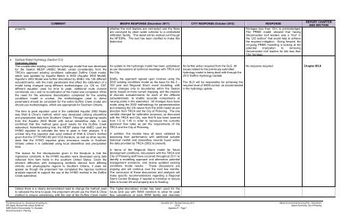
The uncalibrated existing conditions hydrologic model that was developed<br />
for the Seaton MESP (AMEC Model) varied considerably from the<br />
TRCA’s approved existing conditions calibrated Duffins Creek model,<br />
which was updated by Aquafor Beech in 2002 (Aquafor 2002 Model).<br />
Aquafor’s 2002 Model was further discretized by AMEC into 126 different<br />
subcatchments, with the main parameters that affect the calibration <strong>of</strong> a<br />
model being changed using different methodologies (i.e. CN vs. CN*,<br />
different equation used for time to peak, additional route channel<br />
commands, etc.) and no re-calibration <strong>of</strong> the model was completed. While<br />
the need for the extensive discretization completed for the existing<br />
conditions model is unclear, the methodologies used to derive<br />
parameters should be consistent for the entire Duffins Creek model and<br />
should use methodologies, which are appropriate for Southern Ontario.<br />
The time to peak equation used in the calibrated Aquafor 2002 Model<br />
was Watt & Chow’s method, which was developed utilizing streamflow<br />
and precipitation data from Southern Ontario. Through comparing results<br />
from the Aquafor 2002 Model with actual streamflow data, it was<br />
confirmed that this method gave good results for the Duffins Creek<br />
watershed. Notwithstanding that, the MESP states that AMEC used the<br />
HYMO equation to calculate the time to peak in their analysis. It is<br />
unclear why this equation was used instead <strong>of</strong> Watt & Chow’s method<br />
given that the OTTHYMO-89 and VO2 literature, as well as other reports,<br />
state that the HYMO equation gives erroneous results in Southern<br />
Ontario unless it is calibrated using local streamflow and precipitation<br />
data.<br />
The reason for the discrepancies given in the literature is that the<br />
regression constants in the HYMO equation were developed using data<br />
collected from farm fields in the southern United States. Given the<br />
inherent difficulties with transposing methods derived from differing<br />
climatic and physiographic regions to Southern Ontario, it does not<br />
appear as though the proponent has completed the rigorous technical<br />
analysis required to support the use <strong>of</strong> the HYMO method in the Duffins<br />
Creek watershed.<br />
whether the ro<strong>of</strong> leaders are connected and the flows<br />
are conveyed by clean water collector to a centralized<br />
infiltration facility. This detail will be worked out through<br />
the NFSSRs. The text has been clarified to make this<br />
distinction.<br />
An update to the hydrologic model has been undertaken<br />
as per discussions at technical meetings with TRCA and<br />
the <strong>City</strong>.<br />
Briefly, the approach agreed upon involves using the<br />
2002 existing conditions model as the base for the 2 –<br />
100 year and Regional Storm event modelling, with<br />
minor changes only to boundaries within the Seaton<br />
lands, based on more current mapping, and the creation<br />
<strong>of</strong> discrete subcatchments for each <strong>of</strong> the different<br />
subwatersheds, to enable accurate comparisons at<br />
varying points in the watershed. All changes have been<br />
made using the 2002 methodology for parameterization<br />
and retaining the CN values from the 2002 model as per<br />
direction from TRCA and the <strong>City</strong> <strong>of</strong> <strong>Pickering</strong>. The one<br />
variable changed for calibration purposes, as discussed<br />
with the TRCA and <strong>City</strong>, was that N has been lowered<br />
from 1.5 to 1.45 in order to reproduce the currently<br />
approved flow rates as per the requirements <strong>of</strong> the<br />
TRCA and the <strong>City</strong> <strong>of</strong> <strong>Pickering</strong>.<br />
In addition, the models have all been validated by<br />
assessing their performance with additional suitable<br />
historical rainfall and streamflow records found within<br />
the data provided by TRCA (2002 to present).<br />
In terms <strong>of</strong> the Regional Storm model for future<br />
development conditions, discussions with the TRCA and<br />
<strong>City</strong> <strong>of</strong> <strong>Pickering</strong> staff have occurred throughout 2011 to<br />
identify a modelling approach and alternative potential<br />
management scenarios, and review updated existing<br />
conditions model results. These discussions are<br />
ongoing and will continue over the next few months.<br />
The conclusion <strong>of</strong> these discussions and analyses will<br />
make specific recommendations regarding a Regional<br />
Storm Control Strategy, if needed to minimize or reduce<br />
risks to human life and property due to flooding.<br />
No further action required from the SLG. All<br />
issues related to the previously submitted<br />
hydrology model is being dealt with through the<br />
2012 Duffins Hydrology Update.<br />
The SLG will be responsible for achieving the<br />
required level <strong>of</strong> SWM control, as recommended<br />
in the hydrology update.<br />
frontages less than 12m, is acknowledged.<br />
The PRMS model showed that having<br />
disconnected ro<strong>of</strong> leaders was a “tool” in<br />
the “LID toolbox” that would help to achieve<br />
the required mitigation. Going forward, the<br />
on-going PRMS modelling is looking at the<br />
potential implication to removing<br />
disconnected ro<strong>of</strong> leaders for lots less than<br />
12m frontage.<br />
REPORT CHAPTER<br />
AND SECTION<br />
No response required. <strong>Chapter</strong> B5.0<br />
Unless there is a clearly demonstrated need to change the method used<br />
to calculate the time to peak, the proponent should use the Watt & Chow<br />
method to ensure consistency with the rest <strong>of</strong> the Duffins Creek model<br />
The higher-discretized model has been used for the<br />
future land use with SWM condition to allow for peak<br />
flow calculations at each SWM facility and channels<br />
The Sernas Group Inc., Stonybrook Consulting Inc. December 2011, Revised February 2013 Master Environmental Servicing Plan - Amendment<br />
SPL Beatty, Bird and Hale Limited, Earthfx Inc. 07161 Seaton Community, <strong>City</strong> <strong>of</strong> <strong>Pickering</strong><br />
AMEC Earth & Environmental, R.J. Burnside Appendix A7 – Page 7<br />
Amos Environment + Planning


