

Chapter A - Introduction - City of Pickering
Chapter A - Introduction - City of Pickering
Chapter A - Introduction - City of Pickering

You also want an ePaper? Increase the reach of your titles
YUMPU automatically turns print PDFs into web optimized ePapers that Google loves.
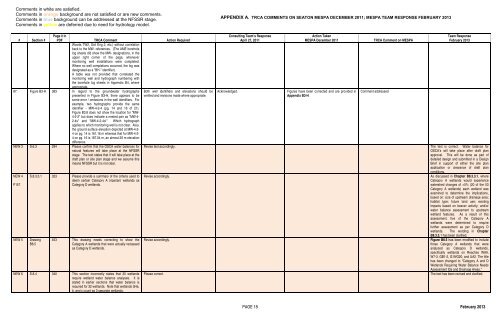
Comments in white are satisfied.<br />
Comments in orange background are not satisfied or are new comments.<br />
Comments in blue background can be addressed at the NFSSR stage.<br />
Comments in yellow are deferred due to need for hydrology model.<br />
APPENDIX A. TRCA COMMENTS ON SEATON MESPA DECEMBER 2011; MESPA TEAM RESPONSE FEBRUARY 2013<br />
# Section #<br />
Page # in<br />
PDF TRCA Comment Action Required<br />
Woods TW2, Soil Eng 2, etc.) without correlation<br />
back to the MW- references. (The AME borehole<br />
log sheets did show the MW- designations, in the<br />
upper right corner <strong>of</strong> the page, whenever<br />
monitoring well installations were completed.<br />
Where no well completions occurred, the log was<br />
designated as a "BH-" identifier).<br />
A table was not provided that correlated the<br />
monitoring well and hydrograph numbering with<br />
the borehole log sheets in Appendix B4, where<br />
appropriate.<br />
87. Figure B3-H 383 In regard to the groundwater hydrographs<br />
presented in Figure B3-H, there appears to be<br />
some error / omissions in the well identifiers. For<br />
example, two hydrographs provide the same<br />
identifier - MW-4-2-4 (pg. 14 and 16 <strong>of</strong> 21).<br />
Figure B3.8 does not show the location for "MW-<br />
4-2-2" but does indicate a nested pair as "MW-4-<br />
2-4s" and "MW-4-2-4d." Which hydrograph<br />
applies to which monitoring well is not clear. Also,<br />
the ground surface elevation depicted at MW-4-2-<br />
4 on pg. 14 is 161.16 m whereas that for MW-4-2-<br />
4 on pg. 16 is 187.04 m, an almost 26 m elevation<br />
difference.<br />
NEW 3 S.6.3 294 Please confirm that the OSCA water balances for<br />
natural features will take place at the NFSSR<br />
stage. The text states that it will take place at the<br />
draft plan or site plan stage and we assume this<br />
means NFSSR but it is not clear.<br />
NEW 4<br />
P157<br />
NEW 5<br />
S.8.3.3.1 323 Please provide a summary <strong>of</strong> the criteria used to<br />
deem certain Category A (riparian) wetlands as<br />
Category D wetlands.<br />
Drawing<br />
B8.5<br />
453 This drawing needs correcting to show the<br />
Category A wetlands that were actually reclassed<br />
as Category D wetlands.<br />
NEW 6 S.8.4 340 This section incorrectly states that 30 wetlands<br />
require wetland water balance analyses. It is<br />
stated in earlier sections that water balance is<br />
required for 32 wetlands. Note that wetlands G4a,<br />
b, and c count as 3 separate wetlands.<br />
Both well identifiers and elevations should be<br />
verified and revisions made where appropriate.<br />
Revise text accordingly.<br />
Revise accordingly.<br />
Revise accordingly.<br />
Please correct.<br />
Acknowledged.<br />
Consulting Team’s Response<br />
April 27, 2011<br />
Action Taken<br />
MESPA December 2011<br />
Figures have been corrected and are provided in<br />
Appendix B3-H.<br />
TRCA Comment on MESPA<br />
Comment addressed<br />
Team Response<br />
February 2013<br />
The text is correct. Water balance for<br />
OSCA’s will take place after draft plan<br />
approval. This will be done as part <strong>of</strong><br />
detailed design and submitted in a Design<br />
Brief in support <strong>of</strong> either the site plan<br />
application or clearance <strong>of</strong> draft plan<br />
conditions.<br />
As discussed in <strong>Chapter</strong> B8.3.3.1, where<br />
Category A wetlands would experience<br />
watershed changes <strong>of</strong> >5% (20 <strong>of</strong> the 53<br />
Category A wetlands) each wetland was<br />
examined to determine the implications,<br />
based on: size <strong>of</strong> upstream drainage area;<br />
habitat type; future land use; existing<br />
impacts based on beaver activity; and/or<br />
water balance assessment to upstream<br />
wetland features. As a result <strong>of</strong> this<br />
assessment, five <strong>of</strong> the Category A<br />
wetlands were determined to require<br />
further assessment as per Category D<br />
wetlands. The wording in <strong>Chapter</strong><br />
B8.3.3.1 has been clarified.<br />
Figure B8.5 has been modified to include<br />
those Category A wetlands that were<br />
analyzed as Category D wetlands,<br />
specifically wetlands on Reaches WA9,<br />
W7-3, GB1-2, G19/G20, and UA2. The title<br />
has been changed to “Category A and D<br />
Wetlands Requiring Water Balance Needs<br />
Assessment IDs and Drainage Areas.”<br />
The text has been revised and clarified.<br />
PAGE 18 February 2013


