
Create successful ePaper yourself
Turn your PDF publications into a flip-book with our unique Google optimized e-Paper software.
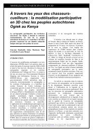
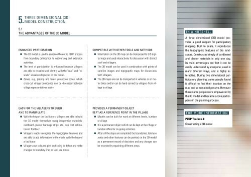
Three dimensional (3D)<br />
5. model construction<br />
5.1<br />
The advantages of the 3D model<br />
Enhanced participation<br />
• The 3D model is used to enhance the entire PLUP process<br />
from boundary delineation to networking and extension<br />
activities.<br />
• The level of participation is enhanced because villagers<br />
are able to visualise and identify with the “real” and “toscale”<br />
situation displayed on the model.<br />
• Zones, e.g., grazing and forest protection zones, which<br />
cross-cut village boundaries can be discussed between<br />
village representatives easily.<br />
Compatible with other tools and methods<br />
• Information on the 3D map can be transposed to GIS digital<br />
maps and used interactively for discussion with district<br />
staff and villagers.<br />
• The 3D model can be used in combination with prints of<br />
satellite images and topographic maps for discussions<br />
with villagers.<br />
• The 3D maps are can be transported in vehicles or on motor<br />
bikes and/or can be hand-carried by villagers from village<br />
to village.<br />
IN A NUTSHELL<br />
A three dimensional (3D) model provides<br />
a good support for participatory<br />
mapping. Built to scale, it reproduces<br />
the topographic features of the landscape.<br />
Constructed simply of cardboard<br />
and plaster materials in only one day,<br />
its main advantages are that it can be<br />
easily understood by everyone, used in<br />
many different ways, and is highly interactive.<br />
During two dimensional participatory<br />
planning, some people found<br />
it difficult to find their location on the<br />
map and so remained passive. However<br />
these same people were empowered by<br />
the 3D model and became active participants<br />
in the planning process.<br />
Easy for the villagers to build<br />
and to manipulate<br />
• With the help of the facilitators, villagers are able to build<br />
the 3D model themselves using inexpensive materials:<br />
cardboard, plaster bandage strips, etc.; see cost estimation<br />
in Toolbox 1.<br />
• Villagers readily recognise the topographic features and<br />
are able to add information to the model with the help of<br />
a facilitator.<br />
• Villagers use coloured pins and string to define and make<br />
changes to boundary lines or land use zones.<br />
Provides a permanent object<br />
kept as a reference point in the village<br />
• Models can be built for work at different levels, kumban<br />
or village<br />
• It is a permanent object which can be kept at the village or<br />
kumban office for on-going activities.<br />
• After all the steps are completed the boundaries, land use<br />
zones and other features can be painted on the 3D model<br />
as a permanent record of decisions and any changes can<br />
be recorded by repainting different areas.<br />
For more information<br />
PLUP Toolbox 4:<br />
Constructing a 3D model