Transportation 2035 - State of Rhode Island: Division of Planning
Transportation 2035 - State of Rhode Island: Division of Planning
Transportation 2035 - State of Rhode Island: Division of Planning
Create successful ePaper yourself
Turn your PDF publications into a flip-book with our unique Google optimized e-Paper software.
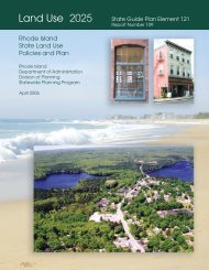
December 2012AIR QUALITYRecommendation: The SPP should continue to work with the <strong>Rhode</strong> <strong>Island</strong> Department <strong>of</strong> Environmental Management (DEM) to submit Rule VIII, whichoutlines the process and criteria for <strong>State</strong> agencies to determine air quality conformity for transportation plans and projects, to the EPA in a timely fashion andno later than September 2010. [Staff worked closely with RIDEM, RIDOT and RIPTA to update DEM’s Air Pollution Control Regulation No. 49. This updatedregulation has been approved by the <strong>State</strong> and the EPA. It will be incorporated into the <strong>State</strong> <strong>Planning</strong> Council’s Rules <strong>of</strong> Procedure as part <strong>of</strong> a larger updateexpected in 2013.]STATE PLANNING ACTIVITIESLAND USE PLANThe <strong>State</strong>’s land use plan was revised for the first time since 1989 and Land Use 2025 was adopted in 2006. The plan looked at several different alternativegrowth patterns, one <strong>of</strong> which was called “Centers and Corridors” and was based on the Travel Corridor <strong>Planning</strong> Initiative that was undertaken by <strong>State</strong>wide<strong>Planning</strong> in 2003. Other conceptual growth patterns were also analyzed. The preferred alternative is a composite <strong>of</strong> the alternatives and identifies an “urbanservice boundary” and potential growth centers outside <strong>of</strong> this urban area. The urban service area includes the metropolitan Providence region, otherdeveloped areas, and other areas that have public water and/or sewers. These are the same parts <strong>of</strong> the state that also have thebest transit service.The land use plan contains three key objectives that address transportation:• 4E. Promote intermodal centers and greater reliance on transit. [by maintaining stations, connections, and allowinggreater density <strong>of</strong> development along transit lines].See Map # 1-2RI <strong>State</strong> Land UsePlan• 4F. Provide pedestrian connections through all centers and urban districts. [through sidewalk investments and reconnected street grids]• 4G. Maintain the functional integrity <strong>of</strong> existing and planned roadways. [primarily through effective land use and corridor plans]In order to show consistency with land use and development plans, three growth scenarios have been developed in the Travel Demand Model based on theLand Use Plan. This scenario analysis is further described in Part Four.This transportation plan carries forward policies that are consistent with the urban services area and compact development principles. The same land usepolicies that strive to preserve open space and create vibrant (and more dense) urban centers and villages also are conducive to more effective and efficientuse <strong>of</strong> public transportation and non-motorized modes. This in turn eases congestion and is less harmful to the environment.<strong>Transportation</strong> <strong>2035</strong> (2012 Update)<strong>State</strong> Guide Plan Element 611<strong>Rhode</strong> <strong>Island</strong> <strong>State</strong>wide <strong>Planning</strong> ProgramPage 1-14


