download pdf - Institut für Umweltphysik - Ruprecht-Karls-Universität ...
download pdf - Institut für Umweltphysik - Ruprecht-Karls-Universität ...
download pdf - Institut für Umweltphysik - Ruprecht-Karls-Universität ...

Create successful ePaper yourself
Turn your PDF publications into a flip-book with our unique Google optimized e-Paper software.
56 CHAPTER 2. ATMOSPHERE AND REMOTE SENSING<br />
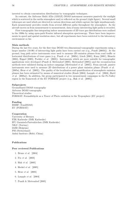
inverted to obtain concentration distributions by tomographic techniques.<br />
In contrast, the Airborne Multi AXis (AMAX) DOAS instrument measures passively the sunlight<br />
which is scattered in the earths atmosphere and/or reflected on the ground (right figure). Several small<br />
telescopes are used which are directed in various directions and which capture the light simultaneously.<br />
Each measurement provides results from several different paths throughout the atmosphere. As the<br />
aircraft moves on from measurement to measurement, data of many intersecting light paths is recorded.<br />
First tomographic line-integrating indoor measurements of 2D trace gas distributions were realized<br />
in the 1990s by using open-path Fourier infrared absorption spectroscopy. There have been improvements<br />
in speed and spatial resolution since, but all experiments have been restricted to the laboratory<br />
environment so far.<br />
Main methods<br />
During the last five years, for the first time DOAS two-dimensional tomographic experiments using a<br />
larger number (10-90) of intersecting light paths have been carried out (e.g., Pundt [2005b]). At the<br />
ground, long path active instruments were used to measure 2D emission plumes from road traffic or<br />
horizontal distributions of trace gases (e.g. Pundt et al. [2005c], Lösch [2001], Kunz [2001], Bäuerle<br />
[2004], Rippel [2005], Poehler et al. [2005]). Instruments which are more suitable for tomographic<br />
applications were developed (Pundt & Mettendorf [2005], Mettendorf [2005]) and the reconstruction<br />
methods were validated during an indoor campaign (Mettendorf et al. [2005]). From aircraft, passive<br />
instruments were used to measure 2D distributions of a power plant emission plume (Pundt et al.<br />
[2005a], Heue et al. [2005]). The quality of the localization and quantification of atmospheric emission<br />
plumes has been estimated by means of numerical studies (Knab [2004], Laepple et al. [2004], Hartl<br />
et al. [2005a]). In addition, the group participated in two measurement campaigns in the Po-Valley<br />
region in the framework of the EU FORMAT project (e.g., Hak et al. [2005]).<br />
Subprojects<br />
Groundbased DOAS tomography<br />
Airborne DOAS tomography<br />
Theoretical studies<br />
FORMAT: Formaldehyde as a Tracer of Photo oxidation in the Troposphere (EU project)<br />
Funding<br />
BMBF (TomDOAS)<br />
EU (FORMAT)<br />
Cooperation<br />
University of Bremen<br />
FZK <strong>Karls</strong>ruhe (IMK <strong>Karls</strong>ruhe)<br />
IFU Garmisch-Partenkirchen (IMK <strong>Karls</strong>ruhe)<br />
NILU (Norway)<br />
IASB (Belgium)<br />
PSI (Switzerland)<br />
Anhui <strong>Institut</strong>e (Hefei, China)<br />
Publications<br />
Peer reviewed Publications<br />
1. Bruns et al. [2004]<br />
2. Fix et al. [2005]<br />
3. Hak et al. [2005]<br />
4. Heckel et al. [2005]<br />
5. Heue et al. [2005]<br />
6. Laepple et al. [2004]<br />
7. Pundt & Mettendorf [2005]