Final Technical Report: - Southwest Fisheries Science Center - NOAA
Final Technical Report: - Southwest Fisheries Science Center - NOAA
Final Technical Report: - Southwest Fisheries Science Center - NOAA

You also want an ePaper? Increase the reach of your titles
YUMPU automatically turns print PDFs into web optimized ePapers that Google loves.
Encounter rate and group size were predicted to segment midpoints located directly on<br />
the survey transects, and the resulting densities were interpolated (as described under Density<br />
Interpolation in the California Current section above) to provide gridded density predictions<br />
throughout the study area. Grids were created for each of the individual survey years (1986-<br />
1990, 1998-2000, 2003, and 2006) and interpolated at a resolution of 100 km. All data within a<br />
search radius of 10 degrees latitude (1,111 km) were included in the inverse distance weighting<br />
calculations.<br />
Model Validation<br />
Data from the 2006 line-transect surveys in the ETP were used to validate the encounter<br />
rate and group size models constructed using data from 1986-2003. Data processing for this<br />
model validation task followed that described under Data Extraction for the ETP above. To<br />
assess the models’ fit to the validation data set and to examine the inter-annual variability in<br />
model predictions, density was predicted separately for each survey year from 1986 to 2006.<br />
Methods used to evaluate model fit included visual inspection of geographic contour plots of the<br />
annual density predictions and computation of geographically stratified ratios of observed to<br />
predicted density.<br />
3.5.3 Line-transect densities for unmodeled species<br />
The predictive habitat models described above were developed for all ETP and CCE<br />
species with sufficient sightings and survey data during the summer/fall season. Several<br />
additional species were observed during the surveys, but too few observations were made to<br />
develop models. Similarly, a SWFSC survey of waters surrounding Hawaii yielded too few<br />
sightings for modeling of cetacean densities in that region. Therefore, constant densities were<br />
derived for these species and regions, based on published line-transect estimates applied to the<br />
most appropriate species-specific strata. Coefficients of variation and lognormal 90%<br />
confidence limits were estimated from the published CVs, or re-calculated for specific strata<br />
using the same methods as the original studies.<br />
Within the California Current Ecosystem, line-transect estimates derived from the 1991-<br />
2005 U.S. West Coast surveys (Barlow and Forney 2007; Table 6) were used for the following<br />
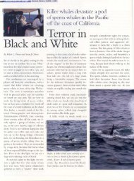
species during summer: long-beaked common dolphin (Delphinus capensis), short-finned pilot<br />
whale, bottlenose dolphin, killer whale, minke whale (Balaenoptera acutorostrata), Bryde's<br />
whale, sei whale, and a combined category for pygmy and dwarf sperm whales (Kogia spp.).<br />
Similarly, average winter densities estimated for cetaceans off California (Forney et al. 1995)<br />
based on aerial line-transect surveys were applied to appropriate geographic strata on a speciesspecific<br />
basis. These species included: common dolphins (Delphinus spp.), Pacific white-sided<br />
dolphin, northern right whale dolphin, Dall's porpoise, Risso's dolphin, bottlenose dolphin, killer<br />
whale, blue whale, fin whale, humpback whale, sperm whale, minke whale, North Pacific right<br />
whale (Eubalaena japonica) and a category of 'small beaked whales' which includes species of<br />
31