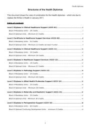
Level 6 Graduate Diploma in Engineering (9210-01) - City & Guilds
Level 6 Graduate Diploma in Engineering (9210-01) - City & Guilds
Level 6 Graduate Diploma in Engineering (9210-01) - City & Guilds

Create successful ePaper yourself
Turn your PDF publications into a flip-book with our unique Google optimized e-Paper software.
11. Assess stereoscopic view<strong>in</strong>g and parallax.<br />
12. Expla<strong>in</strong> the pr<strong>in</strong>ciples of Geodetic survey.<br />
13. Carryout geodetic control surveys <strong>in</strong>clud<strong>in</strong>g precise travers<strong>in</strong>g, triangulation and levell<strong>in</strong>g.<br />
14. Use Global Position<strong>in</strong>g Systems (GPS) <strong>in</strong> survey<strong>in</strong>g <strong>in</strong> respect of:-<br />
a. user, space and control segments<br />
b. overviews of the applications of<br />
i signals and codes<br />
ii static and k<strong>in</strong>ematic applications of GPS<br />
iii real time and post processed solutions<br />
15. Appraise recent developments <strong>in</strong> GNSS eng<strong>in</strong>eer<strong>in</strong>g survey<strong>in</strong>g <strong>in</strong>strumentation and techniques,<br />
<strong>in</strong>clud<strong>in</strong>g laser scann<strong>in</strong>g.<br />
Outcome 3 Analyse survey data accurately and reliably us<strong>in</strong>g standard<br />
convention<br />
The learner can:<br />
1. Handle data <strong>in</strong>volv<strong>in</strong>g:<br />
a. angles<br />
b. bear<strong>in</strong>gs<br />
c. co-ord<strong>in</strong>ates.<br />
2. Produce computations <strong>in</strong>volv<strong>in</strong>g National Grid rectangular co-ord<strong>in</strong>ates.<br />
3. Def<strong>in</strong>e True North and Grid North.<br />
4. Determ<strong>in</strong>e local scale factors, convergence of meridians and other parameters by:<br />
a. approximations<br />
b. precise methods.<br />
5. Correlate both surface and underground surveys to the National Grid.<br />
6. Make Bowditch adjustment of traverses.<br />
7. Appraise eng<strong>in</strong>eer<strong>in</strong>g survey networks.<br />
Outcome 4 Apply survey methods to <strong>in</strong>dustrial applications<br />
The learner can:<br />
1. Implement dimensional control <strong>in</strong> eng<strong>in</strong>eer<strong>in</strong>g constructions by sett<strong>in</strong>g out horizontal, transition<br />
and vertical curves:<br />
a. on the surface<br />
b. <strong>in</strong> tunnell<strong>in</strong>g<br />
2. Select equipment for construction surveys.<br />
3. Apply horizontal and vertical control.<br />
4. Identify sources of error <strong>in</strong> surveys.<br />
5. Monitor deformation and subsidence.<br />
6. Survey tunnels:-<br />
a. direction control<br />
b. gyro-theodolite observations and computations<br />
c. laser <strong>in</strong>struments for alignment and sett<strong>in</strong>g out<br />
7. Determ<strong>in</strong>e areas from plan measurements by:<br />
a. co-ord<strong>in</strong>ates<br />
b. cross-sections.<br />
8. Use general volume and earthwork formulae.<br />
9. Construct and use mass-haul diagrams.<br />
38 <strong>Level</strong> 6 <strong>Graduate</strong> <strong>Diploma</strong> <strong>in</strong> Eng<strong>in</strong>eer<strong>in</strong>g (<strong>9210</strong>-<strong>01</strong>)