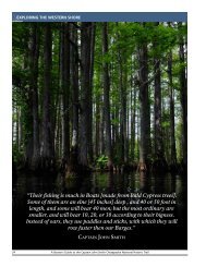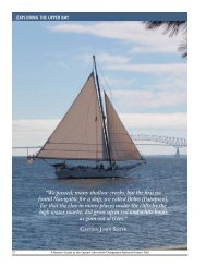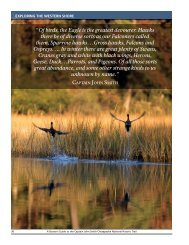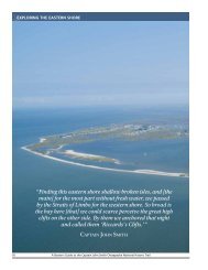
Draft Interpretive Plan Join the adventure! - Captain John Smith ...
Draft Interpretive Plan Join the adventure! - Captain John Smith ...
Draft Interpretive Plan Join the adventure! - Captain John Smith ...

Create successful ePaper yourself
Turn your PDF publications into a flip-book with our unique Google optimized e-Paper software.
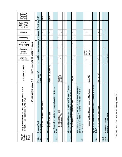
Interpretation<br />
Potential<br />
Public or<br />
Private<br />
Ownership<br />
Public Boat<br />
Access<br />
Restrooms<br />
Parking<br />
NPS site,<br />
NHL, Nat'l<br />
Reg., FWS<br />
Overlaps<br />
Existing/<br />
Proposed<br />
WaterTrails<br />
Map ID<br />
Number<br />
(Stop<br />
Date)<br />
Stop Name (blue rows) and Nearby Public Lands /<br />
Potential Trail Resources (white rows)<br />
Location (County)<br />
JOHN SMITH VOYAGE 2: JULY 24 -- SEPTEMBER 7, 1608<br />
7.27:1 Stingray Point Middlesex, VA no public access; across river is Windmill Point, see 7.17<br />
7.28:1 Cove Point Calvert, MD<br />
Calvert Cliffs State Park, nearby SSBT<br />
7.29:1 Old Road Bay<br />
Fort Howard Park Baltimore County, MD SSBT<br />
7.30:1<br />
past Turkey Point into<strong>the</strong> larger opening of <strong>the</strong> Nor<strong>the</strong>ast<br />
River<br />
Elk Neck State Park Cecil, MD <br />
Charlestown Pier Cecil, MD <br />
7.31:2<br />
along <strong>the</strong> high cliffs east of Howell Point "'Pisings Point') or<br />
just past <strong>the</strong> cliffs, in <strong>the</strong> lower ground near Betterton<br />
Betterton Beach Waterfront Park Kent, MD <br />
8.1:1<br />
<strong>the</strong> Sassafras (Toghwogh) River, village of <strong>the</strong> Tockwoghs<br />
(probably on <strong>the</strong> headland jutting out <strong>the</strong> far<strong>the</strong>st on <strong>the</strong><br />
south side)<br />
Sassafras River Natural Resource Mgmt Area Kent, MD<br />
<br />
public,<br />
state<br />
owned<br />
<br />
8.2:1<br />
up <strong>the</strong> Susquehannock River to <strong>the</strong> head of tide at "<strong>Smith</strong>'s<br />
Falls"<br />
Susquehanna State Park Harford, MD <br />
8.2:2<br />
8.2:3 Susquehanna Flats<br />
8.3:1 <strong>the</strong> head of <strong>the</strong> Elk River private land<br />
* Italics indicates place name as recorded by <strong>John</strong> <strong>Smith</strong><br />
110<br />
APPENDIX C: TRAIL RELATED RESOURCES