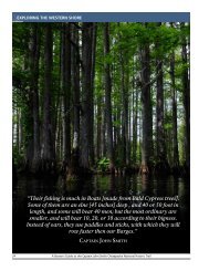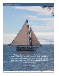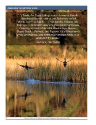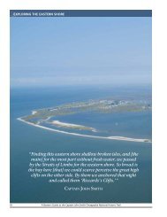
Draft Interpretive Plan Join the adventure! - Captain John Smith ...
Draft Interpretive Plan Join the adventure! - Captain John Smith ...
Draft Interpretive Plan Join the adventure! - Captain John Smith ...

You also want an ePaper? Increase the reach of your titles
YUMPU automatically turns print PDFs into web optimized ePapers that Google loves.
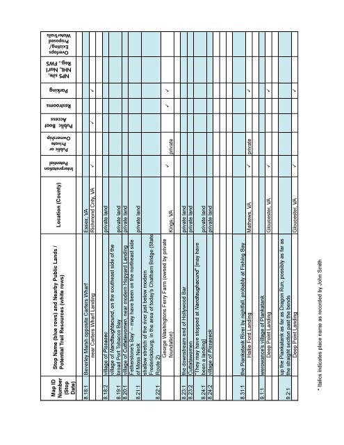
Interpretation<br />
Potential<br />
Public or<br />
Private<br />
Ownership<br />
Public Boat<br />
Access<br />
Restrooms<br />
Parking<br />
NPS site,<br />
NHL, Nat'l<br />
Reg., FWS<br />
Overlaps<br />
Existing/<br />
Proposed<br />
WaterTrails<br />
Map ID<br />
Number<br />
(Stop<br />
Date)<br />
Stop Name (blue rows) and Nearby Public Lands /<br />
Potential Trail Resources (white rows)<br />
Location (County)<br />
8.18:1 Beverley Marsh opposite Carters Wharf Essex, VA<br />
near Carters Wharf Landing Richmond Cnty, VA <br />
8.18:2 village of Pissasec private land<br />
8.19:1 village of Nandtaughtacund, on <strong>the</strong> sou<strong>the</strong>ast side of <strong>the</strong><br />
broad Port Tobacco Bay private land<br />
8.20:1 village of Cuttatawomen, near modern Hopyard Landing private land<br />
8.21:1<br />
8.22:1<br />
Fe<strong>the</strong>rstone's Bay' -- may have been on <strong>the</strong> nor<strong>the</strong>ast side<br />
of Moss Neck private land<br />
shallow stretch of <strong>the</strong> river just below modern<br />
Fredericksburg, in <strong>the</strong> area of today's Chatham Bridge (State<br />
Route 2)<br />
George Washingtons Ferry Farm (owned by private<br />
foundation) Kings, VA<br />
<br />
private<br />
<br />
8.23:1 <strong>the</strong> downstream end of Hollywood Bar private land<br />
8.23:2 Cuttatawomen private land<br />
"They may have stopped at Nandtaughacund" [may have<br />
8.24:1 been a landing] private land<br />
8.24:2 village of Pissaseck private land<br />
8.31:1 <strong>the</strong> Piankatank River by nightfall, probably at Fishing Bay<br />
Hallie Ford Landing Ma<strong>the</strong>ws, VA private <br />
9.1:1 werowance's village of Piankatank<br />
Deep Point Landing Gloucester, VA <br />
9.2:1<br />
up <strong>the</strong> Piankatank as far as Dragon Run, possibly as far as<br />
<strong>the</strong> straight section past <strong>the</strong> bends<br />
Deep Point Landing Gloucester, VA <br />
* Italics indicates place name as recorded by <strong>John</strong> <strong>Smith</strong><br />
APPENDIX C: TRAIL RELATED RESOURCES 113