FINAL VERSION FOR APPROVAL - Sdn Bhd - WWF Malaysia
FINAL VERSION FOR APPROVAL - Sdn Bhd - WWF Malaysia
FINAL VERSION FOR APPROVAL - Sdn Bhd - WWF Malaysia

You also want an ePaper? Increase the reach of your titles
YUMPU automatically turns print PDFs into web optimized ePapers that Google loves.
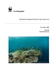
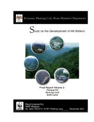
Gunung Stong State Park Preliminary Management Plan<br />
Gunung Stong Tengah Forest Reserve be gazetted as a protected area was unanimously<br />
accepted by the State Government. Subsequently, the Kelantan State Government amended<br />
the National Forestry Act 1984 (which had previously been adopted by the State), creating an<br />
additional category of forest reserves, i.e. as a state park, and the relevant state park<br />
committees were formed to guide the creation of the protected area.<br />
It was realised that there is a big gap between intentions and operational reality, and that a<br />
crucial step was the preparation of a management plan. However, unlike other new (or soonto-be)<br />
protected areas, GSSP is already popular with hikers, and pending a more detailed,<br />
management plan, it was decided that a preliminary management plan was necessary as a<br />
guide to the policy, planning and management of GSSP. To delay may result in negative<br />
impacts on GSSP in view of increasing numbers of visitors and the lack of control and<br />
monitoring over their behaviours, and also the lack for coordination between stakeholders. It<br />
is to be understood that this preliminary management plan is meant as a stopgap instrument<br />
pending a more detailed, management plan for GSSP.<br />
2.2 Location<br />
GSSP is currently the Gunung Stong Tengah Forest Reserve located in the west of the State<br />
(refer to Appendix 1 for location map). GSSP is surrounded by the Basor Forest Reserve<br />
(40,790ha), Gunung Stong Utara Forest Reserve (11,044ha), Gunung Stong Selatan Forest<br />
Reserve (28,134ha), Balah Forest Reserve (56,010ha) and Berangkat Forest Reserve<br />
(21,409ha). GSSP and this group of forest reserves together make up a total of 157,087ha of<br />
forestland.<br />
These blocks of forests are the extensions of the Titiwangsa Range that, at this point, straddles<br />
the borders of Kelantan and Perak. These forest reserves surrounding GSSP make good<br />
buffers and provide connectivity to the larger forest block of the Main Range and should<br />
remain forested. The Basor Forest Reserve, Gunung Stong Utara Forest Reserve, Gunung<br />
Stong Tengah Forest Reserve, Gunung Stong Selatan Forest Reserve and Basor Forest<br />
Reserve are under the management of the West Kelantan District of the Forestry Department.<br />
2.3 Access<br />
Before the advent of motor vehicles, the population traveled significantly by river, and jungle<br />
trails for short distances. Through these trails, forest produce was carried by locals to the<br />
nearest trading outpost and was then transported by traditional boats and bamboo rafts<br />
downstream to the more populous district or directly to the state capital.<br />
In time, these trading outposts expanded into river settlements which, for the more<br />
strategically sited, gradually turned into trading centres. Thus, historically, most towns in<br />
<strong>Malaysia</strong> were either on river junctions or along rivers.<br />
These communities attract other settlers, who then opened up forestland for subsistence and<br />
small-scale agriculture, with aggressive large-scale conversions only occurring after the<br />
introduction of rubber (and later oil palm). Introduction of plantation agriculture resulted in<br />
more forestlands were intensely converted to rubber, and the introduction of motor-vehicles<br />
resulted in a network of roads and railway lines crossing the country, not only improving<br />
access to these communities, but bringing in new ideas, people, and goods, further<br />
accelerating and amplifying the process of development. Towns then developed along these<br />
road and rail arteries, relegating river transportation and river towns to minor roles in<br />
logistics.<br />
Up till the last 20 years, Kelantan had been spared the rapid development that occurred in the<br />
west coast, and the GSSP area (which could be termed the last frontier) is finally experiencing<br />
what had been experienced earlier by the west coast states. Formerly accessible only by river<br />
and rail, it is now accessible by motor-vehicles, and as part of the north-south development<br />
21