FINAL VERSION FOR APPROVAL - Sdn Bhd - WWF Malaysia
FINAL VERSION FOR APPROVAL - Sdn Bhd - WWF Malaysia
FINAL VERSION FOR APPROVAL - Sdn Bhd - WWF Malaysia

Create successful ePaper yourself
Turn your PDF publications into a flip-book with our unique Google optimized e-Paper software.
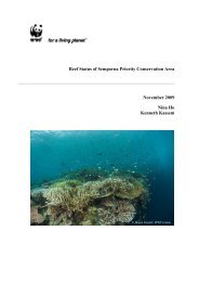
Gunung Stong State Park Preliminary Management Plan<br />
4.2 Trails<br />
There are several destinations guided by BAT, ranging from short, 1-day trips to 7-day treks,<br />
with varying degrees of difficulty. Foreign backpackers opt to stay at Baha Camp, and trek to<br />
the last waterfall, on organised packages offered by guesthouses in Kota Bharu, while locals<br />
and Singaporeans trek to G. Ayam and Stong, while staying at Baha Camp between treks.<br />
The trails were created by BAT.<br />
The list of trails and destinations are as in Table 4.3.<br />
Table 4.3: List of Trails and Tourist Destinations at GSSP<br />
No. Name of Trail Duration<br />
Trail Description<br />
(Days)<br />
1 G. Ayam 2 The trail takes one through a logged-over, dipterocarp<br />
forest, then across two streams, then through an undisturbed<br />
oak-laurel forest, before reaching the summit ridge, and the<br />
summit. The summit is flat, and can easily fit some 50<br />
campers. The summit can be reached within one day from<br />
Baha Camp, and the return journey is another day. From<br />
the summit are excellent views of the neighboring peaks of<br />
Tera (1,545 m asl) and Che Tahir (1,415 m asl). After the<br />
second river crossing, is a ridge with the rare endemic palm,<br />
Licuala stongensis.<br />
2 G. Stong 1 G. Stong (1,400 m asl) is some 4-5 hours from Baha Camp,<br />
and the return trip is some 2-3 hours. Like G. Ayam, the<br />
trail takes the hikers through an abandoned logging trail,<br />
before entering undisturbed oak-laurel forests. On the<br />
summit ridge are found the rare endemic bamboo,<br />
Holtummochloa pubescens. Midway between the basecamp<br />
and the summit is a rock-shelter next to a stream,<br />
known as Bogo Rock Shelter.<br />
3 G. Tera 4 This trail is the extension of the G. Ayam trail, where the<br />
hiker descends G. Ayam, and ascends G. Tera, a day away.<br />
Midway between the two summits is a plateau where there<br />
are many signs of the elephant. The rare endemic bamboo,<br />
H. pubescens, is also found. The journey to G. Tera and<br />
return to Baha Camp takes four days.<br />
4 G. Che Tahir 3 This is also an extension of the G. Ayam trail, where the<br />
hiker descends G. Ayam, and goes up again to the granite<br />
outcrop of G. Che Tahir. The summit is not as spectacular<br />
as Ayam, but the trail is, with pristine rocky streams and<br />
cascades.<br />
5 Semuliang<br />
Trail<br />
5 This trail starts from where the Sg. Kenerong meets the Sg.<br />
Semuliang, (the Mustaq mini-hydro dam) along an<br />
abandoned logging trail, and then upriver, before turning<br />
into the saddle separating G. Ayam and G. Stong. From the<br />
saddle, one could make an ascent to G. Stong, and back<br />
down again to Baha Camp. Highlights of this trail include a<br />
rafflesia site, and a rock-shelter with petrified wood.<br />
6 Seven Summits 7 This trail is a combination of the other trails, where the<br />
seven summits are attempted (Ayam, Tera, Stong, Che Kob,<br />
Che Tahir, Menyelit, Birut). Apart from Ayam, Stong, and<br />
Tera, the other peaks are names introduced by Baha, and<br />
are not named in maps.<br />
7 Last Waterfall 0.5 From the Baha Camp to the last waterfall (30 m high), one<br />
goes upriver of the Sg. Jeri, along rock-pools, and several<br />
44