FINAL VERSION FOR APPROVAL - Sdn Bhd - WWF Malaysia
FINAL VERSION FOR APPROVAL - Sdn Bhd - WWF Malaysia
FINAL VERSION FOR APPROVAL - Sdn Bhd - WWF Malaysia

Create successful ePaper yourself
Turn your PDF publications into a flip-book with our unique Google optimized e-Paper software.
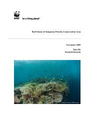
Gunung Stong State Park Preliminary Management Plan<br />
5. Oilpalm 5,927.0 2.5<br />
6. Settlements 597.2 0.2<br />
7. Towns 587.1 0.2<br />
Total 235, 689.1 100<br />
Source: JPBD (1996).<br />
Settlement centres like Dabong, Jelawang, and Kuala Balah are focal points that provide the<br />
basic food and recreational needs of settlers, and the good road linking these communities to<br />
Gua Musang, Tanah Merah, and Kota Bharu means that they are increasingly becoming less<br />
isolated. Dabong also has a train station that provides services to Gua Musang and Wakaf<br />
Baharu. These settlement centres have facilities for basic commercial activities, schools,<br />
police station, and hospitals and clinics, while traditional villages are linearly aligned along<br />
roads, railway tracks, and rivers, especially along the roads linking Dabong-Jeli and<br />
Jelawang-Gua Musang. Dabong has been identified as a growth area and a gateway to GSSP<br />
(MDKKS & JPBD, 2000). Facilities and conveniences available at Dabong, Jelawang and<br />
Kuala Balah are described in Table 2.5.<br />
No.<br />
Table 2.5: Facilities Available at Settlement Centres Near GSSP<br />
Settlement<br />
Center<br />
Population<br />
Distance from<br />
GSSP (km)<br />
Facilities<br />
1. Dabong N/A 10 Medical centre, mosque,<br />
market, train station,<br />
secondary school, police<br />
station, boat jetty, post office.<br />
2. Jelawang N/A 7 Primary school, mosque,<br />
government clinic, technical<br />
institute (Giatmara),<br />
multipurpose hall, motor<br />
workshop.<br />
3. Kuala Balah 3,738 15 Market, post office, mosque,<br />
police station, primary school,<br />
medical centre.<br />
There is an Orang Asli post at Sg. Tako, for the Mendriq sub-tribe, with a population of about<br />
20 families, with basic facilities, and at Sg. Kenerong there is a mini hydropower dam<br />
(Musteq Hydro <strong>Sdn</strong>. <strong>Bhd</strong>.) which produces 11 kV of power that is connected to the national<br />
electricity grid system.<br />
KESEDAR plays a major role in agriculture and rural development surrounding GSSP.<br />
Formed in 1978, the role of KESEDAR is to develop remote areas of Kelantan through largescale<br />
agricultural development and settlements. Under KESEDAR, there are two schemes:<br />
Rancangan Pemulihan Tanah (RPT) and the Rancangan Kemajuan Tanah (RKT). In the RPT<br />
scheme, development schemes originally under the state is transferred to KESEDAR, while<br />
under the RKT, primary forestland is cleared and replanted with rubber or oilpalm. In the<br />
RPT, each settler is allocated 10 acres of oilpalm or rubber, with 0.25 acre for a dwelling,<br />
while under the RKT, six acres are allotted for oilpalm or rubber, two acres for an orchard,<br />
and 0.25 acre for a housing lot. Soft loans of RM45,000 are offered for seedlings, fertiliser,<br />
and pesticides, with RM10,000-12,000 for house construction (pers. comm.. Mohamad bin<br />
Husin, KESEDAR, 2005).<br />
In relation to the area around GSSP, in 1983, KESEDAR acquired state-owned agricultural<br />
schemes under the LKTN (Lembaga Kemajuan Tanah Negeri) and TAKDIR (Perbadanan<br />
27