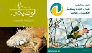
CONSERVATION OF ARABIAN GAZELLES - Nwrc.gov.sa
CONSERVATION OF ARABIAN GAZELLES - Nwrc.gov.sa
CONSERVATION OF ARABIAN GAZELLES - Nwrc.gov.sa

Create successful ePaper yourself
Turn your PDF publications into a flip-book with our unique Google optimized e-Paper software.
measures for their protection. Three basic questions about the populations therefore needed to be<br />
answered: Where What and How many (i.e. where are gazelle located, what taxon do they belong<br />
to, and how many of them are there). The survey zone covered the Asir / Sarawat mountains and<br />
Tihama coastal plain, from Taif and Jeddah southwards to the border with Yemen. This area is<br />
approximately 300,000 \un' in extent (roughly the <strong>sa</strong>me size as Italy), and lies between latitudes<br />
16.00 and 22.oooN, and longitudes 39.00 and 45.oo o E.<br />
Methods<br />
The limited timetable of six months available for the survey was obviously insufficient to allow a<br />
systematic coverage of such a large area. Instead, attention was focused on those areas from which<br />
gazelles had previously been reported. A great deal of information on gazelle distribution in the<br />
survey zone was obtained through discussion with the staff and researchers of the National<br />
Commission for Wildlife Conservation and Development (NCWCD), the National Wildlife Research<br />
Center (NWRC), the King Khalid Wildlife Research Center (KKWRC), and by a literature search of<br />
scientific and technical reports. A total of 38 recent (i.e. from 1985 - 1992) reliable observations of<br />
gazelle or their signs (tracks, faeces, bedding sites, corpses, etc.) were identified. These were located<br />
in four main areas: Qilwah; AI Aqiq; Mahkshush; and scattered observations in the Tihama coastal<br />
plain from AI Lith south to Jizan.<br />
In addition, around 10 areas were identified as potentially harbouring gazelle, based on<br />
communications recei ved by the NCWCD from local people in response to appeals for information<br />
on wildlife distribution. Every effort was made during the survey to visit all the areas identified by<br />
the methods above. together with all new areas to which we became alerted during the course of<br />
fieldwork .<br />
On most field trips an Arabic-speaking biologist / interpreter was provided by NCWCD,<br />
which enabled standardized interviews to be conducted with local residents in each survey area. Data<br />
obtained from these included the past and current distribution of gazelle, the taxon to which they<br />
belonged (as identified from photos and / or the wildlife poster produced by NCWCD), popUlation<br />
estimates, and information on other wildlife species present. In addition, local opinion on the levels<br />
of illegal hunting and reasons for inferred population trends was canvassed - these data are analyzed<br />
and discussed by Magin and Greth (1994).<br />
Contact with the relevant civil authorities was extremely important to the success of this<br />
project. During field trips, courtesy calls were always paid to the local Emarah (the headquarters of<br />
an Emirate) and frequently valuable help (information, guides, extra vehicles) was obtained from the<br />
Emirs and their staff. The guides obtained from the Emarahs proved particularly useful at putting<br />
local people at ease - since although hospitable the Bedu are by nature wary of strangers - thus<br />
persuading them to help answer our questions.<br />
Each ground survey trip was undertaken with a local guide, who took us on foot and by car to<br />
the areas where he knew or suspected gazelle were present. Gazelle observations (visual sightings,<br />
presence of tracks or faeces, discovery of skulls or corpses) were recorded on standardized<br />
observation forms in the field, and were later entered into a Microsoft Word computer database<br />
which will be continued and updated by future workers. The database was also converted to a GIS<br />
format, enabling distribution maps to be output and compared with other species. Amongst the data<br />
noted for each observation were the date, place name, geographical co-ordinates (recorded using a<br />
139