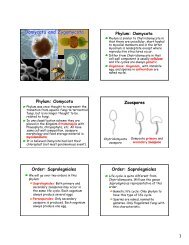
american samoa - University of Hawaii at Manoa Botany Department
american samoa - University of Hawaii at Manoa Botany Department
american samoa - University of Hawaii at Manoa Botany Department
- No tags were found...

Create successful ePaper yourself
Turn your PDF publications into a flip-book with our unique Google optimized e-Paper software.
LOCATIONChapter EightSAUINO STREAMSauino Stream is generally situ<strong>at</strong>ed north <strong>of</strong> Pala Lagoon along the southern coast <strong>of</strong> the Island<strong>of</strong> Tutuila (Figure 8-1). A 600-foot long segment <strong>of</strong> Sauino Stream is examined in this study.This segment is situ<strong>at</strong>ed south <strong>of</strong> Route 1 and about 330 feet upstream <strong>of</strong> the Sauino Streammouth (Figure 8-2).STREAM HYDROLOGYSources <strong>of</strong> Surface Run<strong>of</strong>fSauino Stream and two unnamed tributaries carry a portion <strong>of</strong> the surface run<strong>of</strong>f th<strong>at</strong> drainsfrom south slopes <strong>of</strong> Leele Mountain. Sauino Stream origin<strong>at</strong>es <strong>at</strong> about the 1,000-foot contourand meanders through the middle <strong>of</strong> Nuuuli Village before discharging into Pala Lagoon.An unnamed tributary east <strong>of</strong> the main stem <strong>of</strong> Sauino Stream begins near the 600-footelev<strong>at</strong>ion. This tributary carries surface run<strong>of</strong>f from the west side <strong>of</strong> Suaavamuli Ridge andjoins the main stem <strong>of</strong> Sauino Stream <strong>at</strong> about the 40-foot contour.A third small tributary extends from Deluxe Cafe along Route 1 to its confluence with the mainstem <strong>of</strong> Sauino Stream near the eight-foot elev<strong>at</strong>ion. A portion <strong>of</strong> this tributary represents the600-foot segment investig<strong>at</strong>ed for this study.General Stream CharacteristicsDownstream <strong>of</strong> Route 1, the small Sauino Stream tributary channel is characterized by acombin<strong>at</strong>ion <strong>of</strong> basaltic rock and a man-made, earth lined channel. Smaller rock, cobble, sand,muck, and decomposed organic m<strong>at</strong>erial comprise the bottom <strong>of</strong> the stream channel.Cross-sections documented by PPC in November 1999 indic<strong>at</strong>e th<strong>at</strong> the width <strong>of</strong> the streamsegment (between east and west stream banks) ranges between five and 24 feet. The depth <strong>of</strong>the stream channel (between the top <strong>of</strong> bank to the bottom <strong>of</strong> the stream bed) along the northside <strong>of</strong> the stream tributary is between 2.5 and four feet. Along the south side <strong>of</strong> the tributary,the depth <strong>of</strong> the stream channel ranges between 2.5 and five feet below the stream bank.While some solid waste m<strong>at</strong>erial was found discarded along the 600-foot stream segment inNovember 1999, the type and volume <strong>of</strong> wastes did not appear to impede stream flow. Largersurface flows gener<strong>at</strong>ed from stormw<strong>at</strong>er events can easily overtop the stream banks and spreadinto adjoining residential and agricultural land areas.Stream Modific<strong>at</strong>ionsThe 600-foot segment <strong>of</strong> Sauino Stream was modified by local residents in the l<strong>at</strong>e 1990’s tohelp prevent property damage associ<strong>at</strong>ed with occasional flooding in the residential area(Fanene, 1999). No rock-filled gabions or other bank stabiliz<strong>at</strong>ion structures were observedalong the stream channel in November 1999.American Samoa Wetlands/Streams Restor<strong>at</strong>ion and Enhancement PlanFebruary 2001, Sauino Stream, Page 8-1