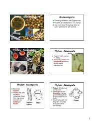
american samoa - University of Hawaii at Manoa Botany Department
american samoa - University of Hawaii at Manoa Botany Department
american samoa - University of Hawaii at Manoa Botany Department
- No tags were found...

Create successful ePaper yourself
Turn your PDF publications into a flip-book with our unique Google optimized e-Paper software.
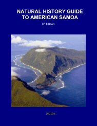
Chapter FourAOA WETLANDLOCATIONAoa Village is loc<strong>at</strong>ed along the northeast coast <strong>of</strong> the Island <strong>of</strong> Tutuila. There is one largewetland in Aoa th<strong>at</strong> comprises roughly 23.5 acres <strong>of</strong> land area (Figure 4-1). The Aoa wetlandincludes a combin<strong>at</strong>ion <strong>of</strong> fresh-w<strong>at</strong>er swamp, fresh-w<strong>at</strong>er marsh, and swamp forest.WETLAND HYDROLOGYSources <strong>of</strong> Surface Run<strong>of</strong>f to the Aoa WetlandThe primary source <strong>of</strong> w<strong>at</strong>er in the wetland is surface run<strong>of</strong>f from Tapua Stream and PunaStream (Figure 4-2). Tapua Stream receives drainage from its upland tributary, Lepa Stream,and generally flows south to north through the middle <strong>of</strong> the wetland before discharging intothe nearshore w<strong>at</strong>ers. Puna Stream, which origin<strong>at</strong>es near the 400-foot contour, transportsrun<strong>of</strong>f from the west side <strong>of</strong> Olomoana Mountain through the northeast side <strong>of</strong> the wetland.Available topographic maps for Aoa Village suggest a contribution <strong>of</strong> run<strong>of</strong>f from VaitoluStream to the Aoa wetland. Field observ<strong>at</strong>ions by PPC in November 1999 indic<strong>at</strong>e th<strong>at</strong> thelower channel may have been modified by local residents to:• help reduce potential flood damages to residential property; and/or,• accommod<strong>at</strong>e past residential development on the southwest side <strong>of</strong> the wetland.Stream flows presently discharge directly to Aoa Bay in the Vaiaga area. PPC believes th<strong>at</strong>Vaitolu Stream may have formerly discharged into Aoa wetland.A smaller portion <strong>of</strong> the run<strong>of</strong>f discharged into the wetland is also received directly from viasteeper, upland slopes on the south side <strong>of</strong> the wetland.Stream FlowsMedian Stream FlowsIn 1996, the U.S. Geological Survey published an estim<strong>at</strong>ed median stream flow for LepaStream (Figure 4-1). The median stream flow estim<strong>at</strong>e was based upon historical stream flowmeasurements obtained from a low-flow, partial-record st<strong>at</strong>ion between 1958 and 1975, as wellas rel<strong>at</strong>ed hydraulic modeling (Table 4-1).TABLE 4-1MEDIAN STREAM FLOW ESTIMATELEPA STREAMStreamUSGSGage St<strong>at</strong>ionGage Loc<strong>at</strong>ionLepa Stream 16905000 0.5 mile upstream fromTapua Stream mouthSource: Wong, 1996Stream FlowMeasure-ments(number)Estim<strong>at</strong>edMedian Flow(cfs)22 0.11American Samoa Wetland/Stream Restor<strong>at</strong>ion and Enhancement PlanFebruary 2001, Aoa Wetland, Page 4-1