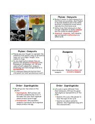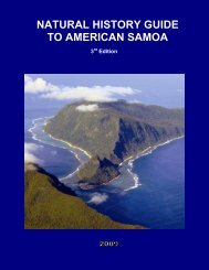
american samoa - University of Hawaii at Manoa Botany Department
american samoa - University of Hawaii at Manoa Botany Department
american samoa - University of Hawaii at Manoa Botany Department
- No tags were found...

Create successful ePaper yourself
Turn your PDF publications into a flip-book with our unique Google optimized e-Paper software.
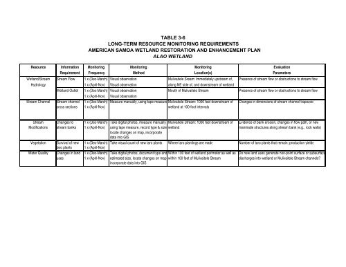
TABLE 3-6LONG-TERM RESOURCE MONITORING REQUIREMENTSAMERICAN SAMOA WETLAND RESTORATION AND ENHANCEMENT PLANALAO WETLANDResource Inform<strong>at</strong>ion Monitoring Monitoring Monitoring Evalu<strong>at</strong>ionRequirement Frequency Method Loc<strong>at</strong>ion(s) ParametersWetland/Stream Stream Flow 1 x (Dec-March) Visual observ<strong>at</strong>ion Mulivaitele Sream: Immedi<strong>at</strong>ely upstream <strong>of</strong>, Presence <strong>of</strong> stream flow or obstructions to stream flowHydrology 1 x (April-Nov) Visual observ<strong>at</strong>ion along NE side <strong>of</strong>, and downstream <strong>of</strong> wetlandWetland Outlet 1 x (Dec-March) Visual observ<strong>at</strong>ion Mouth <strong>of</strong> Mulivaitele Stream Presence <strong>of</strong> stream flow or obstructions to stream flow1 x (April-Nov) Visual observ<strong>at</strong>ionStream Channel Stream channel 1 x (Dec-March) Measure manually, using tape measure Mulivaitele Stream: 1000 feet downstream <strong>of</strong> Changes in dimensions <strong>of</strong> stream channel trapezoidcross sections 1 x (April-Nov) wetland <strong>at</strong> 100-foot intervalsStream Changes to 1 x (Dec-March) Take digital photos, measure manually Mulivaitele Stream: 1000 feet downstream <strong>of</strong> Evidence <strong>of</strong> bank erosion, changes in flow p<strong>at</strong>h, or newModific<strong>at</strong>ions stream banks 1 x (April-Nov) using tape measure, record type & size, wetland manmade structures along stream bank (e.g., rock walls)loc<strong>at</strong>e changes on map, incorpor<strong>at</strong>ed<strong>at</strong>a into GISVeget<strong>at</strong>ion Survival <strong>of</strong> new 1 x (Dec-March) Take visual count <strong>of</strong> new taro plants Where taro plantings are made Number <strong>of</strong> taro plants th<strong>at</strong> remain; production yieldstaro plants 1 x (April-Nov)W<strong>at</strong>er Quality Changes in land 1 x (Dec-March) Take digital photos, document type and Within 100 feet <strong>of</strong> wetland perimeter as well as Do new land uses gener<strong>at</strong>e non-point surface or subsurfaceuses 1 x (April-Nov) estim<strong>at</strong>ed size, loc<strong>at</strong>e changes on map, within 100 feet <strong>of</strong> Mulivaitele Stream discharges into wetland or Mulivaitele Stream channels?incorpor<strong>at</strong>e d<strong>at</strong>a into GIS