Strategic Flood Risk Assessment - South Worcestershire ...
Strategic Flood Risk Assessment - South Worcestershire ...
Strategic Flood Risk Assessment - South Worcestershire ...
Create successful ePaper yourself
Turn your PDF publications into a flip-book with our unique Google optimized e-Paper software.
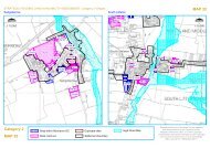
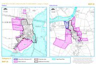
<strong>Flood</strong>plain [“Blue Zone”]Development will not normally be permitted here. Exceptions may be water compatibledevelopments and essential infrastructure, but these must be accompanied by a detailed <strong>Flood</strong><strong>Risk</strong> <strong>Assessment</strong>;<strong>Flood</strong>plain [“Yellow Zone”]Redevelopment of existing sites within the floodplain in areas not subject to significant floodflows [as defined by the Environment Agency], shown as “yellow zone” on the proposals map,will normally be permitted provided:it is for less vulnerable or water compatible use (as defined in Table D2 of PPS25);ground floor levels of all buildings are set above the 1 in 100-year flood level including anallowance for climate change, with an appropriate freeboard to be agreed with the LPAand Environment Agency, and should be flood free during an extreme flood event;safe access is available for the lifetime of the development and is supported by floodwarning and suitable evacuation plans being in place;car parking is designed to have regard to potential flood depths and hazards andmitigation measures are put in place. (No basement car parking shall be permitted);there is no detriment to the available flood storage capacity of the floodplain andadditional flood storage is created; andunnecessary obstructions to flood flow are removed, restoring flood flow pathways.<strong>Flood</strong>plain [“Red Zone”]New development (including extensions) and redevelopment will not normally be permitted inareas of existing or previously existing floodplain flow [as defined by the environment agency]shown as “red zone”, or within 8 metres of the top of both banks of other watercourses, asshown on the proposals map. Where options for managed retreat or land swap exist, developersshould explore these with the Local Authority.Maps showing these three <strong>Flood</strong> Zone 3 sub-divisions are shown in Appendix E.4.2.3 Actual <strong>Flood</strong> <strong>Risk</strong>If it has not been possible for all future development to be situated in Zone 1 then a moredetailed assessment is needed to understand the implications of locating proposed developmentin Zones 2 or 3. This is accomplished by considering information on the “actual risk” of flooding.The assessment of actual risk takes account of the presence of flood defences and provides apicture of the safety of existing and proposed development. It should be understood that thestandard of protection afforded by flood defences is not constant and it is presumed that therequired minimum standards for new development are:Residential development should be protected against flooding with an annual probabilityof river flooding of 1% in any year; andResidential development should be protected against flooding with an annual probabilityof tidal (sea) flooding of 0.5% in any year.The assessment of the actual risk should take the following issues into accountThe level of protection afforded by existing defences might be less than the appropriatestandards and hence may need to be improved if further growth is contemplatedTemporary and demountable defences have a high residual risk due the possibility offailure to deploy the defences before the onset of flooding. These types of defence arereliant on there being sufficient warning and mobilisation time for deployment.The flood risk management policy for the defences will provide information on the levelof future commitment to maintain existing standards of protection. If there is a conflict2012s5947 S <strong>Worcestershire</strong> Level 2 SFRA Update FINAL Report v1.0.doc 25


