Strategic Flood Risk Assessment - South Worcestershire ...
Strategic Flood Risk Assessment - South Worcestershire ...
Strategic Flood Risk Assessment - South Worcestershire ...
You also want an ePaper? Increase the reach of your titles
YUMPU automatically turns print PDFs into web optimized ePapers that Google loves.
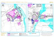
5 Mapping and risk based approach5.1 Summary of mapping for all sources of flood risk5.1.1 FluvialThe data used to prepare mapping is based on the results from hydraulic models either providedby the Environment Agency or prepared for the purposes of this SFRA update.Generalised modelling using Jflow+, supplied by the Environment Agency. Wheredetailed model results exist, these have been used in preference to the Jflow modelling.Watercourses with detailed modelling include:ooooRiver SalwarpeRiver Severn from Abermule to WorcesterHatfield BrookRiver AvonBarbourne BrookModelled outlines using Jflow+ have been developed to determine <strong>Flood</strong> Zone 3a, anindicative <strong>Flood</strong> Zone 3b* and <strong>Flood</strong> Zone 2 for the following watercourses, as well asthe effects of climate change.oooooooooooooooo5.1.2 Surface WaterA small watercourse, to the north west of Droitwich Spa, draining into a tributaryof Hadley BrookA small drain that flows through Pebworth before joining Noleham BrookA small, unnamed drain, to the east of WellandBattleton Brook and tributaries, to the south of EveshamTwo small, unnamed drain, flowing through Malvern WellsThree, unnamed drains, flowing through PoolbrookUnnamed drain, flowing through Great MalvernMadresfield Brook, at Great MalvernUnnamed drain at Pershore High SchoolUnnamed drain at Drake’s BroughtonUnnamed drain flowing to the north of PinvinTwo, unnamed drains, flowing through KemertonThree, unnamed tributaries of Laughern Brook at RushwickUpstream section of Barbourne Brook, not covered by Environment Agencyflood zonesUnnamed drain near SwinesherdSmall tributary of Bengeworth Brook, near Bengeworth Lake*Note: <strong>Flood</strong> Zone 3b is indicative and further investigation will be required throughdetailed site specific <strong>Flood</strong> <strong>Risk</strong> <strong>Assessment</strong>sMapping of surface water flood risk has been taken from the locally agreed surface waterinformation prepared by <strong>Worcestershire</strong> Council and described in the PFRA. The information isbased on a national scale map identifying those areas where surface water flooding poses a risk.The mapping is based on two rainfall events, one with a 1 in 30 and the other with a 1 in 200chance of occurring in any year.5.1.3 GroundwaterThe Areas Susceptible to Groundwater (AStGW) map has been used, along with <strong>Worcestershire</strong>County Council’s database of past flooding events, to identify areas potentially at risk fromgroundwater flooding.2012s5947 S <strong>Worcestershire</strong> Level 2 SFRA Update FINAL Report v1.0.doc 28


