Strategic Flood Risk Assessment - South Worcestershire ...
Strategic Flood Risk Assessment - South Worcestershire ...
Strategic Flood Risk Assessment - South Worcestershire ...
Create successful ePaper yourself
Turn your PDF publications into a flip-book with our unique Google optimized e-Paper software.
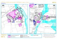
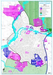
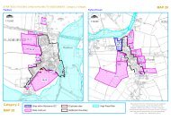
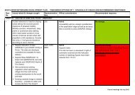
7 Summary assessment of SWDP developmentsites7.1 IntroductionAs of 3 rd July 2012, there are 177 proposed allocation sites proposed for inclusion in the <strong>South</strong><strong>Worcestershire</strong> Development Plan by the three councils.An initial scoping assessment of these sites was undertaken to identify the level of flood risk tothese sites and potential requirement for further, more detailed, assessment. The sites werecompared against <strong>Flood</strong> Zones 1, 2 and 3, the 2007 historic flood map and the <strong>Flood</strong> Map forSurface Water. The sites were placed into one of four categories.Sites in <strong>Flood</strong> Zone One only and not shown at risk from surface waterSites in <strong>Flood</strong> Zone One only but shown as being at risk from surface waterSites in <strong>Flood</strong> Zone Two (including 2007 historic flood map)Sites in <strong>Flood</strong> Zone Two and ThreeA summary of these findings are provided inTable 7-1 and a breakdown of the risk to each site is provided in Appendix F.Important Note: An update to the Environment Agency’s <strong>Flood</strong> Zones, to be completed later thisyear, will incorporate the Environment Agency’s Historic <strong>Flood</strong> Map into the <strong>Flood</strong> Zone 2 outline.The Historic <strong>Flood</strong> Map is based on Environment Agency data, aerial photography and ground surveyand observations during the flood events.After discussions with the EA, the Historic <strong>Flood</strong> Map has been incorporated into <strong>Flood</strong> Zone 2 for thisstudy. When using the mapping provided as part of this SFRA update, where the Historicoutline extent is greater than the 1 in 1000 year modelled extent (<strong>Flood</strong> Zone 2) then theHistoric outline is considered to be <strong>Flood</strong> Zone 2, and should be used when undertakingassessments of flood risk.<strong>Flood</strong> ZoneOne onlyTable 7-1: Summary of risk to proposed allocation sites<strong>Flood</strong> ZoneOne andFMfSWNumber of Sites<strong>Flood</strong> ZoneTwo<strong>Flood</strong> ZoneTwo andThreeTotal48 91 9 29 177Sites with ordinary watercourses not included in the flood zones were modelled for this SFRA todetermine the level of risk. Of the 24 sites identified, one was shown to be at risk from <strong>Flood</strong>Zone 2 and 15 were shown to be at risk from <strong>Flood</strong> Zone 3. The remaining sites were shown notto be at any risk from fluvial flooding.Those sites shown to be in <strong>Flood</strong> Zone Two and <strong>Flood</strong> Zone 3 have been taken forward in thisSFRA for more detailed assessment. This assessment is summarised in the following tables.Guidance for <strong>Flood</strong> <strong>Risk</strong> <strong>Assessment</strong> requirements for the remaining sites is provided in sections5 and 8.Note: Environment Agency guidance provided with the <strong>Flood</strong> Map with Surface Water placeslimitations on the base map scale and zoom scale at which it can be displayed 13 as scales largerthan those suggested implies an inappropriate degree of accuracy which may lead to increasedrisk of misinformed decision making. Thus when using the maps it should be appreciated thatthe level of detail of the analysis does not reflect the high resolution inferred by the scale of the13 Using Surface Water <strong>Flood</strong> <strong>Risk</strong> Information: Guidance for LRF, RRT, LPA and LLFA. V1 (Environment Agency,November 2010)2012s5947 S <strong>Worcestershire</strong> Level 2 SFRA Update FINAL Report v1.0.doc 42


