Strategic Flood Risk Assessment - South Worcestershire ...
Strategic Flood Risk Assessment - South Worcestershire ...
Strategic Flood Risk Assessment - South Worcestershire ...
You also want an ePaper? Increase the reach of your titles
YUMPU automatically turns print PDFs into web optimized ePapers that Google loves.
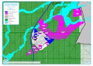
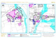
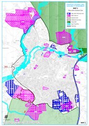
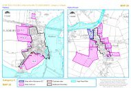
5.1.4 Hazard MapsHazard mapping has also been produced for the potential development areas. The hazardrating is calculated directly within the Jflow modelling package and utilises the classifications ofhazard presented in DEFRA R&D Technical Note FD2320: <strong>Flood</strong> <strong>Risk</strong> <strong>Assessment</strong>.Hazard mapping for the Level 2 SFRA update has been produced using depth and velocity,excluding a debris factor, and therefore may underestimate hazard in some areas. Therefore, itshould be noted that the hazard mapping prepared for the SFRA using JFlow+ will need to berefined when more detailed consideration is given to preparing development proposals at therespective sites where development is proposed. At that time it is likely that more detailed 1d –2D modelling will have to be prepared to enable results with an appropriate level of detail andresolution.5.1.5 Suite of MapsAll of the mapping can be found in the appendices and is presented in the following structure<strong>Flood</strong> ZonesClimate change outlinesHazard MappingSurface Water <strong>Flood</strong> <strong>Risk</strong> Mapping<strong>Flood</strong>plain Policy Mapping5.2 Other relevant flood risk informationThe mapping prepared for this Level 2 SFRA update provides information onThe extent of floodingThe depth of flooding<strong>Flood</strong> water velocityHazard from flood waterOther relevant information on flood risk should be referred to by users of this SFRA, whereappropriate. This information includes:<strong>South</strong> <strong>Worcestershire</strong> Joint Core Strategy <strong>Strategic</strong> <strong>Flood</strong> <strong>Risk</strong> <strong>Assessment</strong> – Level 1and 2<strong>Worcestershire</strong> Preliminary <strong>Flood</strong> <strong>Risk</strong> <strong>Assessment</strong> (2011)River Severn Catchment <strong>Flood</strong> Management Plan (2010)River Basin Management Plan: Severn River Basin District (2009)Hazard and <strong>Risk</strong> Mapping prepared for the <strong>Flood</strong> <strong>Risk</strong> Regulations (available in 2013)<strong>Flood</strong> <strong>Risk</strong> Management Plan in accordance with the <strong>Flood</strong> <strong>Risk</strong> Regulations (availablein 2015)Surface Water Management PlansNational <strong>Flood</strong> and Coastal Defences Dataset (NFCDD) – users should note thatrecently completed schemes may not yet be included in this dataset.National Receptor Dataset (NRD) – users should note the NRD dataset is representativeof the current situation. New developments or changes to a property type (i.e. house toflat) or property use (i.e. residential to non-residential) may not be represented.5.3 Sequential approachIt is often the case that it is not possible for all new development to be allocated on land that isnot at risk from flooding. In these circumstances the <strong>Flood</strong> Zone maps (that show the extent ofinundation assuming that there are no defences) are too simplistic. A greater understanding ofthe scale and nature of the flood risks are required. To help achieve this, more detailedmodelling has been undertaken, including depth, hazard and velocity outputs.2012s5947 S <strong>Worcestershire</strong> Level 2 SFRA Update FINAL Report v1.0.doc 29


