Strategic Flood Risk Assessment - South Worcestershire ...
Strategic Flood Risk Assessment - South Worcestershire ...
Strategic Flood Risk Assessment - South Worcestershire ...
Create successful ePaper yourself
Turn your PDF publications into a flip-book with our unique Google optimized e-Paper software.
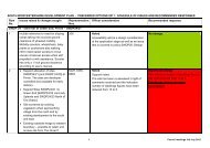
SUDS and the development siteSUDS TypeSource ControlInfiltrationDetentionFiltrationConveyancePotentialSuitabilityCommentsAll forms of source controls are likely to be suitableMapping suggests underlying soil is likely to be permeable.However, the high risk of groundwater flooding would makeinfiltration unsuitableMapping suggests that site slopes are steep and therefore somelarger ‘above ground’ features may not be viableMapping suggests that filtrations would be suitable but require a formof liner to prevent ingress of groundwater into the SUDS systemAll forms of conveyance are likely to be suitable<strong>Flood</strong> Defences:None.The site is not located within a groundwater source protection zone.Mixed use developments should provide at least two independent SUDS features inseries to provide a suitable level of water quality treatment.Effects of Climate Change:Increased rainfall intensities. Increased water levels in the River Severn.<strong>Flood</strong> <strong>Risk</strong> Implications for Development:All development should be located within <strong>Flood</strong> Zone 1, unless appropriate inaccordance with NPPF Technical Guidance.A detailed site-specific flood risk assessment, including hazard mapping, will berequired for any development in <strong>Flood</strong> Zone 2, or for sites greater than 1ha in <strong>Flood</strong>Zone 1.The site is located within the Red Zone of the <strong>Flood</strong> Policy maps.Redevelopment or alternative use of the site will focus on recreation and leisureeither singly or as mixed use proposals.The site is not appropriate for residential allocation as it is a former landfill site.Resilience measures will be required if buildings are situated in the flood risk area.Green infrastructure should be considered within the mitigation measures for surfacewater runoff from potential development<strong>Assessment</strong> for runoff should include allowance for climate change effectsNew or re-development should adopt exemplar source control SUDS techniques toreduce the risk of frequent low impact flooding due to post-development runoff.The site falls within an area indicated to potentially be susceptible to groundwateremergence. Further assessment of groundwater risk would be required and anassessment of suitable surface water mitigation techniques should be made at thedetailed FRA level.Onsite attenuation schemes would need to be tested against the hydrograph of thereceiving watercourse to ensure flows are not exacerbated downstream within thecatchment.There are currently no access roads to the site. If new access roads are consideredflood risk needs to be investigated further.Demonstration that development at this location can be made safe.2012s5947 S <strong>Worcestershire</strong> Level 2 SFRA Update FINAL Report v1.0.doc 82


