Strategic Flood Risk Assessment - South Worcestershire ...
Strategic Flood Risk Assessment - South Worcestershire ...
Strategic Flood Risk Assessment - South Worcestershire ...
You also want an ePaper? Increase the reach of your titles
YUMPU automatically turns print PDFs into web optimized ePapers that Google loves.
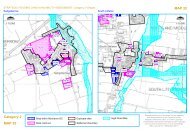
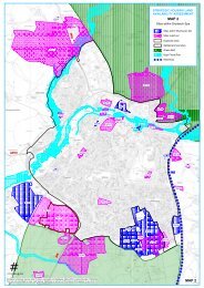
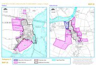
mapping. To understand the risk of flooding at an individual property scale would require moredetailed modelling to be prepared.7.1.1 <strong>Flood</strong> HotspotsHistoric flooding incidents are based on <strong>Worcestershire</strong> County Council's historic floodingdataset. This consisted of a point layer of all historic flooding incidents within the <strong>Worcestershire</strong>area and a polygon layer of hotspots. The hotspots are based on the historic flooding incidentsand a buffer applied to allow for any inaccuracy or uncertainty on the exact location of thehistoric incident.Therefore, it is important to note that whilst a site may be shown as falling within, or partiallywithin, a flooding hotspot, the site itself may not have experienced any historic flooding. Thisassessment is indicative only. Detailed of the number of historic flooding incidents recorded foreach proposed allocation is provided in Appendix F.7.2 Surface Water Drainage <strong>Assessment</strong>A simple scoping assessment was conducted to provide a broad and generalised assessment ofthe hydraulic and geological characteristics of each development site to determine theconstraining factors for surface water management at the proposed development sites. Thisassessment is designed to inform the early-stage site planning process and is not intended toreplace site-specific detailed drainage assessments.Greenfield runoff rates for each ward have been calculated using the Revitalised <strong>Flood</strong>Hydrograph (ReFH) method for non-permeable areas and the FEH Statistical method forpermeable areas. The data required for these calculations was derived on a ward-by-ward basisusing the FEH CD-ROM, a database of numerical descriptors representing the hydrologicalcharacteristics of watercourse catchments in the UK. Catchments were chosen which wereconsidered to be representative of the ward, generally with a small area and fully containedwithin the ward boundaries. The catchment descriptors used are as follows:BFIHOST A measure of the catchment permeability (%)DPLBARDPSBARSAAR 4170A measure of drainage path length and a function ofsite area (km)A measure of the average catchment slope (m/km)A measure of the average annual rainfall (mm)The required attenuation volume was estimated using the Quick Storage Estimate tool in thesoftware package WinDES by MicroDrainage. This tool derives a range of attenuation volumesby comparing post development runoff rates with maximum allowable discharge rates (i.e.greenfield runoff rates) for two extreme drainage outfall schematisations, assuming one largestorage feature serving the entire site. For the purposes of this scoping assessment it has beenassumed that development of the sites will create 75% impervious surfaces.From the catchment characteristics derived above and additional datasets (areas susceptible togroundwater flooding map, Soil map of England and Wales, Environment Agency ‘What’s in yourBackyard’ online mapping) a broad criterion for the applicability of SUDS techniques wasdetermined. These criteria were then used to carry out a simple assessment of the likelyfeasibility of different types of SUDS techniques at each of the proposed development sites.SUDS techniques were categorized into 5 main groups as follows.2012s5947 S <strong>Worcestershire</strong> Level 2 SFRA Update FINAL Report v1.0.doc 43


