

Aerial Archaeology in Ireland - The Heritage Council
Aerial Archaeology in Ireland - The Heritage Council
Aerial Archaeology in Ireland - The Heritage Council

Create successful ePaper yourself
Turn your PDF publications into a flip-book with our unique Google optimized e-Paper software.
Geological Survey of <strong>Ireland</strong><br />
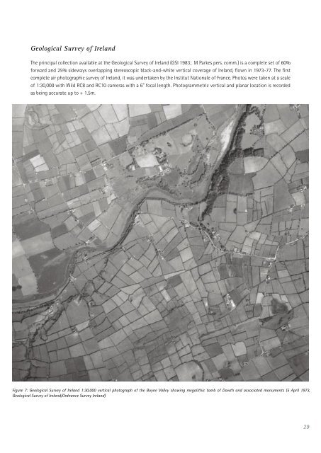
<strong>The</strong> pr<strong>in</strong>cipal collection available at the Geological Survey of <strong>Ireland</strong> (GSI 1983; M Parkes pers. comm.) is a complete set of 60%<br />
forward and 25% sideways overlapp<strong>in</strong>g stereoscopic black-and-white vertical coverage of <strong>Ireland</strong>, flown <strong>in</strong> 1973-77. <strong>The</strong> first<br />
complete air photographic survey of <strong>Ireland</strong>, it was undertaken by the Institut Nationale of France. Photos were taken at a scale<br />
of 1:30,000 with Wild RC8 and RC10 cameras with a 6” focal length. Photogrammetric vertical and planar location is recorded<br />
as be<strong>in</strong>g accurate up to + 1.5m.<br />
Figure 7: Geological Survey of <strong>Ireland</strong> 1:30,000 vertical photograph of the Boyne Valley show<strong>in</strong>g megalithic tomb of Dowth and associated monuments (5 April 1973,<br />
Geological Survey of <strong>Ireland</strong>/Ordnance Survey <strong>Ireland</strong>)<br />
29


