

Aerial Archaeology in Ireland - The Heritage Council
Aerial Archaeology in Ireland - The Heritage Council
Aerial Archaeology in Ireland - The Heritage Council

Create successful ePaper yourself
Turn your PDF publications into a flip-book with our unique Google optimized e-Paper software.
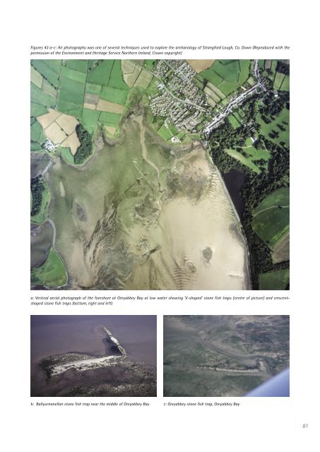
Figures 43 a-c: Air photography was one of several techniques used to explore the archaeology of Strangford Lough, Co. Down (Reproduced with the<br />
permission of the Environment and <strong>Heritage</strong> Service Northern <strong>Ireland</strong>, Crown copyright)<br />
a: Vertical aerial photograph of the foreshore at Greyabbey Bay at low water show<strong>in</strong>g ‘V-shaped’ stone fish traps (centre of picture) and crescentshaped<br />
stone fish traps (bottom, right and left)<br />
b: Ballyurnanellan stone fish trap near the middle of Greyabbey Bay c: Greyabbey stone fish trap, Greyabbey Bay<br />
81


