

Aerial Archaeology in Ireland - The Heritage Council
Aerial Archaeology in Ireland - The Heritage Council
Aerial Archaeology in Ireland - The Heritage Council

You also want an ePaper? Increase the reach of your titles
YUMPU automatically turns print PDFs into web optimized ePapers that Google loves.
92<br />
‘…numerous sites <strong>in</strong> pasture marked as “de-listed” on the Record of Monuments and Places which can still<br />
be seen as crop marks <strong>in</strong> the more recent aerial Ordnance Survey high-level vertical aerial photographic<br />
coverage (Black and White 1995; Colour 2000)…’<br />
<strong>The</strong> NMS note that the records for all monuments are under review, <strong>in</strong>clud<strong>in</strong>g the de-listed monuments <strong>in</strong> the context of a<br />
reissue of the Record of Monuments and Places.<br />
In 2004, 374 applications were dealt with through this procedure, among which 25 def<strong>in</strong>ite new archaeological sites or<br />
monuments were identified largely as a result of the aerial photography. As a result, 8.6% of these cases had areas permanently<br />
excluded; another 3% were made subject, either <strong>in</strong> part or total, to an ‘archaeological impact assessment’ (AIA); 5% were subject<br />
to archaeological monitor<strong>in</strong>g; and just under 2% were refused outright. In addition to the desk-based assessment procedure, 46<br />
(12.3%) of the applications <strong>in</strong> 2004 referred to the Forest Service Archaeologist were also <strong>in</strong>spected <strong>in</strong> person <strong>in</strong> the field.<br />
<strong>The</strong> <strong>in</strong>ter-visibility of sites and landscape relationships are now be<strong>in</strong>g taken <strong>in</strong>to account for archaeological complexes and areas,<br />
with outright refusals or requirements for the ma<strong>in</strong>tenance of l<strong>in</strong>kages or whole areas to be left open and unplanted. Often, this<br />
can be achieved at least partly through targeted application of a 15% biodiversity/open space provision with the afforestation<br />
grant/premium scheme. This can be used to protect <strong>in</strong>dividual sites and allow for the ma<strong>in</strong>tenance of l<strong>in</strong>kages or whole areas to<br />
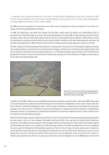
be left open and unplanted (Figure 50).<br />
Figure 50: A relatively recent forestry plantation adjacent<br />
to a moated site on the southern slope of Brandonhill, Co.<br />
Kilkenny (Ian Doyle, 26 July 2005)<br />
In addition to the 2001 regulations, new and additional assessment procedures were put <strong>in</strong> place <strong>in</strong> November 2003. <strong>The</strong>se apply<br />
to all <strong>in</strong>itial afforestation applications identified through the ‘Environmental Considerations’ criteria which <strong>in</strong>clude areas that<br />
have a def<strong>in</strong>ite or potential archaeological concern. This has made archaeology a standard issue to be assessed for any forestry<br />
proposal. In the last two years, 16 <strong>in</strong>dividual consultant archaeologists or companies have been work<strong>in</strong>g for farmers/forestry<br />
companies <strong>in</strong>volved <strong>in</strong> the preparation of archaeological assessments, monitor<strong>in</strong>g or <strong>in</strong>spection reports, either <strong>in</strong> advance of or<br />
<strong>in</strong> conjunction with afforestation proposals.<br />
While aerial archaeology now plays a significant and effective role <strong>in</strong> the procedures for <strong>in</strong>dividual forestry proposals, less progress<br />
has been made <strong>in</strong> terms of a more strategic Afforestable Land Survey (ALS) of the type that the Scottish Royal Commission<br />
undertook <strong>in</strong> the 1990s, and which was part of the <strong>Heritage</strong> <strong>Council</strong>’s recommendations. To some extent, the Scottish model of<br />
an afforestable land survey is now outdated, as it dealt with large stretches of unimproved uplands that were once considered<br />
the prime target for afforestation. Mr Emmet Byrnes po<strong>in</strong>ts out that <strong>in</strong> the last 15 years, the yearly plant<strong>in</strong>g rate <strong>in</strong> <strong>Ireland</strong> has<br />
almost halved and the average block of land proposed for afforestation is now only 10ha <strong>in</strong> size. Plant<strong>in</strong>g now occurs <strong>in</strong> a more<br />
fragmentary way, and on average only 50% of those farmers who make an application to the Forest Service for ‘consent to<br />
afforest’ end up plant<strong>in</strong>g their land <strong>in</strong> any given year. Furthermore, the recent designation of over 80,000 acres of land <strong>in</strong> the


